MyTopo
Edgewood Illinois US Topo Map
Couldn't load pickup availability
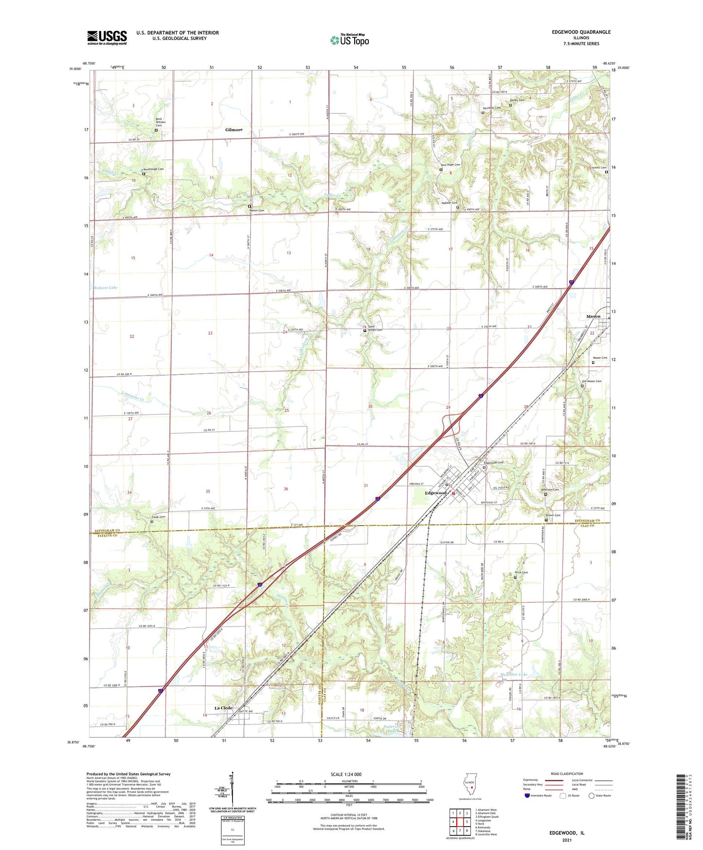
2024 topographic map quadrangle Edgewood in the state of Illinois. Scale: 1:24000. Based on the newly updated USGS 7.5' US Topo map series, this map is in the following counties: Effingham, Clay, Fayette. The map contains contour data, water features, and other items you are used to seeing on USGS maps, but also has updated roads and other features. This is the next generation of topographic maps. Printed on high-quality waterproof paper with UV fade-resistant inks.
Quads adjacent to this one:
West: Loogootee
Northwest: Altamont West
North: Altamont East
Northeast: Effingham South
East: Hord
Southeast: Louisville West
South: Oskaloosa
Southwest: Kinmundy
This map covers the same area as the classic USGS quad with code o38088h6.
Contains the following named places: Bailey Cemetery, Beck William Cemetery, Bristol, Brockett Cemetery, Brown Cemetery, Davidson Cemetery, Edgewood, Edgewood Bi - County Fire Department, Edgewood Cemetery, Edgewood Grade School, Edgewood Post Office, Faulk Cemetery, Gilmore, Kavanaugh Cemetery, La Clede, La Clede Census Designated Place, Laclede Post Office, Limestone Creek, Locust Grove School, Mahon Cemetery, Mason Cemetery, McArthur Lake, New Hope Cemetery, Old Mason Cemetery, Patterson Lake Dam, Price Cemetery, Robinson Cemetery, Saint Annes Cemetery, Town of Mason, Township of Mason, Township of West, Village of Edgewood, Wabash Cemetery, ZIP Codes: 62426, 62443, 62838