MyTopo
Effingham South Illinois US Topo Map
Couldn't load pickup availability
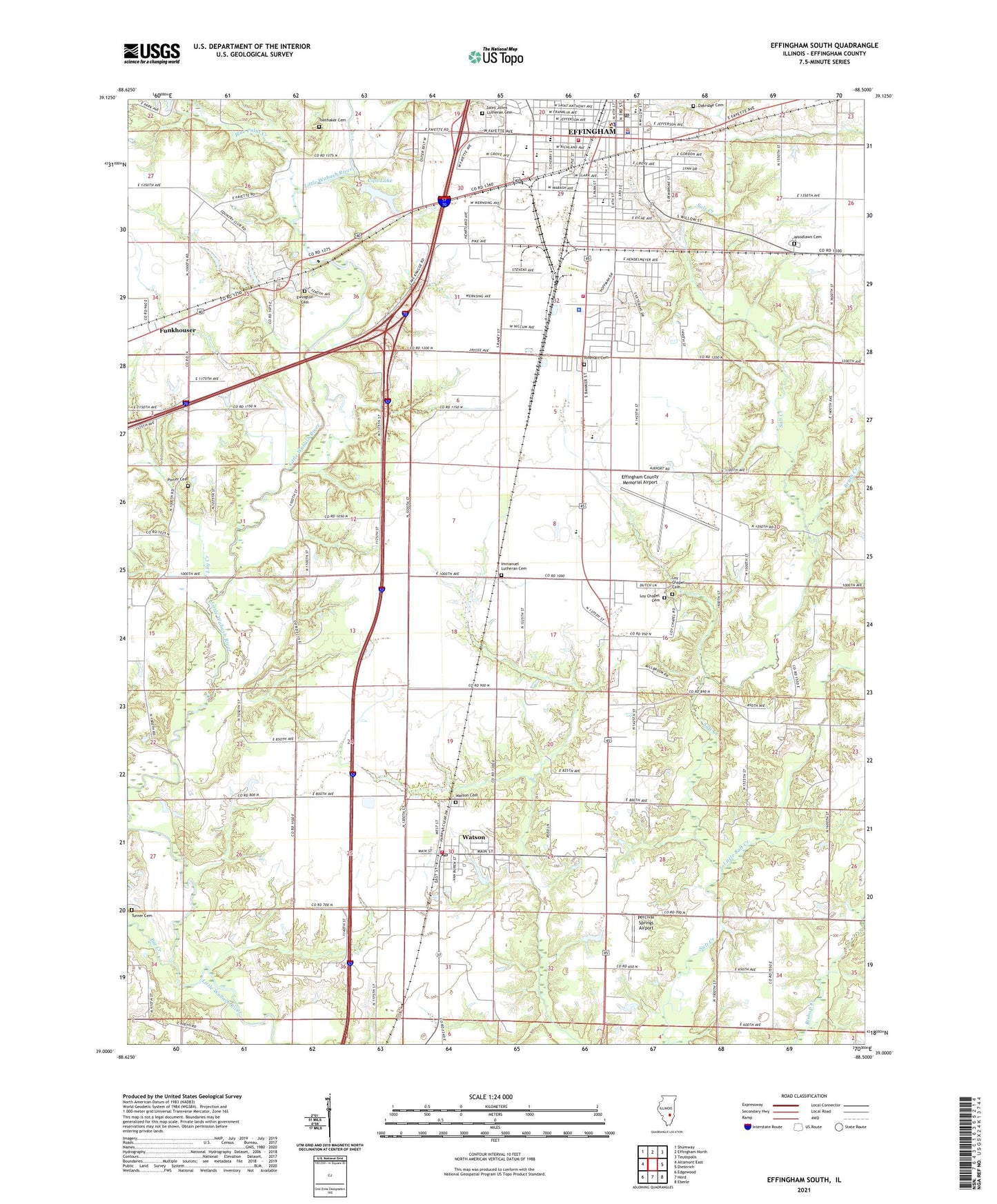
2024 topographic map quadrangle Effingham South in the state of Illinois. Scale: 1:24000. Based on the newly updated USGS 7.5' US Topo map series, this map is in the following counties: Effingham. The map contains contour data, water features, and other items you are used to seeing on USGS maps, but also has updated roads and other features. This is the next generation of topographic maps. Printed on high-quality waterproof paper with UV fade-resistant inks.
Quads adjacent to this one:
West: Altamont East
Northwest: Shumway
North: Effingham North
Northeast: Teutopolis
East: Dieterich
Southeast: Eberle
South: Hord
Southwest: Edgewood
This map covers the same area as the classic USGS quad with code o39088a5.
Contains the following named places: Air Evac Lifeteam 28, Arch Air Medical Services, Big Creek, Bliss Park, Blue Point Creek, Bourgeois Farms, Brush Creek, Bryant School, Central Grade School, Central Illinois Public Service Dam, Central Illinois Public Service Reservoir, Church of the Nazarene, Cips Lake, City of Effingham, City of Effingham Central Fire Station, D and V Farms, East Side Grade School, Effingham, Effingham City - County Ambulance Service, Effingham City Hall, Effingham County, Effingham County Courthouse, Effingham County Jail, Effingham County Memorial Airport, Effingham County Sheriff's Office, Effingham Fire Department Station 3, Effingham High School, Effingham Police Department, Effingham Post Office, Ewington, Ewington Cemetery, Ewington School, Feldhake Dairy, First Baptist Church, First Christian Church, First Presbyterian Church, Free Methodist Church, Funkhouser, Funkhouser School, Healthone Paramedics, Heartville, Helen Matthes Library, Hill School, Illinois State Police Department District 12, Immanuel Lutheran Cemetery, Landfill 33, Lily Creek, Little Salt Creek, Little Wabash River Dam, Little Wabash River Reservoir, Loy Chapel Cemetery, Loy Church, Loy School, Oakridge Cemetery, Percival Springs Airport, Porter Cemetery, Rinehart Cemetery, Sacred Hearth School, Saint Anthony Memorial Hospital Heliport, Saint Johns Church, Saint Johns Lutheran Cemetery, Saint Johns Lutheran Church, Salt Creek Church, Salt Creek School, South School, South Side Grade School, Toothaker Cemetery, Township of Watson, Tristar Academy Safe Schools Program, Turner Cemetery, Village of Watson, Watson, Watson Cemetery, Watson Fire Protection District, Watson Post Office, WCRA-AM (Effingham), WCRC-FM (Effingham), White School, Woodlawn Cemetery, ZIP Codes: 62401, 62473