MyTopo
Loogootee Illinois US Topo Map
Couldn't load pickup availability
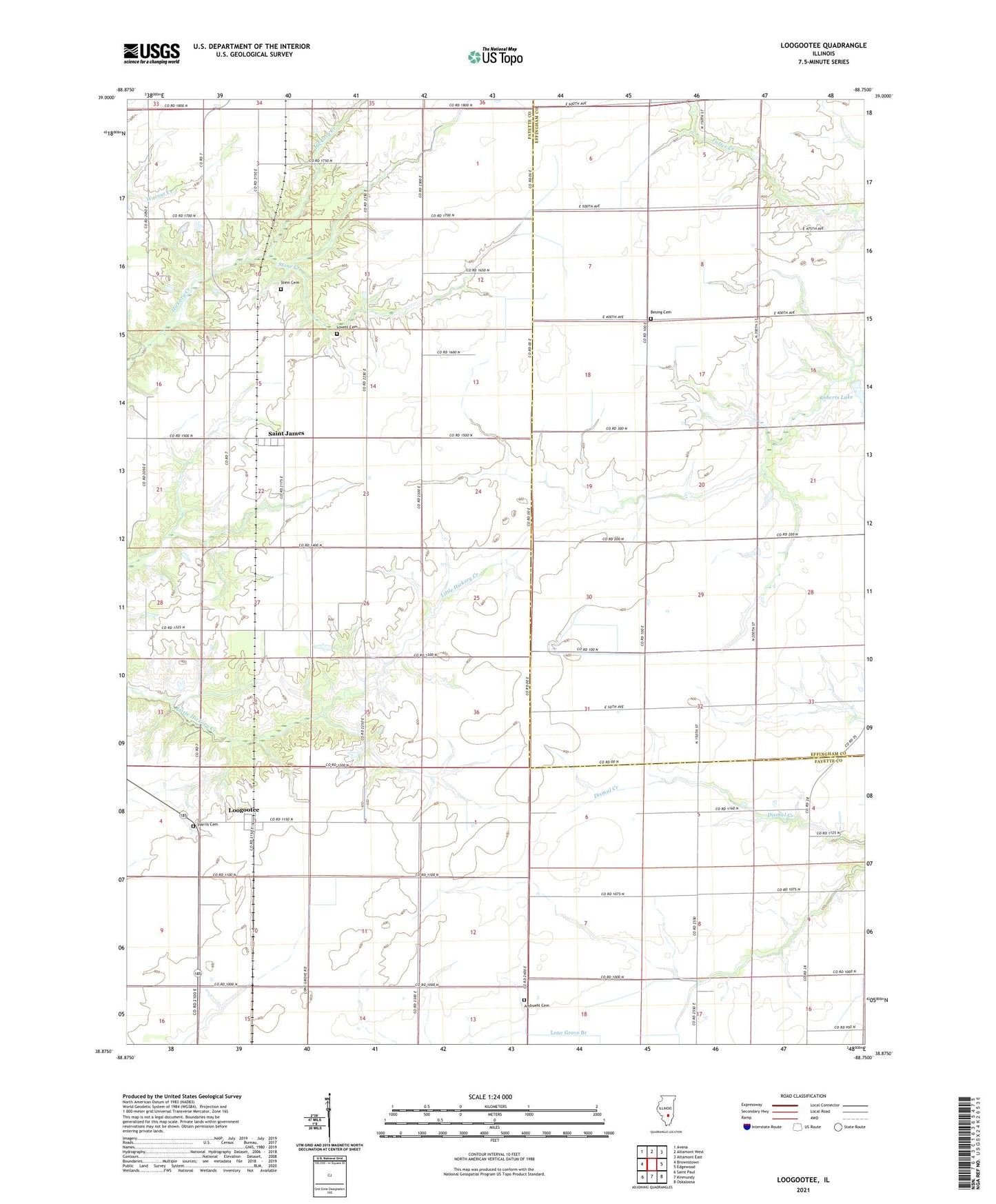
2024 topographic map quadrangle Loogootee in the state of Illinois. Scale: 1:24000. Based on the newly updated USGS 7.5' US Topo map series, this map is in the following counties: Fayette, Effingham. The map contains contour data, water features, and other items you are used to seeing on USGS maps, but also has updated roads and other features. This is the next generation of topographic maps. Printed on high-quality waterproof paper with UV fade-resistant inks.
Quads adjacent to this one:
West: Brownstown
Northwest: Avena
North: Altamont West
Northeast: Altamont East
East: Edgewood
Southeast: Oskaloosa
South: Kinmundy
Southwest: Saint Paul
This map covers the same area as the classic USGS quad with code o38088h7.
Contains the following named places: Ambuehl Cemetery, Besing Cemetery, Centerville School, Eldorado School, Grieder School, Harris Cemetery, Loogootee, Loogootee Post Office, Lovett Cemetery, Macedonia Church, Maple Grove School, Nirider School, Point Pleasant School, Prairie View School, Rauchman School, Roberts Lake, Roberts Lake Dam, Rush School, Saint James, Saint Johns Church, Stein Cemetery, Township of Wheatland, Voelker School