MyTopo
Elsah Illinois US Topo Map
Couldn't load pickup availability
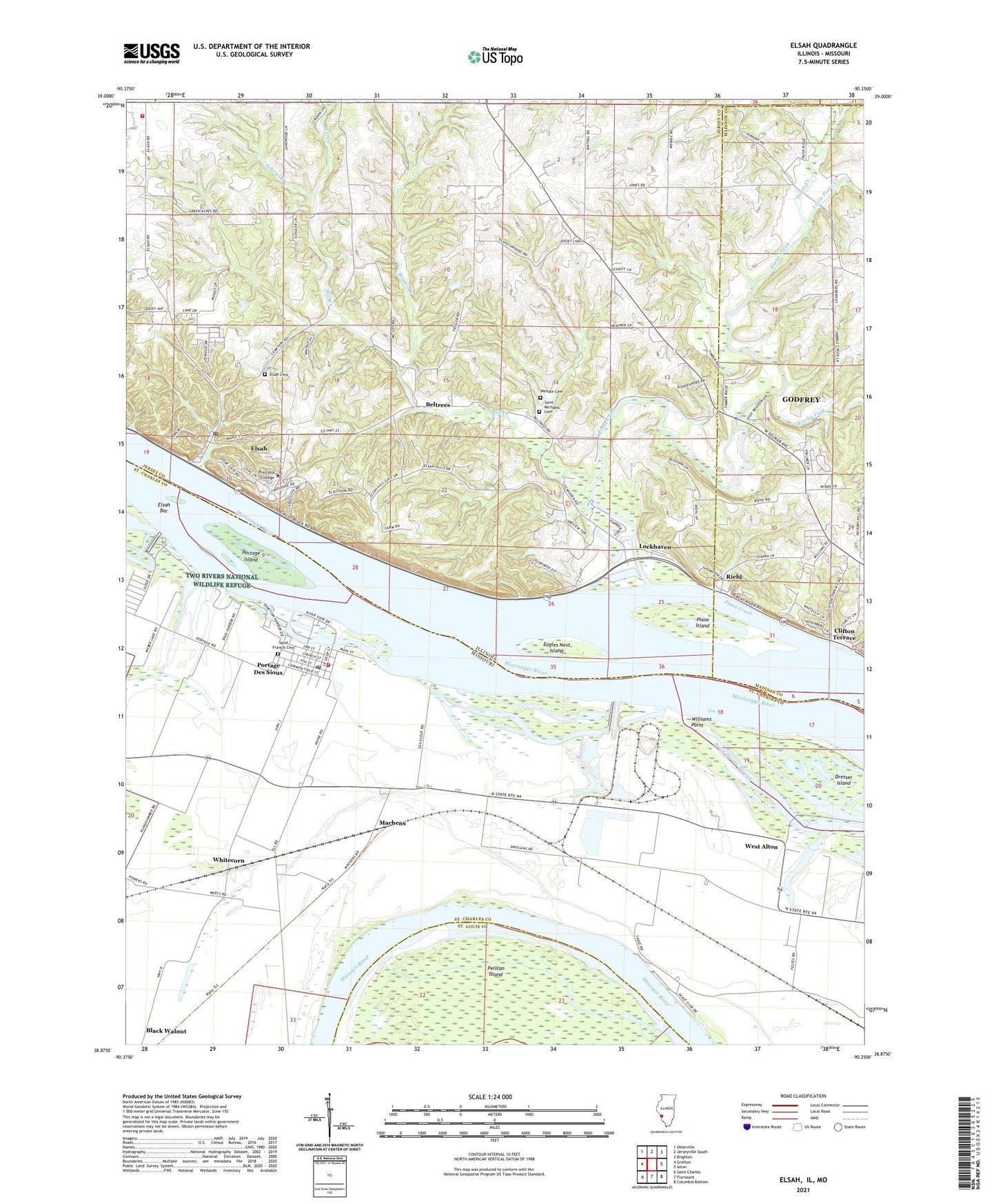
2024 topographic map quadrangle Elsah in the states of Illinois, Missouri. Scale: 1:24000. Based on the newly updated USGS 7.5' US Topo map series, this map is in the following counties: Jersey, St. Charles, Madison, St. Louis. The map contains contour data, water features, and other items you are used to seeing on USGS maps, but also has updated roads and other features. This is the next generation of topographic maps. Printed on high-quality waterproof paper with UV fade-resistant inks.
Quads adjacent to this one:
West: Grafton
Northwest: Otterville
North: Jerseyville South
Northeast: Brighton
East: Alton
Southeast: Columbia Bottom
South: Florissant
Southwest: Saint Charles
Contains the following named places: Askew Branch, Beltrees, Briggs Branch, City of Portage Des Sioux, Clifton Terrace, Common Fields of Portage des Sioux, Dresser Island, Eagles Nest Island, Elsah, Elsah Bar, Elsah Cemetery, Elsah Historic District, Elsah Post Office, Independence School, Little Piasa Creek, Lockhaven, Machens, Melville Church, Mertz School, Mill Creek, Pelican Island, Piasa Creek, Piasa Creek Access Area, Piasa Hills, Piasa Island, Poeling Lake, Portage Des Sioux, Portage Des Sioux Post Office, Portage Island, Principia College, Quarry Elsah Mississippi Fire Protection District, Randolph School, Riehl, River View School, Rivers Pointe Fire and Rescue Station 2, Rocky Fork, Saint Francis Cemetery, Saint Michael Church, Saint Michaels Cemetery, Smelzer Lake, Smelzer Lake School, Smith Lake, Smith Lake Dam, Township of Elsah, Village of Elsah, Weber Lake, Wendle Cemetery, White Oak School, Whitecorn, Williams Point, WTPC-FM (Elsah), Wunsch School, ZIP Code: 62028