MyTopo
Jerseyville South Illinois US Topo Map
Couldn't load pickup availability
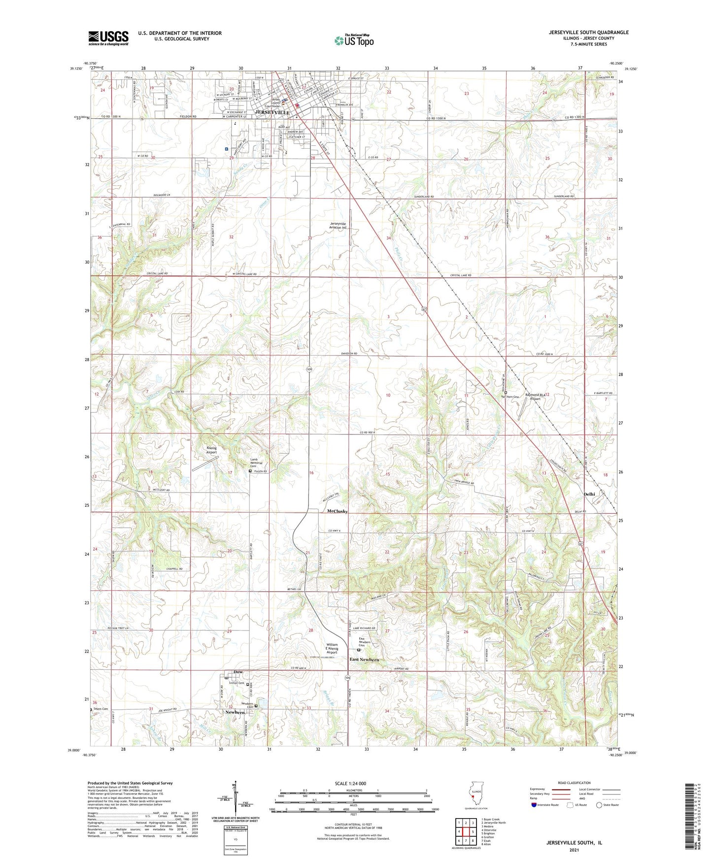
2024 topographic map quadrangle Jerseyville South in the state of Illinois. Scale: 1:24000. Based on the newly updated USGS 7.5' US Topo map series, this map is in the following counties: Jersey, Madison. The map contains contour data, water features, and other items you are used to seeing on USGS maps, but also has updated roads and other features. This is the next generation of topographic maps. Printed on high-quality waterproof paper with UV fade-resistant inks.
Quads adjacent to this one:
West: Otterville
Northwest: Boyer Creek
North: Jerseyville North
Northeast: Medora
East: Brighton
Southeast: Alton
South: Elsah
Southwest: Grafton
This map covers the same area as the classic USGS quad with code o39090a3.
Contains the following named places: Bethel Church, Bible Baptist Church, Blackjack School, Centennial School, Church of the Nazarene, City of Jerseyville, Community Christian Church, Delhi, Delhi Baptist Church, Delhi Elementary School, Dolan City Park, Dow, Dow Elementary School, Dow Post Office, Dow Southern Baptist Church, East Newbern, East Newbern Cemetery, First Assembly of God Church, First Baptist Church of Jerseyville, First Church of Christ Scientist, First Presbyterian Church, First Southern Baptist Church, First United Methodist Church of Jerseyville, Gospel Assembly Church, Greenwood Manor Nursing Home, Healing Waters Temple, Henderson School, Holy Chost Church, Illini Junior High School, Irene School, Jersey Community Hospital, Jersey Community Hospital Area Ambulance Service, Jersey Community Hospital Heliport, Jersey County, Jersey County Courthouse, Jersey County Sheriff's Office, Jerseyville, Jerseyville Aviation Inc, Jerseyville Downtown Historic District, Jerseyville East Elementary School, Jerseyville Municipal Building, Jerseyville Police Department, Jerseyville Post Office, Jerseyville Public Library, Jerseyville Volunteer Fire Department, Jerseyville West Elementary School, Kingdom Hall of Jehovahs Witnesses, Koenig Airport, Lamb Memorial Cemetery, Lions Club City Park, Little Piasa Creek, Lurton Cemetery, McClusky, New Delhi, Newbern, Newbern Cemetery, Newbern Cumberland Presbyterian Church, Open Door Fellowship Church, Public Square, Raymond RLA Airport, Round Prairie School, Saint Francis School, Saint Francis Xavier Church, Salem School, Susnig Civic Center, Township of Mississippi, Union School, Van Horn Cemetery, Victory Baptist Church, Victory Baptist School, Webster School, White School, William E Koenig Airport, WJBM-AM (Jerseyville), ZIP Codes: 62022, 62052