MyTopo
Brighton Illinois US Topo Map
Couldn't load pickup availability
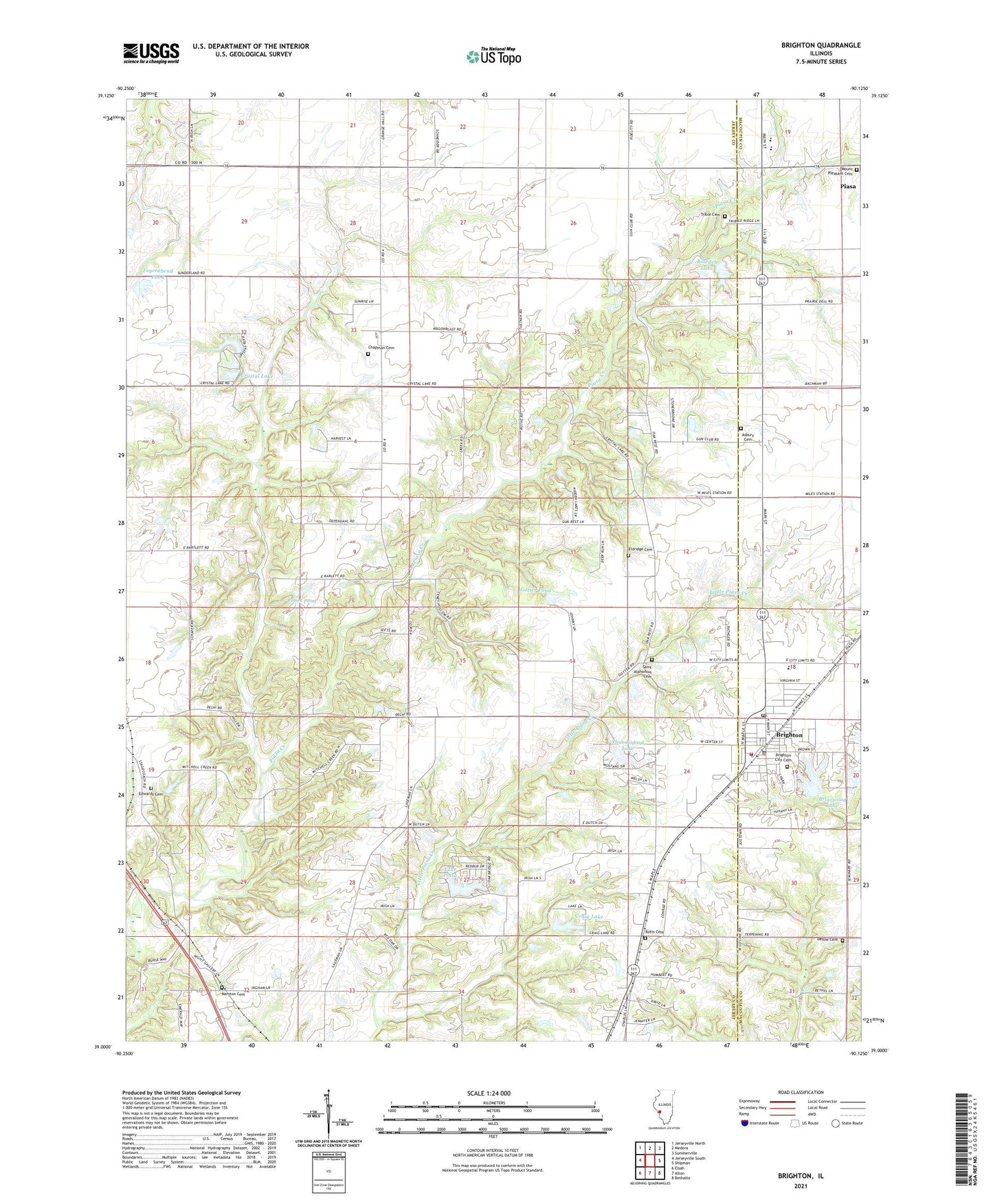
2024 topographic map quadrangle Brighton in the state of Illinois. Scale: 1:24000. Based on the newly updated USGS 7.5' US Topo map series, this map is in the following counties: Jersey, Macoupin, Madison. The map contains contour data, water features, and other items you are used to seeing on USGS maps, but also has updated roads and other features. This is the next generation of topographic maps. Printed on high-quality waterproof paper with UV fade-resistant inks.
Quads adjacent to this one:
West: Jerseyville South
Northwest: Jerseyville North
North: Medora
Northeast: Summerville
East: Shipman
Southeast: Bethalto
South: Alton
Southwest: Elsah
This map covers the same area as the classic USGS quad with code o39090a2.
Contains the following named places: Asbury Cemetery, Asbury Methodist Church, Baptist Church Cemetery, Betsy Ann Park, Botts Cemetery, Briarwood Lake, Brighton, Brighton Betsy Ann Fire Protection District, Brighton North Elementary School, Brighton Police Department, Brighton Post Office, Brighton West Elementary School, Budd School, Carlson Lake, Carlson Lake Dam, Central School, Chapman Cemetery, Craig Lake, Craig Lake Dam, Crystal Lake, Crystal Lake Dam, Dehne Cemetery, Dehne School, Diamond Hill School, Edwards Cemetery, Eldridge Cemetery, Eldridge School, Feyerabend Pond, Feyerabend Pond Dam, Gotter Pond, Gotter Pond Dam, Jones Pond, Jones Pond Dam, Lake Piasa, Lake Piasa Dam, Marston Cemetery, Mount Pleasant Cemetery, Paradise Church, Paradise School, Pembroke School, Prairie Union School, Rowden Lake, Rowden Lake Dam, Saint Alphonsus Cemetery, Southwestern High School, Thunderbird Lake, Township of Piasa, Trible Cemetery, Village of Brighton, Wagenblast School, ZIP Codes: 62012, 62079