MyTopo
Fair Haven Illinois US Topo Map
Couldn't load pickup availability
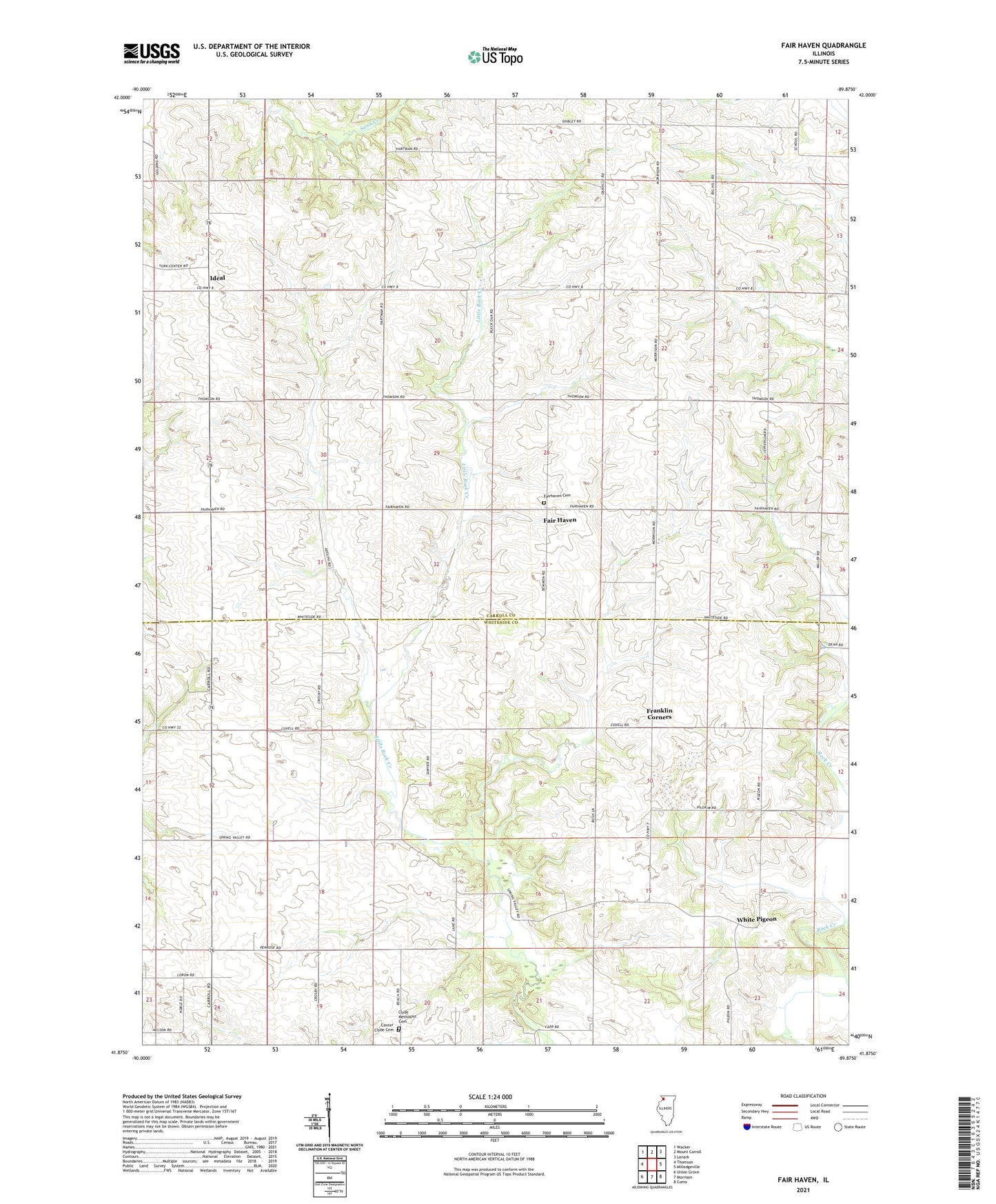
2024 topographic map quadrangle Fair Haven in the state of Illinois. Scale: 1:24000. Based on the newly updated USGS 7.5' US Topo map series, this map is in the following counties: Carroll, Whiteside. The map contains contour data, water features, and other items you are used to seeing on USGS maps, but also has updated roads and other features. This is the next generation of topographic maps. Printed on high-quality waterproof paper with UV fade-resistant inks.
Quads adjacent to this one:
West: Thomson
Northwest: Wacker
North: Mount Carroll
Northeast: Lanark
East: Milledgeville
Southeast: Como
South: Morrison
Southwest: Union Grove
This map covers the same area as the classic USGS quad with code o41089h8.
Contains the following named places: Center Clyde Cemetery, Center Clyde School, Clyde Church, Clyde Methodist Cemetery, Cobb School, Fair Haven, Fair Haven Center School, Fairhaven Cemetery, Fox School, Franklin Corners, Hartman School, Ideal, Jackson School, Jefferson School, Johnsons Creek Post Office, North Clyde School, Schultz Quarry, Township of Clyde, Township of Fairhaven, Ustick, White Pigeon, York School, ZIP Code: 61014