MyTopo
Mount Carroll Illinois US Topo Map
Couldn't load pickup availability
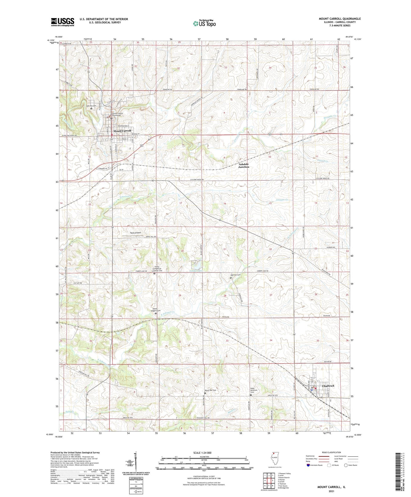
2024 topographic map quadrangle Mount Carroll in the state of Illinois. Scale: 1:24000. Based on the newly updated USGS 7.5' US Topo map series, this map is in the following counties: Carroll. The map contains contour data, water features, and other items you are used to seeing on USGS maps, but also has updated roads and other features. This is the next generation of topographic maps. Printed on high-quality waterproof paper with UV fade-resistant inks.
Quads adjacent to this one:
West: Wacker
Northwest: Pleasant Valley
North: Loran
Northeast: Boone Branch
East: Lanark
Southeast: Milledgeville
South: Fair Haven
Southwest: Thomson
This map covers the same area as the classic USGS quad with code o42089a8.
Contains the following named places: Adams - Daggert Cemetery, Ashdale Junction, Black Oak Cemetery, Black Oak Church, Carroll County, Carroll County Farm, Carroll County Sheriff's Office, Chadwick, Chadwick Fire Protection District, Chadwick Junior High School, Chadwick Police Department, Chadwick Post Office, City of Mount Carroll, Daggett, Daggett School, Emerson School, Fairground School, Fairview School, Ferrin School, First Baptist Church, First Lutheran Church, Hope Brethren Cemetery, Hope United Methodist Church, Kingery School, Mission Ridge School, Mount Carroll, Mount Carroll Ambulance, Mount Carroll Fire Protection District, Mount Carroll High School, Mount Carroll Historic District, Mount Carroll Police Department, Mount Carroll Post Office, Mount Carroll United Methodist Church, Oak Hill Cemetery, Oakville Cemetery, Oakville School, Pleasant Hill School, Straddle Creek, Tautz Airport, Timber Lake, Timber Lake Dam, Township of Salem, Trinity Evangelical Lutheran Cemetery, Trinity Lutheran Church, Village of Chadwick, Vinegar Hill School, Williard Nycum RLA Airport, ZIP Code: 61053