MyTopo
Fairman Illinois US Topo Map
Couldn't load pickup availability
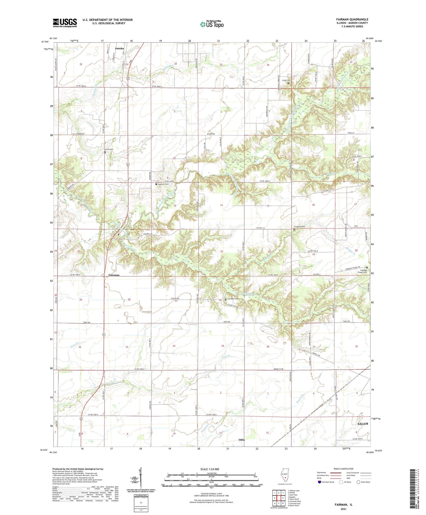
2024 topographic map quadrangle Fairman in the state of Illinois. Scale: 1:24000. Based on the newly updated USGS 7.5' US Topo map series, this map is in the following counties: Marion. The map contains contour data, water features, and other items you are used to seeing on USGS maps, but also has updated roads and other features. This is the next generation of topographic maps. Printed on high-quality waterproof paper with UV fade-resistant inks.
Quads adjacent to this one:
West: Boulder
Northwest: Wildcat Lake
North: Patoka
Northeast: Saint Paul
East: Salem North
Southeast: Salem South
South: Centralia East
Southwest: Centralia West
This map covers the same area as the classic USGS quad with code o38089f1.
Contains the following named places: Barden Creek, Brick School, Carrigan Cemetery, Carrigan School, Cruse Cemetery, Cubbage Chapel, Cubbage Chapel Cemetery, Davidson Creek, Eaglin Church, Fairman, Fredonia Cemetery, Fredonia School, Gattis School, Harrison Cemetery, Hemple School, Hoots Chapel Christian Church, Jacks School, Jims Creek, Jones Dairy Farm, Lewis Cemetery, Marshall Creek Church, Odin Oil Field, Patoka East Oil Field, Patoka South Oil Field, Possomtrot School, Quick Airport, Steward School, Township of Carrigan, Wisher School, Wood School, ZIP Codes: 62870, 62882