MyTopo
Patoka Illinois US Topo Map
Couldn't load pickup availability
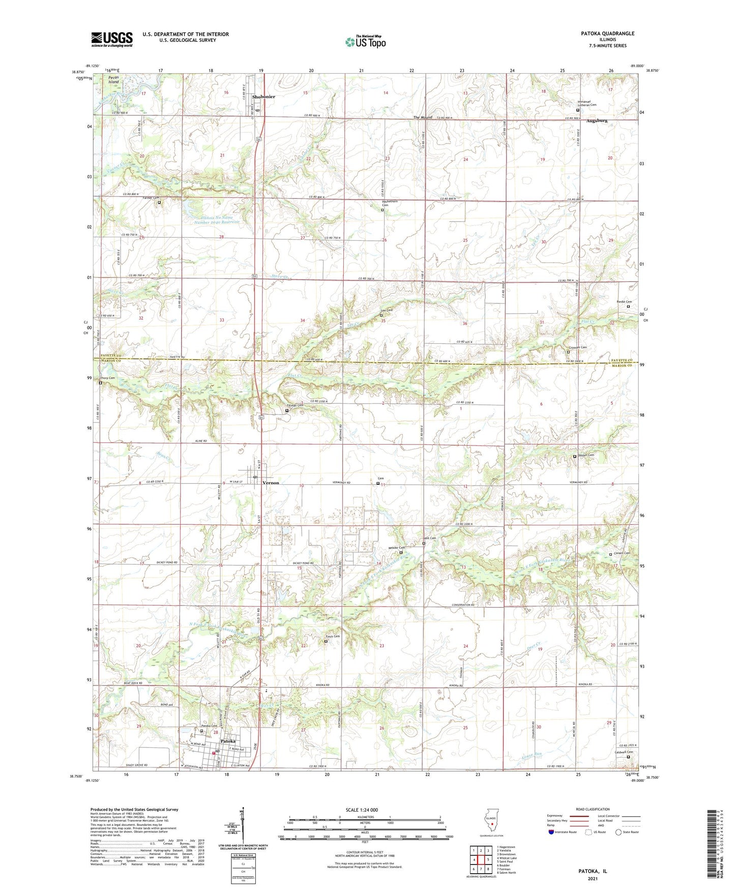
2024 topographic map quadrangle Patoka in the state of Illinois. Scale: 1:24000. Based on the newly updated USGS 7.5' US Topo map series, this map is in the following counties: Marion, Fayette. The map contains contour data, water features, and other items you are used to seeing on USGS maps, but also has updated roads and other features. This is the next generation of topographic maps. Printed on high-quality waterproof paper with UV fade-resistant inks.
Quads adjacent to this one:
West: Wildcat Lake
Northwest: Hagarstown
North: Vandalia
Northeast: Brownstown
East: Saint Paul
Southeast: Salem North
South: Fairman
Southwest: Boulder
This map covers the same area as the classic USGS quad with code o38089g1.
Contains the following named places: Augsburg, Caldwell Cemetery, Cemetery, Chance School, Conant Cemetery, Crowder Cemetery, Deer Creek, Doolen Cemetery, Doolen School, Farmer Cemetery, Finch Cemetery, Heckethorn Cemetery, Heckethorn School, Holt Cemetery, Illinois No Name Number 2040 Dam, Illinois No Name Number 2040 Reservoir, Immanuel Lutheran Cemetery, Independence School, Kaskaskia School, Lee Cemetery, Lee Creek, Lewis School, McConnell Cemetery, Meador Cemetery, Mound School, Patoka, Patoka Cemetery, Patoka Christian Church, Patoka Fire Protection District and Ambulance Service, Patoka Oil Field, Patoka Post Office, Patoka School, Plum Branch, Richview School, Riedle Cemetery, Sadler School, Shobonier, Shobonier Post Office, The Mound, Thorp Cemetery, Tillman Cemetery, Township of Kaskaskia, Township of Patoka, Vernon, Vernon Post Office, Village of Patoka, Village of Vernon, White Haven School, Zion Church, ZIP Codes: 62875, 62885, 62892