MyTopo
Wildcat Lake Illinois US Topo Map
Couldn't load pickup availability
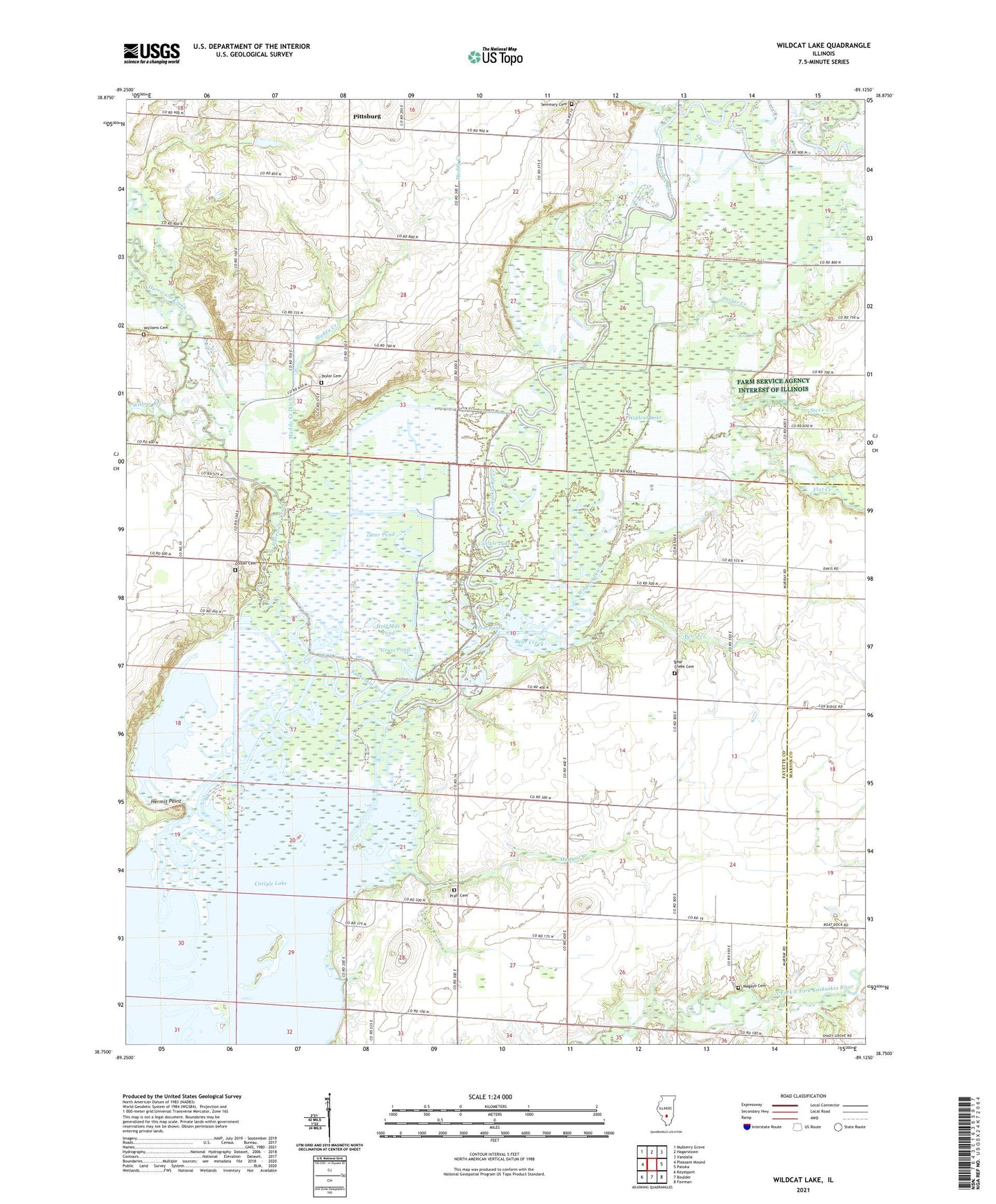
2024 topographic map quadrangle Wildcat Lake in the state of Illinois. Scale: 1:24000. Based on the newly updated USGS 7.5' US Topo map series, this map is in the following counties: Fayette, Marion. The map contains contour data, water features, and other items you are used to seeing on USGS maps, but also has updated roads and other features. This is the next generation of topographic maps. Printed on high-quality waterproof paper with UV fade-resistant inks.
Quads adjacent to this one:
West: Pleasant Mound
Northwest: Mulberry Grove
North: Hagarstown
Northeast: Vandalia
East: Patoka
Southeast: Fairman
South: Boulder
Southwest: Keyesport
This map covers the same area as the classic USGS quad with code o38089g2.
Contains the following named places: Bear Creek, Bear Creek Cemetery, Bear Creek Church, Bear Creek School, Buck Creek, Carlyle Lake State Wildlife Management Area, Cassar Creek, Collier Cemetery, Columbus Church, Columbus School, Cox Bridge Access Area, East Chapel School, East Fork Kaskaskia River, Flat Creek, Goose Pond, Grass Pond, Half Mile Pond, Hem Pond, Hermit Point, Hurricane Creek, Magassi Cemetery, Maggot Creek, Maple Grove School, Mound Chapel, Muddy Creek, Muddy Creek Ditch, Okaw School, Old River Lake, Otter Pond, Patoka Access Area, Pittsburg, Pope Townhall, Pratt Cemetery, Seminary Cemetery, Shady Grove School, Shiloh School, Soper Lake, Steve Creek, Taylor Cemetery, Township of Pope, Township of Seminary, West Chapel School, Wildcat Ditch, Wildcat Lake, Williams Cemetery, Willow Branch