MyTopo
Florid Illinois US Topo Map
Couldn't load pickup availability
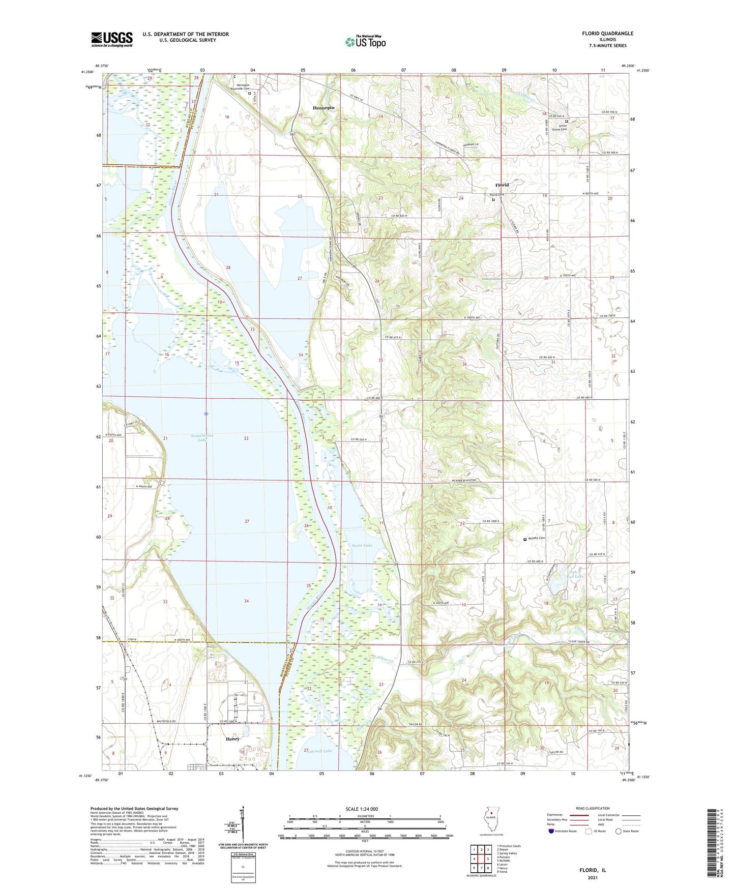
2024 topographic map quadrangle Florid in the state of Illinois. Scale: 1:24000. Based on the newly updated USGS 7.5' US Topo map series, this map is in the following counties: Putnam, Marshall, Bureau. The map contains contour data, water features, and other items you are used to seeing on USGS maps, but also has updated roads and other features. This is the next generation of topographic maps. Printed on high-quality waterproof paper with UV fade-resistant inks.
Quads adjacent to this one:
West: Putnam
Northwest: Princeton South
North: Depue
Northeast: Spring Valley
East: McNabb
Southeast: Varna
South: Henry
Southwest: Lacon
This map covers the same area as the classic USGS quad with code o41089b3.
Contains the following named places: Big Bureau Creek, Clear Creek, Coffee Creek, Durley School, Fish N Fun Lake, Fish N Fun Lake Dam, Florid, Florid Cemetery, Harrison School, Hennepin Riverside Cemetery, Indian Spring, Lake Senachwine Conservation Area, Little Sister Seaplane Base, Maple Grove School, Murphy Cemetery, Poole Creek, Poole School, Putnam County, Putnam County Elementary School-Hennepin Building, Sand Prairie School, Senachwine Creek, Senachwine Lake, Sprinkleburg School, Strawn School, Swan Lake, Township of Hennepin, Undercliff, Union Grove Cemetery, Village of Hennepin, Walnut Grove, ZIP Code: 61327