MyTopo
McNabb Illinois US Topo Map
Couldn't load pickup availability
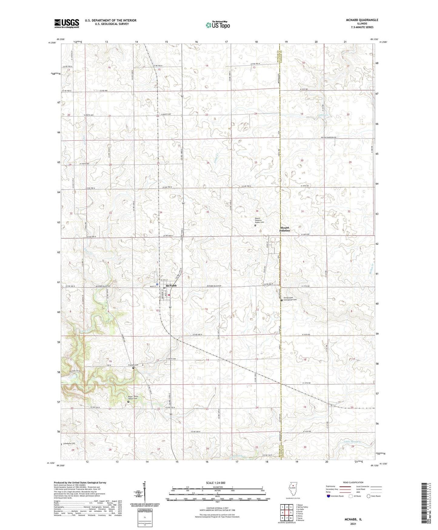
2024 topographic map quadrangle McNabb in the state of Illinois. Scale: 1:24000. Based on the newly updated USGS 7.5' US Topo map series, this map is in the following counties: Putnam, LaSalle. The map contains contour data, water features, and other items you are used to seeing on USGS maps, but also has updated roads and other features. This is the next generation of topographic maps. Printed on high-quality waterproof paper with UV fade-resistant inks.
Quads adjacent to this one:
West: Florid
Northwest: Depue
North: Spring Valley
Northeast: La Salle
East: Tonica
Southeast: Wenona
South: Varna
Southwest: Henry
This map covers the same area as the classic USGS quad with code o41089b2.
Contains the following named places: Black College School, Boyle - Price Valley Cemetery, Brennemann School, British Lane School, Caledonia Cemetery, Centerville School, Coleman Park, Dose School, Dysart School, Edgewood Park Golf Course, Fairview School, Friends Cemetery, Friends Church, Hartenbower Hectares Airport, Hullinger School, Immaculate Conception Cemetery, Immaculate Conception Church, Immanuel Church, John Swaney School, Mc Nabb Post Office, McNabb, Mcnabb City Police Department, McNabb Fire Department, Mount Palatine, Mount Palatine Cemetery Prairie Nature Preserve, Mount Palatine Public Cemetery, Powell School, Putnam County EMS, Putnam County Junior High School, Robert Siemers Landing Strip, Township of Magnolia, Village of McNabb, ZIP Codes: 61326, 61335