MyTopo
Henry Illinois US Topo Map
Couldn't load pickup availability
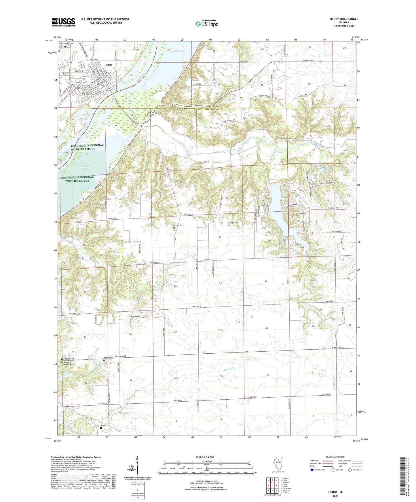
2024 topographic map quadrangle Henry in the state of Illinois. Scale: 1:24000. Based on the newly updated USGS 7.5' US Topo map series, this map is in the following counties: Marshall, Putnam. The map contains contour data, water features, and other items you are used to seeing on USGS maps, but also has updated roads and other features. This is the next generation of topographic maps. Printed on high-quality waterproof paper with UV fade-resistant inks.
Quads adjacent to this one:
West: Lacon
Northwest: Putnam
North: Florid
Northeast: McNabb
East: Varna
Southeast: La Rose
South: Washburn
Southwest: Chillicothe
This map covers the same area as the classic USGS quad with code o41089a3.
Contains the following named places: Barnes Lake, Barnes Lake Dam, Billsbach Lake, Caledonia, City of Henry, Forbes Cemetery, George S Park Memorial Woods Nature Preserve, Greeves Cemetery, Harmony School, Harris Cemetery, Held, Henry, Henry Cemetery, Henry Community Ambulance Service, Henry Fire Protection District, Henry Police Department, Henry Post Office, Henry-Senachwine Grade School, Henry-Senachwine High School, Hopewell Townhall, Jason and Broadus Cemetery, Kings House of Retreats Chapel, Lacon Country Club, Lake Tanglewood, Lake Tanglewood Dam, Lake Wildwood, Marshall County, Marshall School, Newhaven Lake, Russell Cemetery, Sandy Creek, Sawmill Lake, Sawyer Cemetery, Sawyer School, Shaw Creek, Shaws Point School, Strawn Cemetery, Tax School, Township of Hopewell, Whitney Lake, Wildwood Lake Dam, WRVY-FM (Henry), ZIP Code: 61540