MyTopo
Gifford Illinois US Topo Map
Couldn't load pickup availability
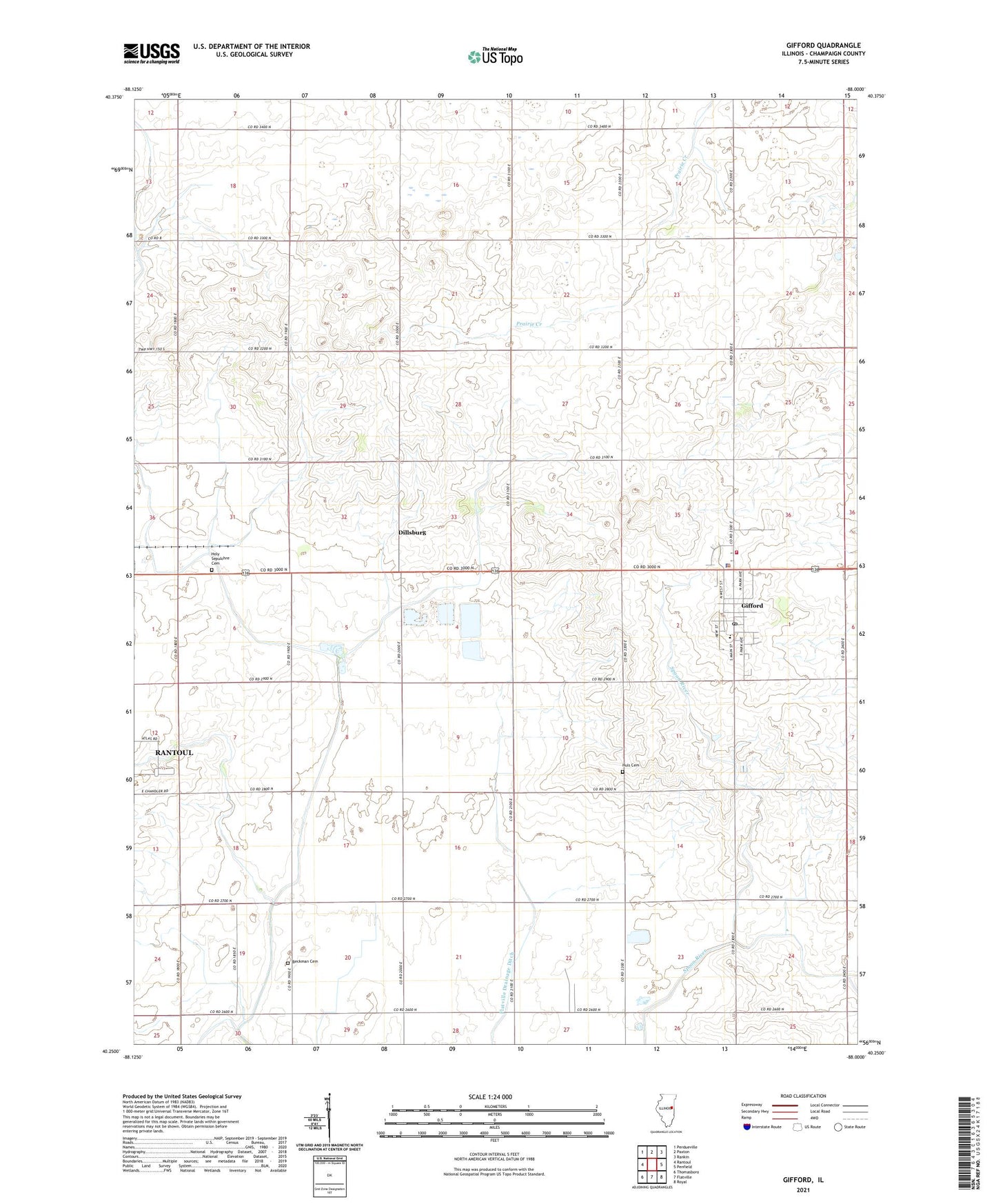
2024 topographic map quadrangle Gifford in the state of Illinois. Scale: 1:24000. Based on the newly updated USGS 7.5' US Topo map series, this map is in the following counties: Champaign. The map contains contour data, water features, and other items you are used to seeing on USGS maps, but also has updated roads and other features. This is the next generation of topographic maps. Printed on high-quality waterproof paper with UV fade-resistant inks.
Quads adjacent to this one:
West: Rantoul
Northwest: Perdueville
North: Paxton
Northeast: Rankin
East: Penfield
Southeast: Royal
South: Flatville
Southwest: Thomasboro
This map covers the same area as the classic USGS quad with code o40088c1.
Contains the following named places: Battles School, Beckman Cemetery, Busboom Airport, Church of Christ, Cook School, Dillsburg, Flatville Drainage Ditch, Franzen School, Gifford, Gifford Elementary School, Gifford Fire Protection District, Gifford Police Department, Gifford Post Office, Griswold School, Harwood Center School, Harwood Townhall, Holy Sepulchre Cemetery, Huls Cemetery, Kentucky School, McMaster School, Mennenga Farm, Pleasant Ridge School, Pleasant Vale School, Prairie Star School, Rantoul Plaza Shopping Center, Roessler Memorial Park, Saint Pauls Lutheran Church, Township of Compromise, Township of Harwood, Village of Gifford, ZIP Code: 61847