MyTopo
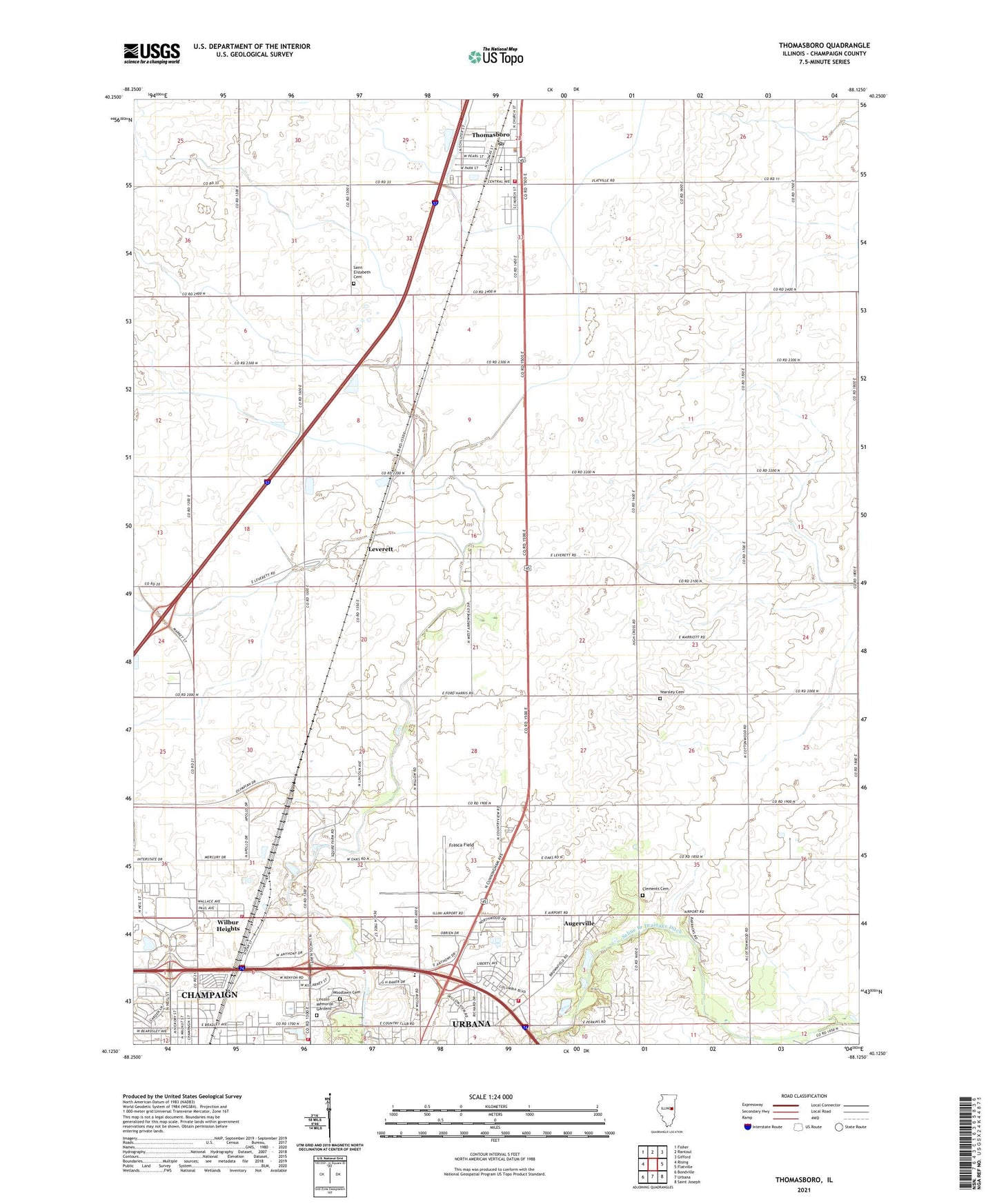
Thomasboro Illinois US Topo Map
Couldn't load pickup availability
2024 topographic map quadrangle Thomasboro in the state of Illinois. Scale: 1:24000. Based on the newly updated USGS 7.5' US Topo map series, this map is in the following counties: Champaign. The map contains contour data, water features, and other items you are used to seeing on USGS maps, but also has updated roads and other features. This is the next generation of topographic maps. Printed on high-quality waterproof paper with UV fade-resistant inks.
Quads adjacent to this one:
West: Rising
Northwest: Fisher
North: Rantoul
Northeast: Gifford
East: Flatville
Southeast: Saint Joseph
South: Urbana
Southwest: Bondville
This map covers the same area as the classic USGS quad with code o40088b2.
Contains the following named places: Augerville, Beardsley Park, Boneyard Creek, Busey Woods, Carley Church, Carroll Fire Department, Champaign County, Clements Cemetery, Columbia Elementary School, Eastern Prairie Fire Protection District, Faith Church, Fiedler School, Ford-Harris Park, Frasca Field, Frasca Field Industrial Park, Hazel Park, Illini Airport, Leverett, Lincoln Memorial Gardens, Locust Grove School, Market Place Business & Technical Center, Market Place Mall Shopping Center, Market Street Industrial Park, North Lincoln Industrial Park, Perkins School, Saint Elizabeth Cemetery, Saline Branch Drainage Ditch, Stewart School, Thomasboro, Thomasboro Fire Protection District, Thomasboro Grade School, Thomasboro Post Office, Thomasboro Village Police Department, Township of Somer, University of Illinois Experimental Forest, University of Illinois Research Forest, Urbana Country Club, Urbana Fire Rescue Services North Station, Village of Thomasboro, Wilbur Heights, WLTM-FM (Rantoul), Woodlawn Cemetery, Yearsley Cemetery, ZIP Codes: 61802, 61878