MyTopo
Penfield Illinois US Topo Map
Couldn't load pickup availability
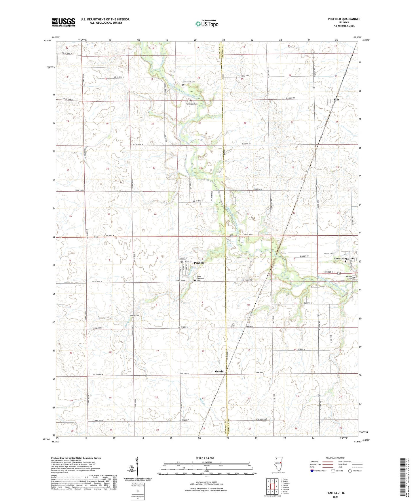
2024 topographic map quadrangle Penfield in the state of Illinois. Scale: 1:24000. Based on the newly updated USGS 7.5' US Topo map series, this map is in the following counties: Champaign, Vermilion. The map contains contour data, water features, and other items you are used to seeing on USGS maps, but also has updated roads and other features. This is the next generation of topographic maps. Printed on high-quality waterproof paper with UV fade-resistant inks.
Quads adjacent to this one:
West: Gifford
Northwest: Paxton
North: Rankin
Northeast: East Lynn
East: Potomac
Southeast: Collison
South: Royal
Southwest: Flatville
This map covers the same area as the classic USGS quad with code o40087c8.
Contains the following named places: Armstrong, Armstrong High School, Armstrong Post Office, Armstrong-Ellis Elementary School, Buck Creek, Chenoweth Cemetery, Circle Post Office, Ellis, Foster School, Gerald, Gordon School, Kuder School, Martin School, Obenchain School, Partlow Cemetery, Penfield, Penfield Census Designated Place, Penfield Post Office, Penfield United Methodist Church, Saint Lawrence Catholic Church, Saint Lawrence Cemetery, Sugar Creek, Tomlinson Cemetery, Tomlinson Pioneer Cemetery Prairie Nature Preserve, Township of Kerr, Walters School, WCCU-TV (Urbana), Welles Cemetery, ZIP Code: 61862