MyTopo
Iuka Illinois US Topo Map
Couldn't load pickup availability
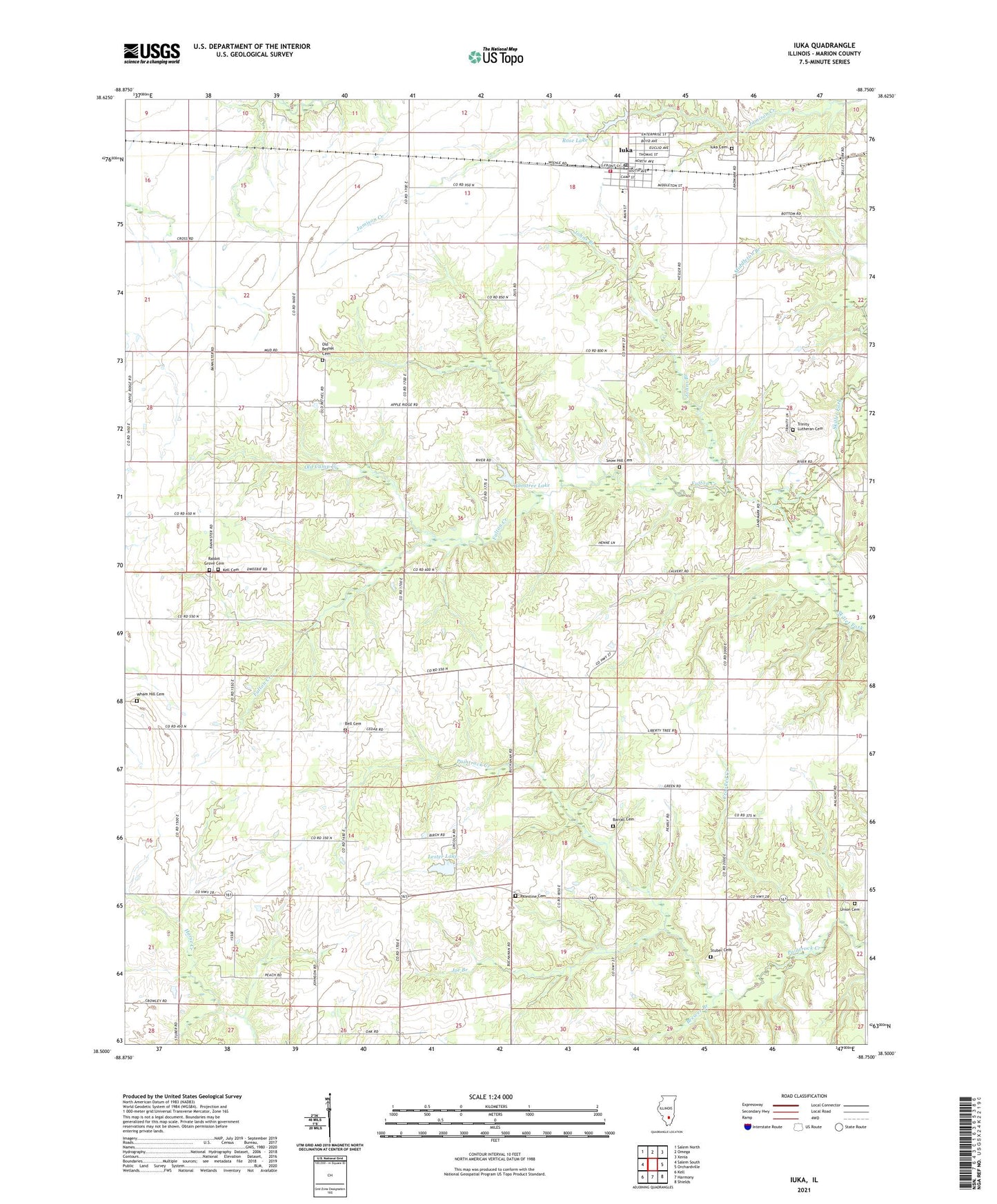
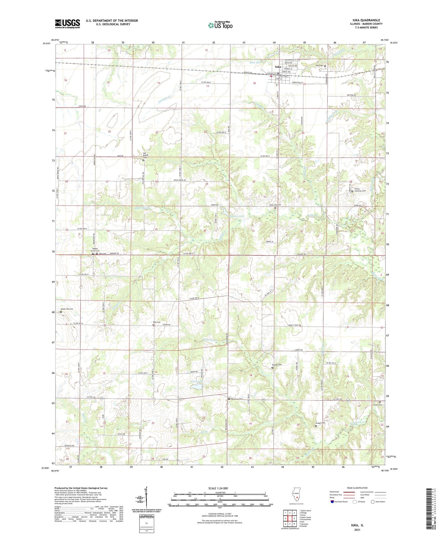
2024 topographic map quadrangle Iuka in the state of Illinois. Scale: 1:24000. Based on the newly updated USGS 7.5' US Topo map series, this map is in the following counties: Marion. The map contains contour data, water features, and other items you are used to seeing on USGS maps, but also has updated roads and other features. This is the next generation of topographic maps. Printed on high-quality waterproof paper with UV fade-resistant inks.
Quads adjacent to this one:
West: Salem South
Northwest: Salem North
North: Omega
Northeast: Xenia
East: Orchardville
Southeast: Shields
South: Harmony
Southwest: Kell
This map covers the same area as the classic USGS quad with code o38088e7.
Contains the following named places: Apple Ridge School, Bannister, Bannister Switch, Barrall Cemetery, Bell Cemetery, Bell Church, Bell School, Brewer Branch, Cherry Ridge School, Crooked Creek, Dalton School, Elm Grove Church, Fulton Creek, Goostree Lake, Green Church, Haines Townhall, Iuka, Iuka Cemetery, Iuka Elementary School, Iuka Fire Protection District, Iuka Post Office, Joe Branch, Johns Branch, Kell Cemetery, Lester Lake, Lester Lake Dam, Liberty School, Metcalf School, New Home School, Old Bethel Cemetery, Old Bethel Church, Old Camp Creek, Palestine Cemetery, Palestine Church, Palestine School, Panhandle School, Pleasant Grove Church, Prairie Grove School, Rabbit Grove Cemetery, Rabbit Grove Church, Romine Townhall, Rose Lake, Rose Lake Dam, Snow Hill Cemetery, Snowhill Church, Snowhill School, Stevenson Townhall, Stuber Cemetery, Township of Haines, Township of Iuka, Township of Romine, Township of Stevenson, Trinity Church, Trinity Lutheran Cemetery, Trinity School, Union Cemetery, Union Grove Cemetery, Union Town, Village of Iuka, Wham Hill Cemetery, ZIP Code: 62849