MyTopo
Orchardville Illinois US Topo Map
Couldn't load pickup availability
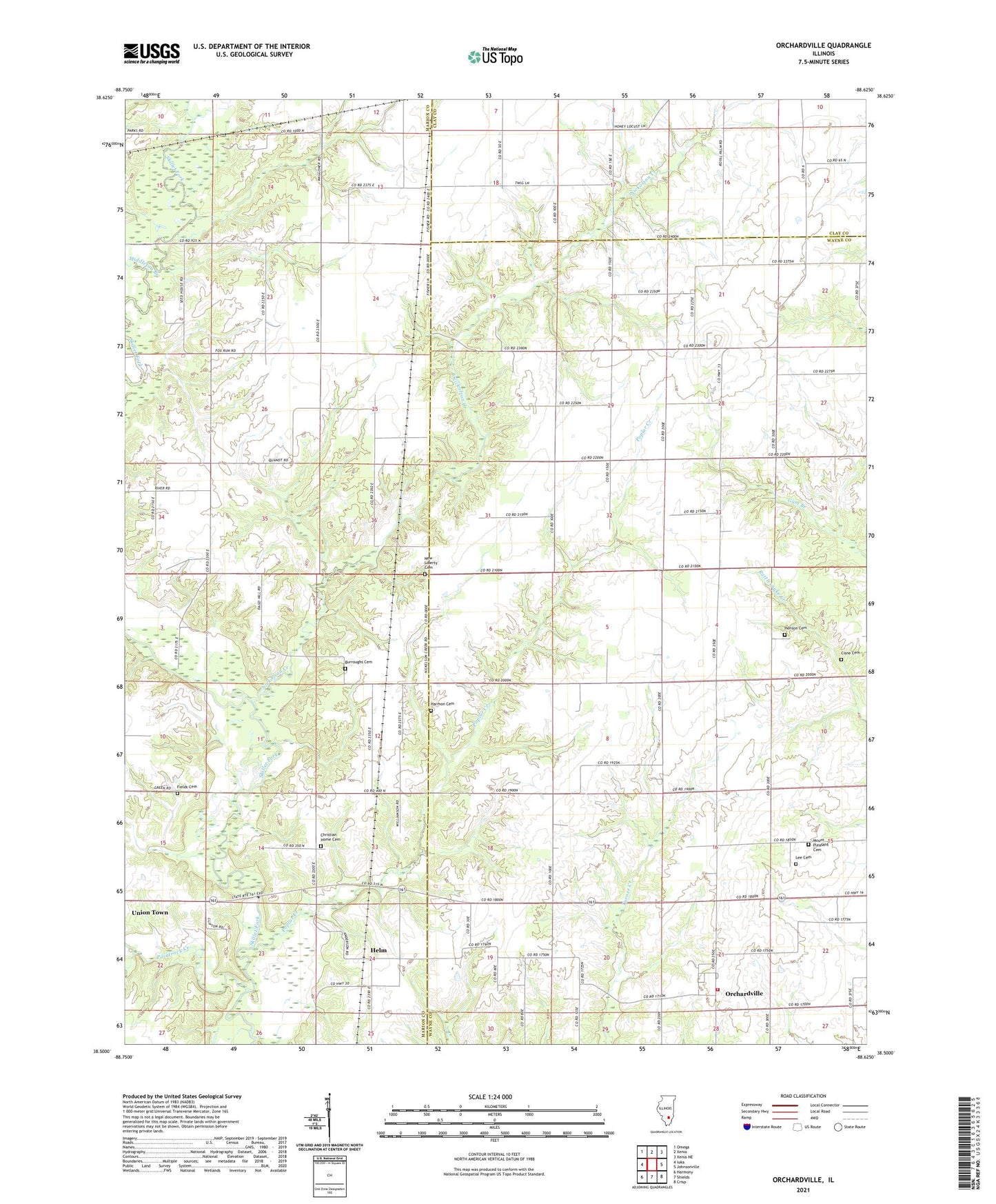
2024 topographic map quadrangle Orchardville in the state of Illinois. Scale: 1:24000. Based on the newly updated USGS 7.5' US Topo map series, this map is in the following counties: Wayne, Marion, Clay. The map contains contour data, water features, and other items you are used to seeing on USGS maps, but also has updated roads and other features. This is the next generation of topographic maps. Printed on high-quality waterproof paper with UV fade-resistant inks.
Quads adjacent to this one:
West: Iuka
Northwest: Omega
North: Xenia
Northeast: Xenia NE
East: Johnsonville
Southeast: Crisp
South: Shields
Southwest: Harmony
This map covers the same area as the classic USGS quad with code o38088e6.
Contains the following named places: Banner School, Burrough School, Burroughs Cemetery, Butterfly School, Chapman School, Christian Home Cemetery, Christian Home Church, Cisne Cemetery, Cornish, Fields Cemetery, Gum Branch School, Harmon Cemetery, Helm, Henson Cemetery, Hickory Flat School, Holiday School, Iuka Oil Field, Lee Cemetery, Middleton Branch, Mount Pleasant Cemetery, Mount Pleasant Church, New Liberty Cemetery, New Liberty Church, Nickolson Creek, Orchardville, Orchardville Fire Protection District, Paintrock Creek, Pleasant Hill Church, Poplar Creek, Poplar Creek Church, Powers Church, Township of Garden Hill, Township of Orchard, Union School, Vaughn Church, Vest School, Vickrey School, Young School, ZIP Code: 62899