MyTopo
Xenia Illinois US Topo Map
Couldn't load pickup availability
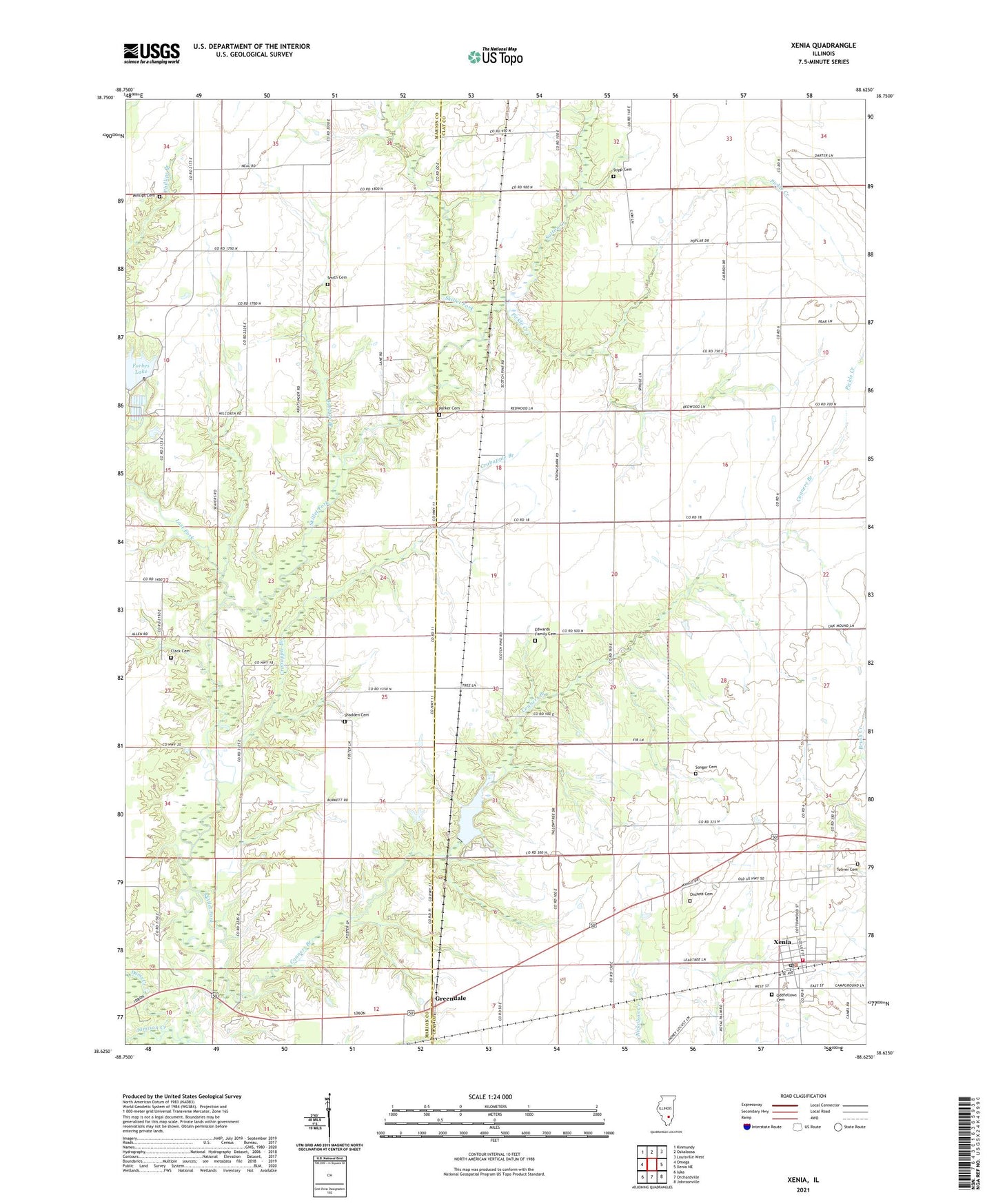
2024 topographic map quadrangle Xenia in the state of Illinois. Scale: 1:24000. Based on the newly updated USGS 7.5' US Topo map series, this map is in the following counties: Clay, Marion. The map contains contour data, water features, and other items you are used to seeing on USGS maps, but also has updated roads and other features. This is the next generation of topographic maps. Printed on high-quality waterproof paper with UV fade-resistant inks.
Quads adjacent to this one:
West: Omega
Northwest: Kinmundy
North: Oskaloosa
Northeast: Louisville West
East: Xenia NE
Southeast: Johnsonville
South: Orchardville
Southwest: Iuka
This map covers the same area as the classic USGS quad with code o38088f6.
Contains the following named places: Bethel, Bobbies Branch, Brown Church, Brown School, Center School, Clack Cemetery, Conners Branch, Conners Chapel, Crabapple Branch, Dums Creek, Edwards Family Cemetery, Forbes Lake, Forbes Lake Dam, Forest School, Greendale, Greendale Lake, Greendale Lake Dam, Jamison Creek, Lakeview Picnic Area, Lone Star School, Lost Fork, Marlow Pond, Marlow Pond Dam, Mount Carmel Church, Oddfellows Cemetery, Onstott Cemetery, Onstott Church, Paine School, Parker Cemetery, Phillips Cemetery, Pickle Creek, Russell School, Shadden Cemetery, Shadden School, Smith Cemetery, Songer Cemetery, Stipp Cemetery, Sutton Creek, Toliver Cemetery, Township of Songer, Township of Xenia, Village of Xenia, White Pine School, Woodland School, Woodlawn Church, Xenia, Xenia Grade School, Xenia Oil Field, Xenia Post Office, Xenia Volunteer Fire Protection District, Zion Church