MyTopo
Jerseyville North Illinois US Topo Map
Couldn't load pickup availability
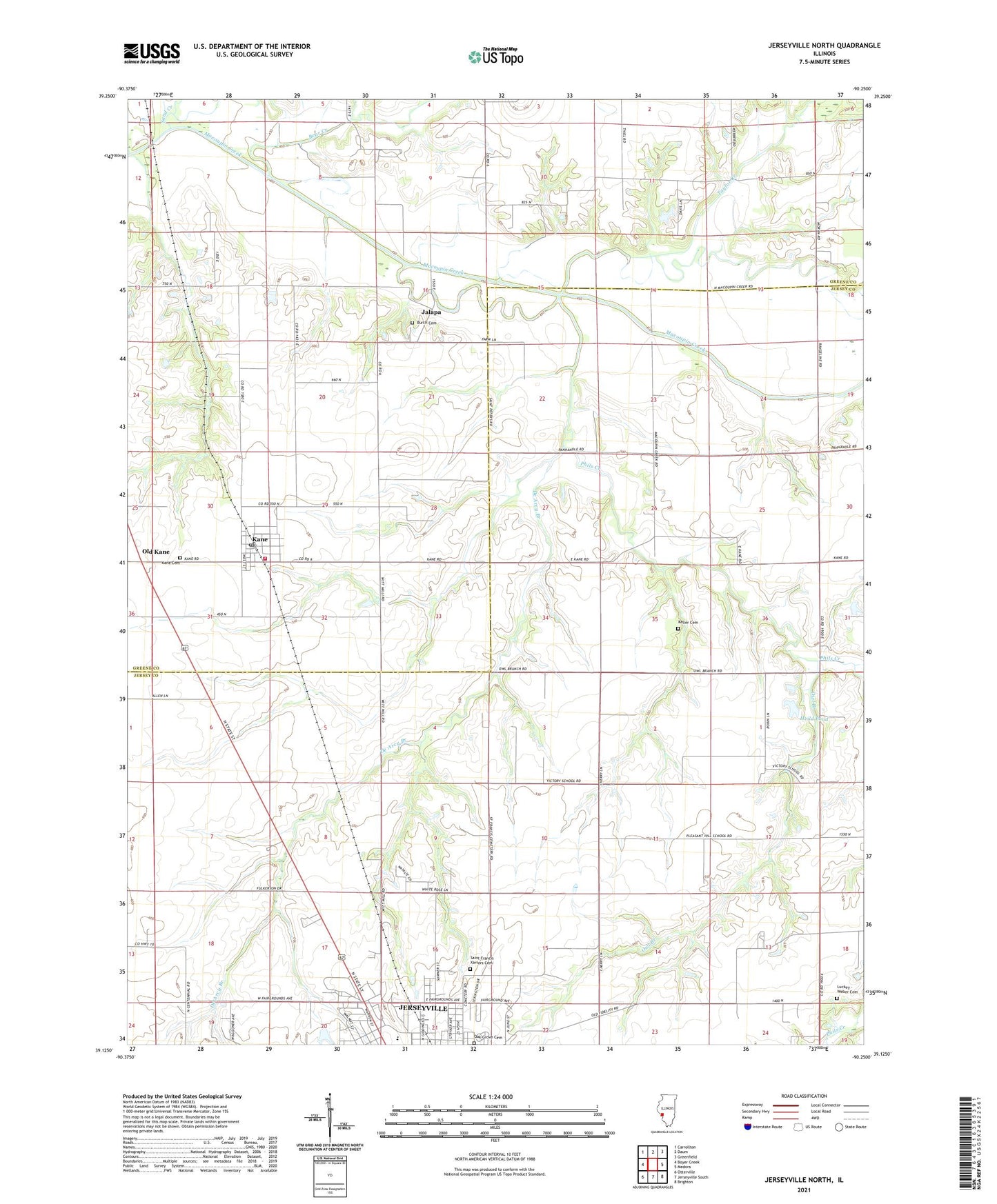
2024 topographic map quadrangle Jerseyville North in the state of Illinois. Scale: 1:24000. Based on the newly updated USGS 7.5' US Topo map series, this map is in the following counties: Jersey, Greene. The map contains contour data, water features, and other items you are used to seeing on USGS maps, but also has updated roads and other features. This is the next generation of topographic maps. Printed on high-quality waterproof paper with UV fade-resistant inks.
Quads adjacent to this one:
West: Boyer Creek
Northwest: Carrollton
North: Daum
Northeast: Greenfield
East: Medora
Southeast: Brighton
South: Jerseyville South
Southwest: Otterville
This map covers the same area as the classic USGS quad with code o39090b3.
Contains the following named places: American Legion Fairground, Bear Creek, Burch Cemetery, De Arcy Branch, Green Persimmon School, Heild Pond, Heild Pond Dam, Hope Lutheran Church, Jalapa, Jersey Community High School, Jerseyville Church of Christ, Kane, Kane Baptist Church, Kane Cemetery, Kane Post Office, Keller Cemetery, Link Branch, Little Bear Rough, Luckey - Weber Cemetery, Mount Pleasant School, Oak Grove Cemetery, Old Kane, Owl Branch, Phils Creek, Pleasant Hill School, Saint Francis Xaviers Cemetery, Sand Creek, Sherman School, Taylor Creek, Tolman School, Township of Jersey, Victory School, Village of Kane, Westlake Golf Course, White Rose School, White School, Woodbury School, ZIP Code: 62054