MyTopo
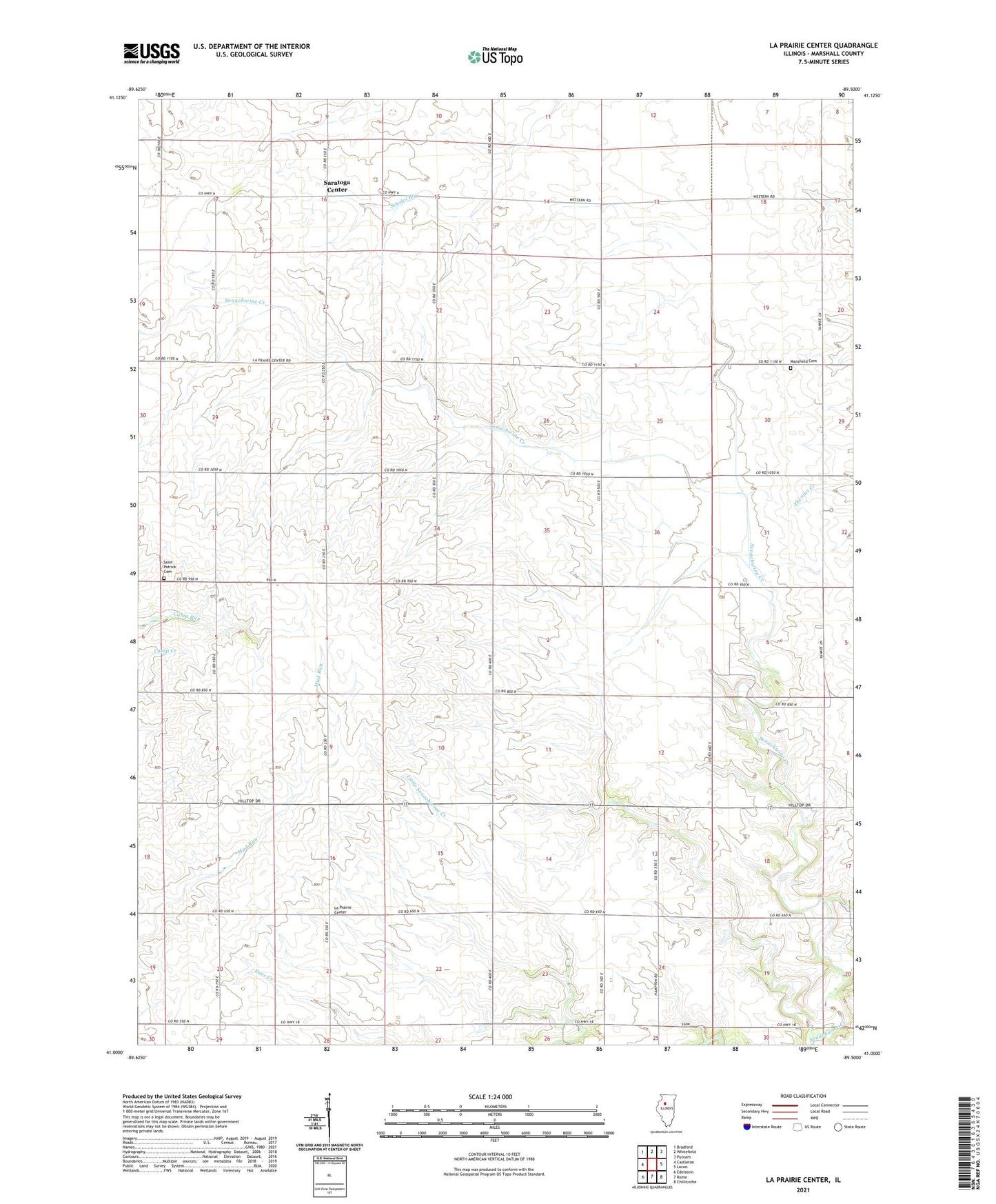
La Prairie Center Illinois US Topo Map
Couldn't load pickup availability
2024 topographic map quadrangle La Prairie Center in the state of Illinois. Scale: 1:24000. Based on the newly updated USGS 7.5' US Topo map series, this map is in the following counties: Marshall. The map contains contour data, water features, and other items you are used to seeing on USGS maps, but also has updated roads and other features. This is the next generation of topographic maps. Printed on high-quality waterproof paper with UV fade-resistant inks.
Quads adjacent to this one:
West: Castleton
Northwest: Bradford
North: Whitefield
Northeast: Putnam
East: Lacon
Southeast: Chillicothe
South: Rome
Southwest: Edelstein
This map covers the same area as the classic USGS quad with code o41089a5.
Contains the following named places: Collins School, Coulter School, Doyle School, Drake School, Henry Fire Protection District Station 2, Hull School, Kaifer School, La Prairie Center, La Prairie United Presbyterian Church, Mansfield Cemetery, McVicker School, Red Town School, Rickey School, Saint Patrick Cemetery, Saratoga Center, Saratoga Church, Senachwine School, Smith School, Township of La Prairie, Township of Saratoga, ZIP Code: 61565