MyTopo
Whitefield Illinois US Topo Map
Couldn't load pickup availability
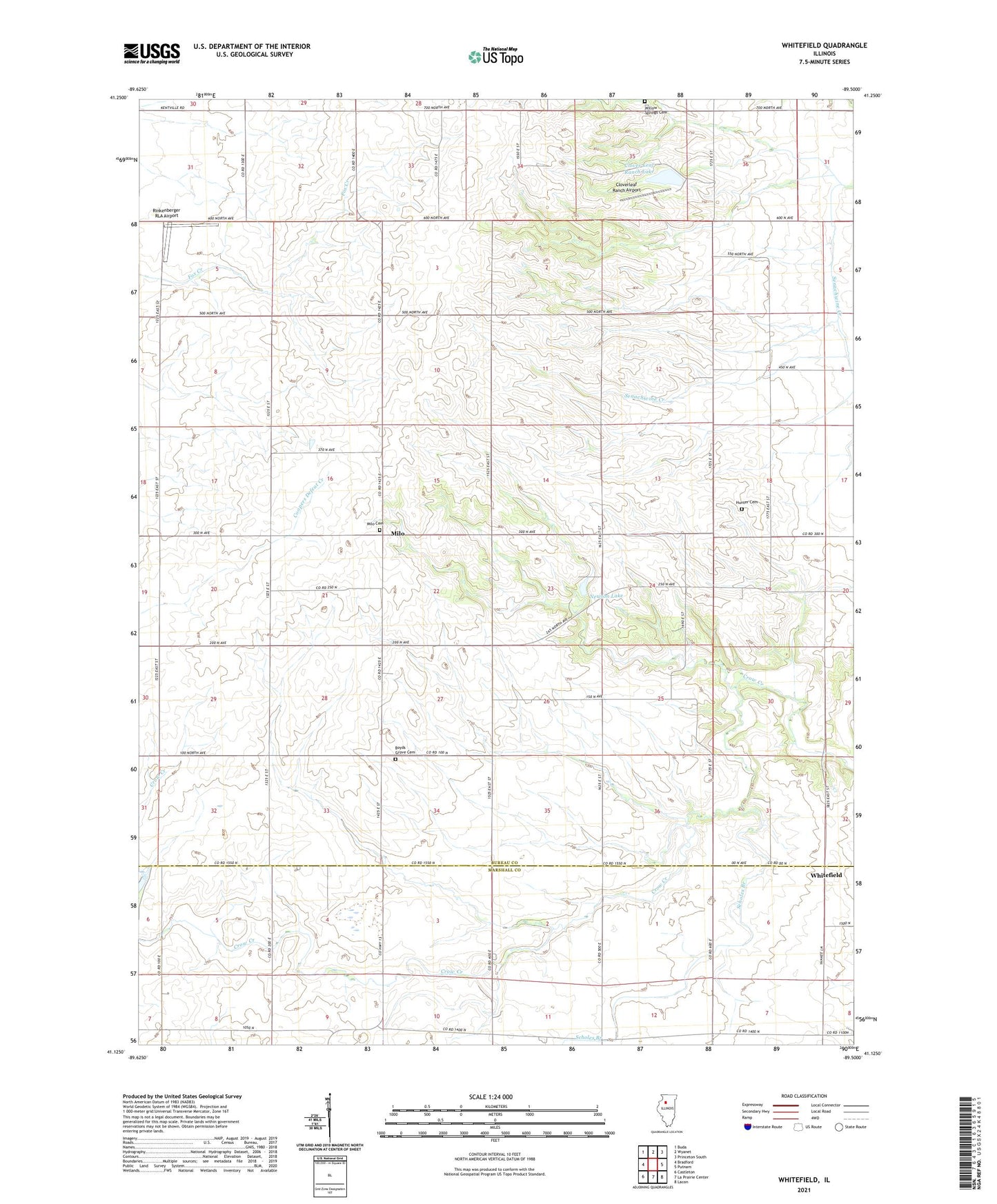
2024 topographic map quadrangle Whitefield in the state of Illinois. Scale: 1:24000. Based on the newly updated USGS 7.5' US Topo map series, this map is in the following counties: Bureau, Marshall. The map contains contour data, water features, and other items you are used to seeing on USGS maps, but also has updated roads and other features. This is the next generation of topographic maps. Printed on high-quality waterproof paper with UV fade-resistant inks.
Quads adjacent to this one:
West: Bradford
Northwest: Buda
North: Wyanet
Northeast: Princeton South
East: Putnam
Southeast: Lacon
South: La Prairie Center
Southwest: Castleton
This map covers the same area as the classic USGS quad with code o41089b5.
Contains the following named places: Boyds Grove Cemetery, Boyds Grove Church, Clover Leaf Ranch Lake, Clover Leaf Ranch Lake Dam, Cloverleaf Ranch Airport, Conover School, Cottage School, Dorr Hill School, Evergreen School, Hoffman School, Hunter Cemetery, Hunter School, Jamison School, Mason School, Milo, Milo Cemetery, Newton Lake, Newton Lake Dam, Newton-Hager Lake, Newton-Hager Lake Dam, Reid School, Rinkenberger RLA Airport, Scholes Branch, Sharkey School, Shurts School, Township of Milo, Whitefield, Willow Springs Cemetery, Willow Springs Mennonite Church, Wilson School