MyTopo
Castleton Illinois US Topo Map
Couldn't load pickup availability
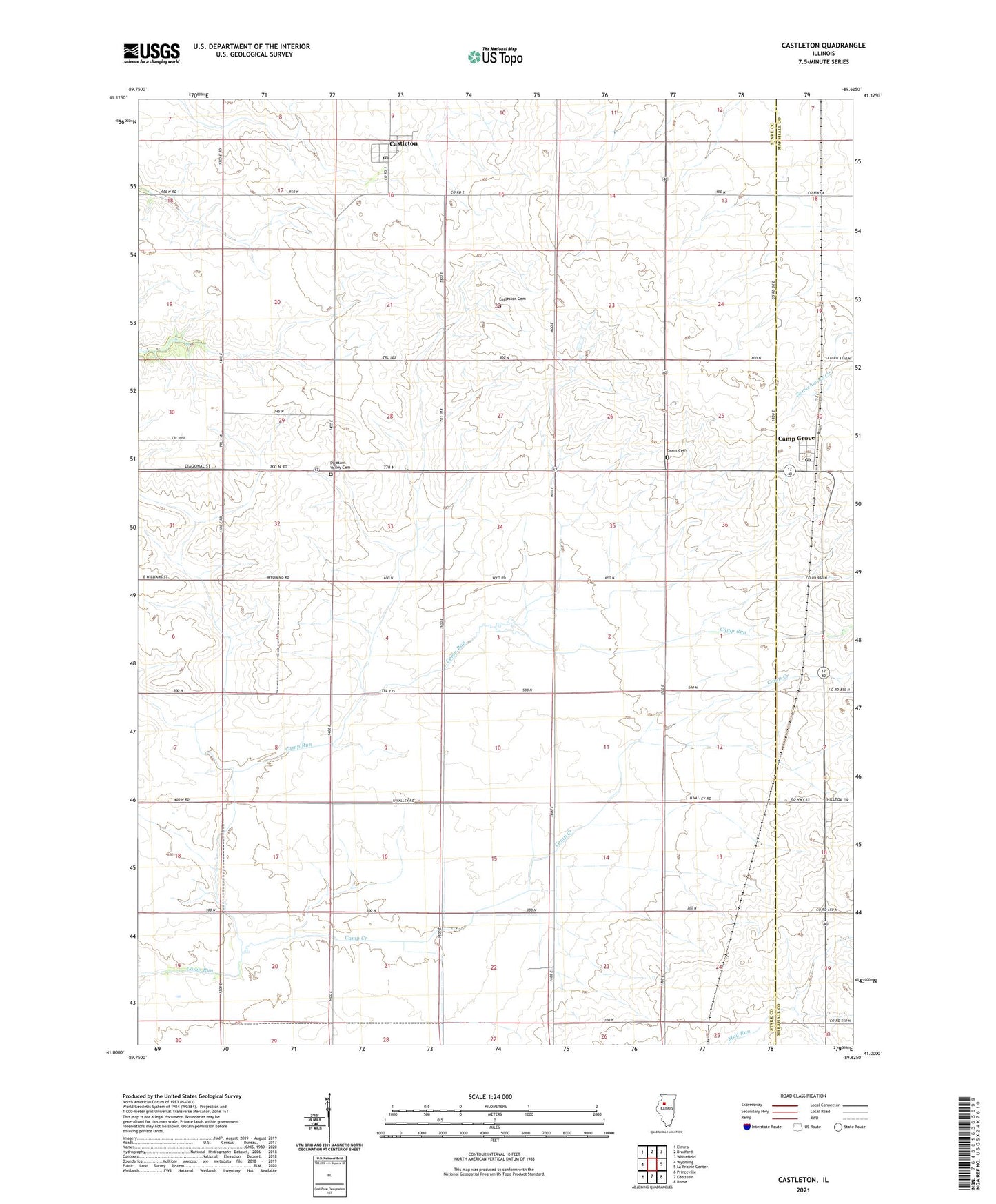
2024 topographic map quadrangle Castleton in the state of Illinois. Scale: 1:24000. Based on the newly updated USGS 7.5' US Topo map series, this map is in the following counties: Stark, Marshall. The map contains contour data, water features, and other items you are used to seeing on USGS maps, but also has updated roads and other features. This is the next generation of topographic maps. Printed on high-quality waterproof paper with UV fade-resistant inks.
Quads adjacent to this one:
West: Wyoming
Northwest: Elmira
North: Bradford
Northeast: Whitefield
East: La Prairie Center
Southeast: Rome
South: Edelstein
Southwest: Princeville
This map covers the same area as the classic USGS quad with code o41089a6.
Contains the following named places: Baughn School, Breezy Point Landing Strip, Camp Creek, Camp Grove, Camp Grove Community Fire District, Castleton, Castleton Post Office, Colgan School, Dewey School, Eagleston Cemetery, Grant Cemetery, Grant School, Jefferson School, Kellogg School, Lincoln School, Logan School, Pleasant Valley Cemetery, Saint Timothy Lutheran Church, Sheridan School, Tanner's Orchard, Township of Penn, Township of Valley, Valley Center School, Valley Grove School, Valley School, ZIP Codes: 61424, 61426, 61479, 61491