MyTopo
Lee Illinois US Topo Map
Couldn't load pickup availability
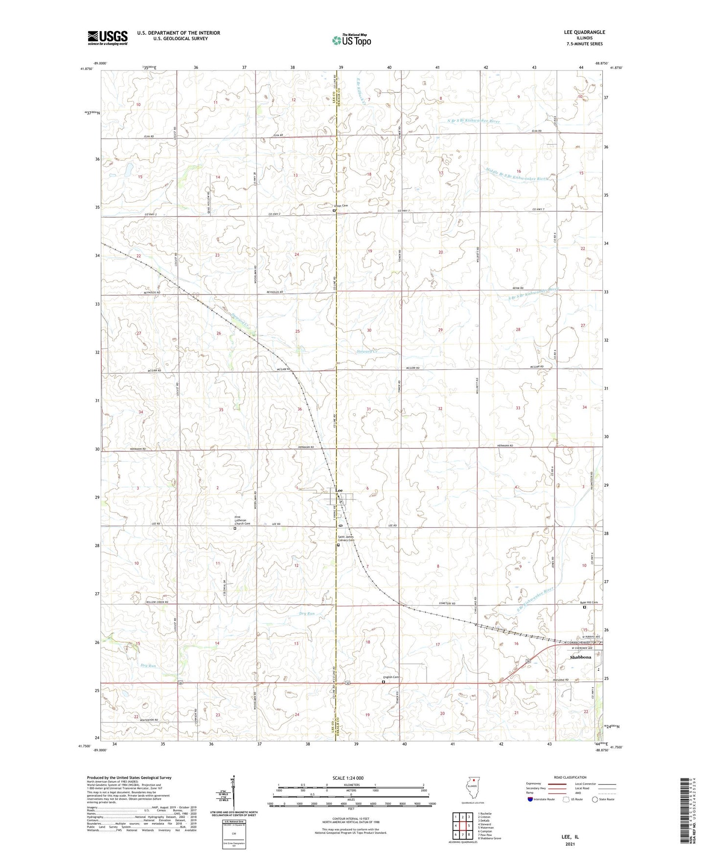
2024 topographic map quadrangle Lee in the state of Illinois. Scale: 1:24000. Based on the newly updated USGS 7.5' US Topo map series, this map is in the following counties: DeKalb, Lee. The map contains contour data, water features, and other items you are used to seeing on USGS maps, but also has updated roads and other features. This is the next generation of topographic maps. Printed on high-quality waterproof paper with UV fade-resistant inks.
Quads adjacent to this one:
West: Steward
Northwest: Rochelle
North: Creston
Northeast: DeKalb
East: Waterman
Southeast: Shabbona Grove
South: Paw Paw
Southwest: Compton
This map covers the same area as the classic USGS quad with code o41088g8.
Contains the following named places: Berg School, Calvary Church, English Cemetery, First Lutheran Church Cemetery, Gogol Farm, Hillson School, Indian Creek High School, Lee, Lee Post Office, Milan School, Nordic Farms, Peterson School, Prestegard School, Rose Hill Cemetery, Saint James Calvary Cemetery, Shabbona, Sheridan School, Thorpe School, Toad Hollow School, Township of Alto, Township of Milan, Township of Shabbona, Township of Willow Creek, Union Cemetery, Village of Lee, Village of Shabbona, Winterton Airport, Wormley School, ZIP Code: 60530