MyTopo
Paw Paw Illinois US Topo Map
Couldn't load pickup availability
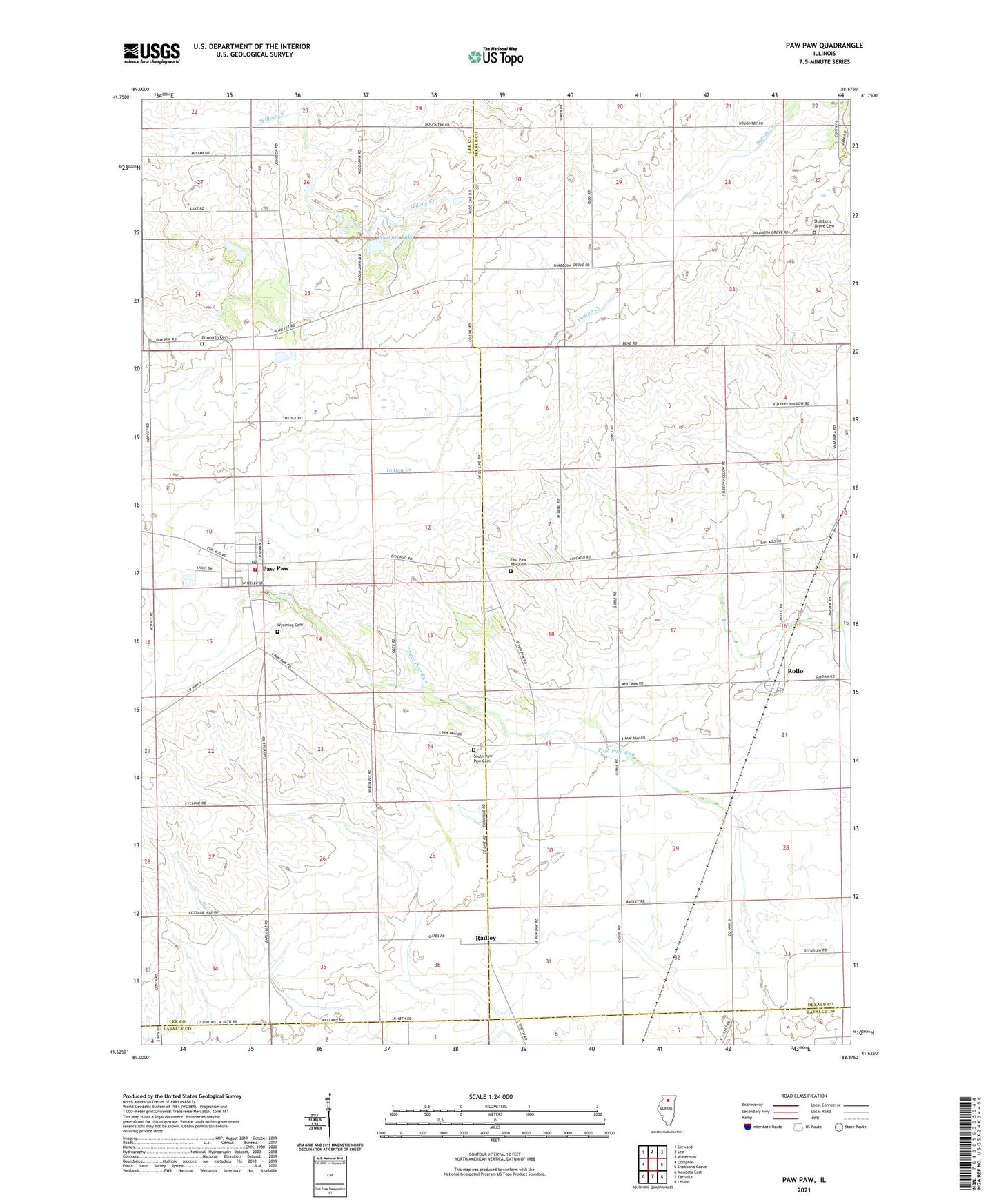
2024 topographic map quadrangle Paw Paw in the state of Illinois. Scale: 1:24000. Based on the newly updated USGS 7.5' US Topo map series, this map is in the following counties: DeKalb, Lee, LaSalle. The map contains contour data, water features, and other items you are used to seeing on USGS maps, but also has updated roads and other features. This is the next generation of topographic maps. Printed on high-quality waterproof paper with UV fade-resistant inks.
Quads adjacent to this one:
West: Compton
Northwest: Steward
North: Lee
Northeast: Waterman
East: Shabbona Grove
Southeast: Leland
South: Earlville
Southwest: Mendota East
This map covers the same area as the classic USGS quad with code o41088f8.
Contains the following named places: Baptist Church, Cyclone School, East Paw Paw, East Paw Paw Cemetery, Ellsworth Cemetery, First Baptist Church, First Presbyterian Church, Howlett School, Illinois Copter Service Heliport, Moffett School, Paw Paw, Paw Paw Bible Church, Paw Paw Elementary School, Paw Paw Fire Protection District, Paw Paw Junior-Senior High School, Paw Paw Post Office, Paw Paw United Methodist Church, Radley, Rogers Brothers Landing Strip, Rollo, Rollo Congregational Church, Shabbona Grove Cemetery, South Paw Paw, South Paw Paw Cemetery, Stroyan Lake, Stroyan Lake Dam, Township of Paw Paw, Township of Wyoming, Village of Paw Paw, Wyoming Cemetery, ZIP Code: 61353