MyTopo
Loami Illinois US Topo Map
Couldn't load pickup availability
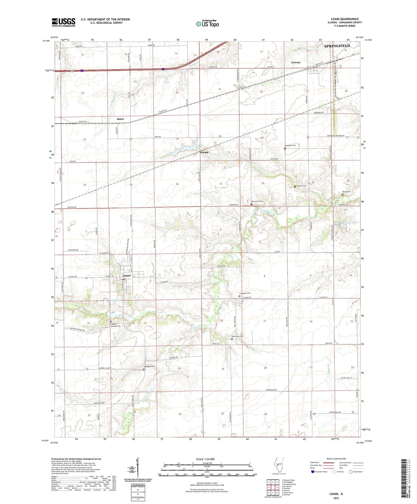
2024 topographic map quadrangle Loami in the state of Illinois. Scale: 1:24000. Based on the newly updated USGS 7.5' US Topo map series, this map is in the following counties: Sangamon. The map contains contour data, water features, and other items you are used to seeing on USGS maps, but also has updated roads and other features. This is the next generation of topographic maps. Printed on high-quality waterproof paper with UV fade-resistant inks.
Quads adjacent to this one:
West: New Berlin
Northwest: Pleasant Plains
North: Farmingdale
Northeast: Springfield West
East: Chatham
Southeast: Divernon
South: Virden North
Southwest: Waverly
This map covers the same area as the classic USGS quad with code o39089f7.
Contains the following named places: Allen School, Bates, Campbell Cemetery, College Corner School, Curran, Fairplay School, Highwater Mark School, Hong Kong School, Johns Creek, Knapp, Lake Loami, Leisure Lakes, Loami, Loami Christian Church, Loami Elementary School, Loami Fire Department, Loami Post Office, Loami United Methodist Church, McGinnis Cemetery, Mound Grove School, Oak Grove Cemetery, Oak Grove School, Oak Ridge School, Patterson Cemetery, Patton School, Pleasant View School, Reyhan Heliport, Shelton Cemetery, South Fork Lick Creek, South Fork School, Springfield Southwest Airpark, Sudduth, Sudduth Lake, Sudduth Lake Dam, Sulphur Springs Cemetery, Township of Chatham, Township of Curran, Township of Loami, Village of Curran, Village of Loami, WNNS-FM (Springfield), Young Cemetery, ZIP Code: 62661