MyTopo
Pleasant Plains Illinois US Topo Map
Couldn't load pickup availability
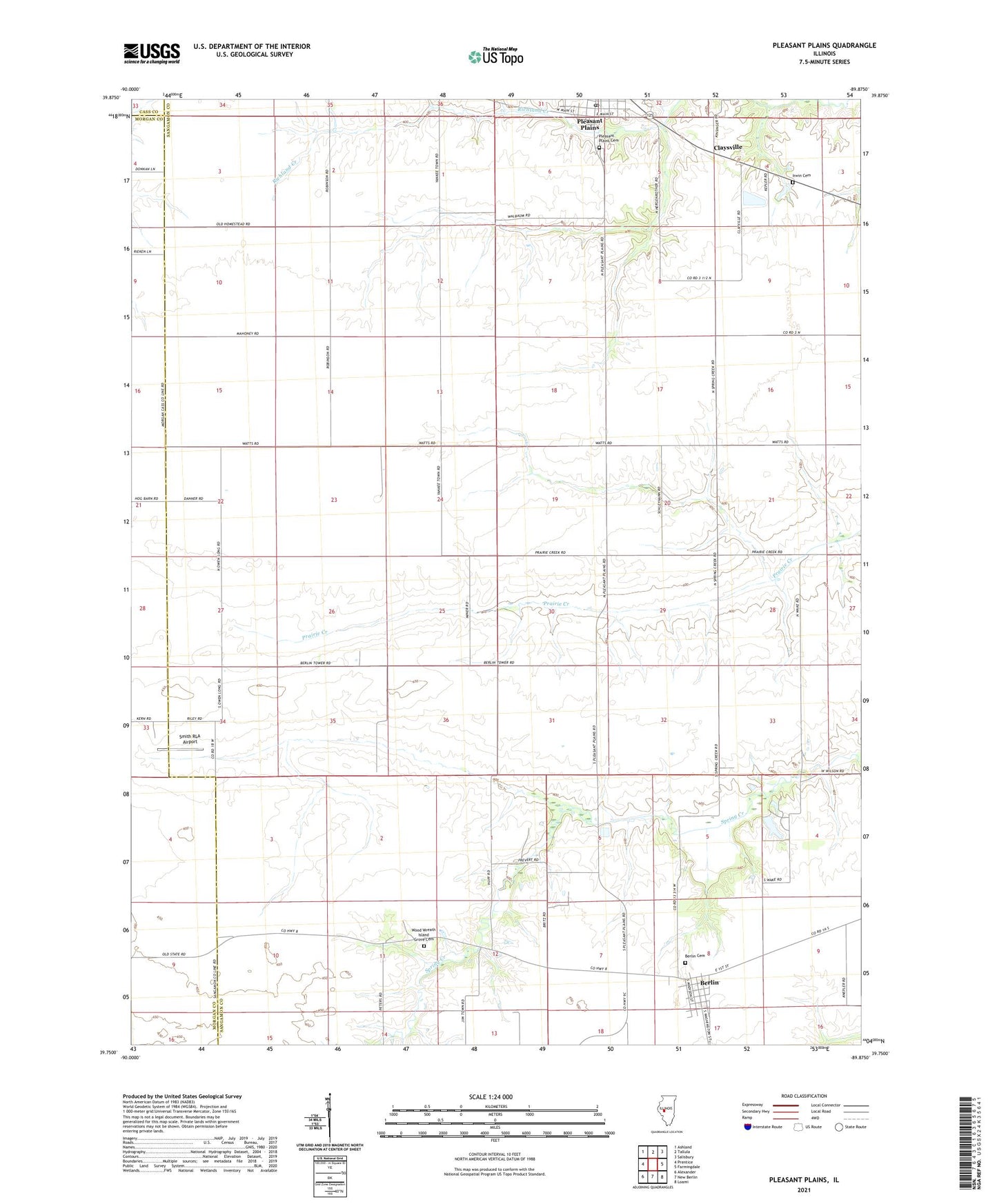
2024 topographic map quadrangle Pleasant Plains in the state of Illinois. Scale: 1:24000. Based on the newly updated USGS 7.5' US Topo map series, this map is in the following counties: Sangamon, Morgan, Cass. The map contains contour data, water features, and other items you are used to seeing on USGS maps, but also has updated roads and other features. This is the next generation of topographic maps. Printed on high-quality waterproof paper with UV fade-resistant inks.
Quads adjacent to this one:
West: Prentice
Northwest: Ashland
North: Tallula
Northeast: Salisbury
East: Farmingdale
Southeast: Loami
South: New Berlin
Southwest: Alexander
This map covers the same area as the classic USGS quad with code o39089g8.
Contains the following named places: Berlin, Berlin Cemetery, Claysville, Irwin Cemetery, Island Grove Church, Pleasant Plains, Pleasant Plains Cemetery, Pleasant Plains Post Office, Smith RLA Airport, Township of Cartwright, Township of Island Grove, Village of Berlin, Village of Pleasant Plains, Wood Wreath Island Grove Cemetery, ZIP Code: 62677