MyTopo
Long Creek Illinois US Topo Map
Couldn't load pickup availability
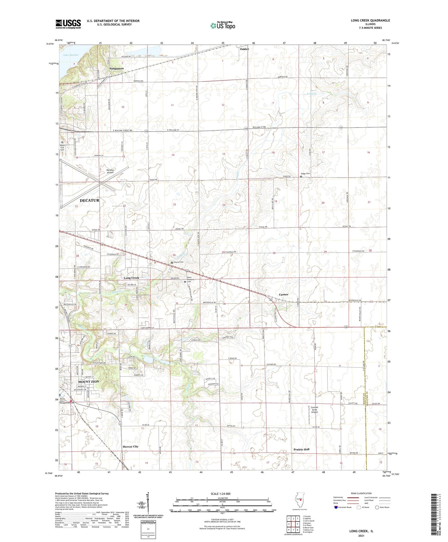
2024 topographic map quadrangle Long Creek in the state of Illinois. Scale: 1:24000. Based on the newly updated USGS 7.5' US Topo map series, this map is in the following counties: Macon, Moultrie. The map contains contour data, water features, and other items you are used to seeing on USGS maps, but also has updated roads and other features. This is the next generation of topographic maps. Printed on high-quality waterproof paper with UV fade-resistant inks.
Quads adjacent to this one:
West: Decatur
Northwest: Forsyth
North: Argenta
Northeast: Cerro Gordo
East: La Place
Southeast: Lovington
South: Dalton City
Southwest: Macon East
This map covers the same area as the classic USGS quad with code o39088g7.
Contains the following named places: Airport Industrial Park, Antioch Church, Big Creek, Blue Door School, Bois d'Arc School, Bois Du Sangamon Nature Preserve, Camp Warren, Casner, Corman Acres Airport, Ehrhart School, Excelsior School, Florey Cemetery, Fort Daniel Conservation Area, Fort Daniel School, Hervey City, Long Creek, Mount Zion, Mount Zion Elementary School, Mount Zion Fire Protection District, Mount Zion Police Department, North Fork Cemetery, Point Pleasant Cemetery, Prairie Hall, Prairie Hall School, Ridge Cemetery, Ridge School, Salem Elementary School, Sangamon, Spitler Woods Nature Preserve, Spitler Woods State Park, Township of Long Creek, Village of Long Creek, ZIP Code: 62549