MyTopo
Lovington Illinois US Topo Map
Couldn't load pickup availability
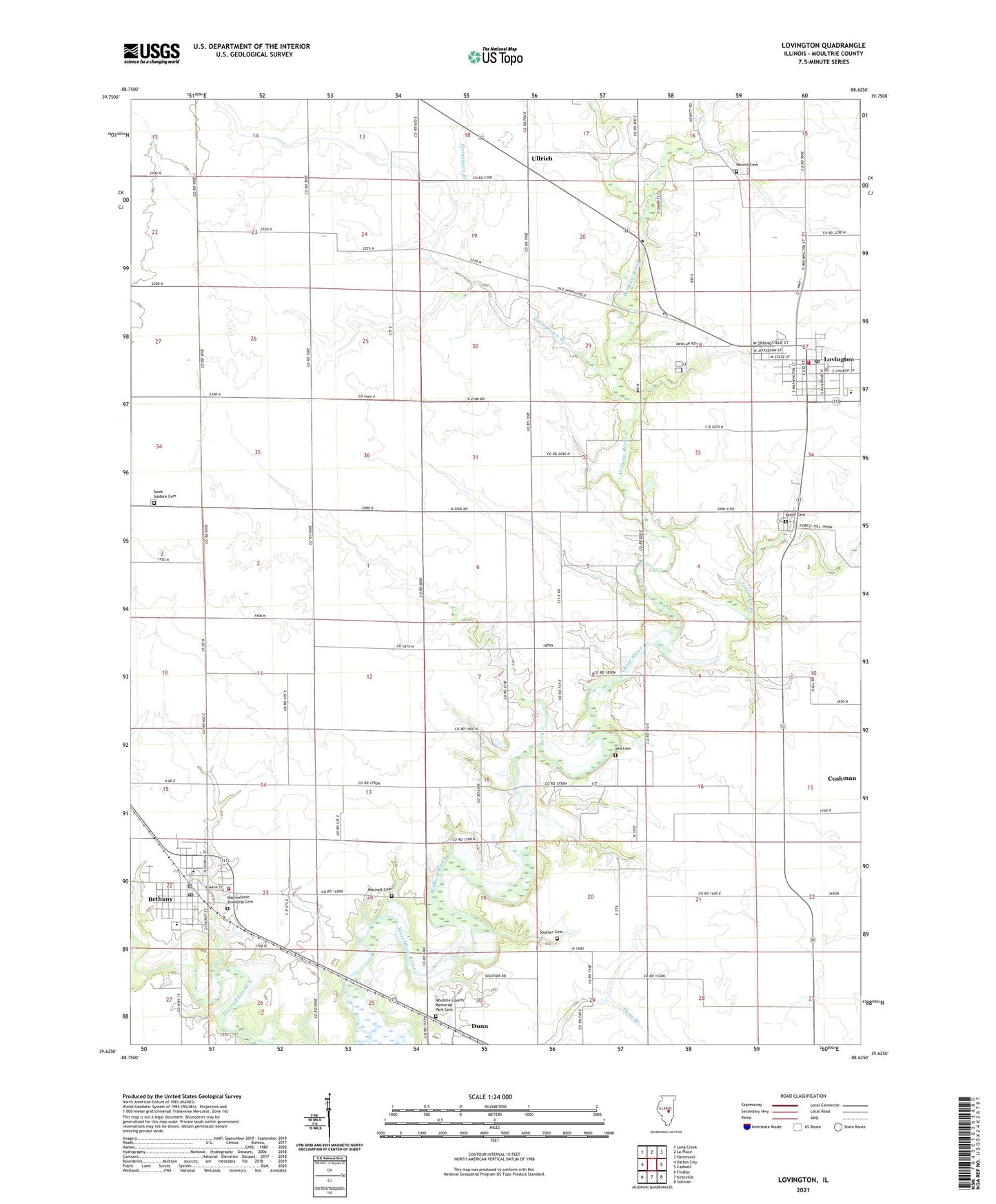
2024 topographic map quadrangle Lovington in the state of Illinois. Scale: 1:24000. Based on the newly updated USGS 7.5' US Topo map series, this map is in the following counties: Moultrie. The map contains contour data, water features, and other items you are used to seeing on USGS maps, but also has updated roads and other features. This is the next generation of topographic maps. Printed on high-quality waterproof paper with UV fade-resistant inks.
Quads adjacent to this one:
West: Dalton City
Northwest: Long Creek
North: La Place
Northeast: Hammond
East: Cadwell
Southeast: Sullivan
South: Kirksville
Southwest: Findlay
This map covers the same area as the classic USGS quad with code o39088f6.
Contains the following named places: American School, Bethany, Bethany Elementary School, Bethany Fire Protection District and Ambulance Service, Bethany High School, Bethany Police Department, Bethany Post Office, Bland Landing Strip, Bohler School, Brush Creek, Dunn, East Stringtown School, First Christian Church of Bethany, Forest Hill School, Forest View School, Free Methodist Church, Hewitt Cemetery, Hewitt School, Jonathan Branch, Keller Cemetery, Lovington, Lovington Community Ambulance, Lovington Elementary School, Lovington High School, Lovington Police Department, Lovington Post Office, Lovington Volunteer Fire Protection District, Marrowbone Township Cemetery, Mayflower School, Mitchell Cemetery, Moultrie County Memorial Park Cemetery, Mount Pleasant School, New Castle School, Okaw Valley Orchard, Pea Cemetery, Pulltight School, Saint Isadore Cemetery, Saint Isadore Church, Souther Cemetery, Stringtown Branch, Stringtown School, Township of Dora, Township of Lovington, Ullrich, Village of Bethany, Village of Lovington, White School, ZIP Code: 61937