MyTopo
La Place Illinois US Topo Map
Couldn't load pickup availability
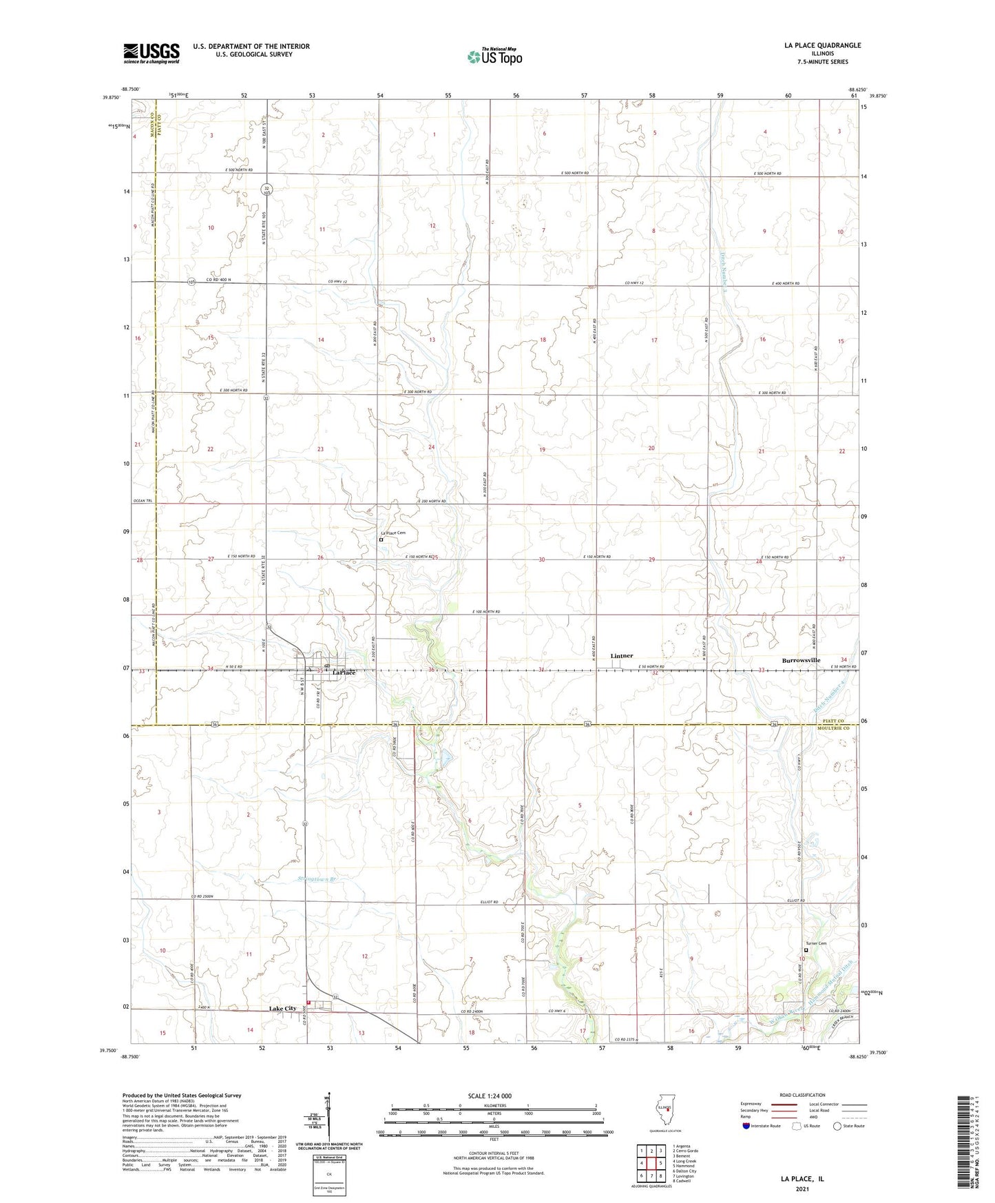
2024 topographic map quadrangle La Place in the state of Illinois. Scale: 1:24000. Based on the newly updated USGS 7.5' US Topo map series, this map is in the following counties: Piatt, Moultrie, Macon. The map contains contour data, water features, and other items you are used to seeing on USGS maps, but also has updated roads and other features. This is the next generation of topographic maps. Printed on high-quality waterproof paper with UV fade-resistant inks.
Quads adjacent to this one:
West: Long Creek
Northwest: Argenta
North: Cerro Gordo
Northeast: Bement
East: Hammond
Southeast: Cadwell
South: Lovington
Southwest: Dalton City
This map covers the same area as the classic USGS quad with code o39088g6.
Contains the following named places: Asbury Church, Burrowsville, Dawson Farms Airport, Ditch Number 3, Dora Township Fire Protection District Lake City, Hammond Mutual Ditch, Henry Airport, La Place Cemetery, La Place Post Office, Lake City, Lake City Census Designated Place, LaPlace, LaPlace Cemetery, LaPlace Census Designated Place, Lintner, Township of Cerro Gordo, Turner Cemetery, White Landing Strip, ZIP Codes: 61929, 61936