MyTopo
Marine Illinois US Topo Map
Couldn't load pickup availability
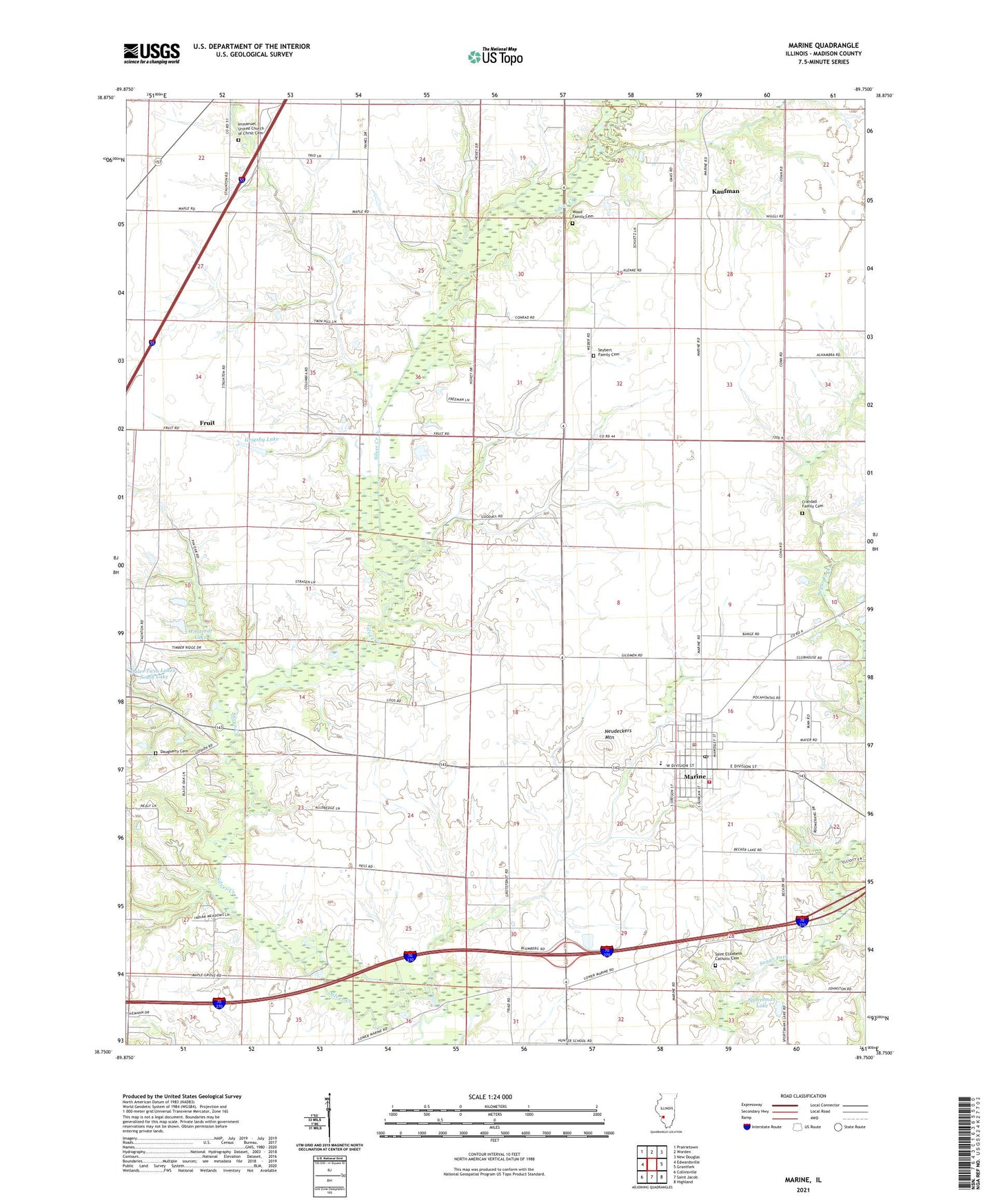
2024 topographic map quadrangle Marine in the state of Illinois. Scale: 1:24000. Based on the newly updated USGS 7.5' US Topo map series, this map is in the following counties: Madison. The map contains contour data, water features, and other items you are used to seeing on USGS maps, but also has updated roads and other features. This is the next generation of topographic maps. Printed on high-quality waterproof paper with UV fade-resistant inks.
Quads adjacent to this one:
West: Edwardsville
Northwest: Prairietown
North: Worden
Northeast: New Douglas
East: Grantfork
Southeast: Highland
South: Saint Jacob
Southwest: Collinsville
This map covers the same area as the classic USGS quad with code o38089g7.
Contains the following named places: Bonn School, Columbia School, Crandall Family Cemetery, Daugherty Cemetery, First Christian Church of Marine, Fruit, Grigsby Lake, Grigsby Lake Dam, Immanuel Church, Immanuel United Church of Christ Cemetery, Kaufman, Keeven Lake, Keeven Lake Dam, Loos School, Marine, Marine City Park, Marine Community Fire Protection District, Marine Police Department, Marine Post Office, Marine School, Marine United Church of Christ, Mount Zion School, Neudeckers Mountain, Oak Brook Golf Course, Saint Elizabeth Catholic Cemetery, Saint Elizabeths Catholic Church, Seibert School, Seybert Family Cemetery, Sportsman Lake, Sylvan Hill School, Township of Alhambra, Township of Marine, Township of Pin Oak, Union Grove School, Village of Marine, Willaredt Lake, Willaredt Lake Dam, Wood Family Cemetery, ZIP Code: 62061