MyTopo
New Douglas Illinois US Topo Map
Couldn't load pickup availability
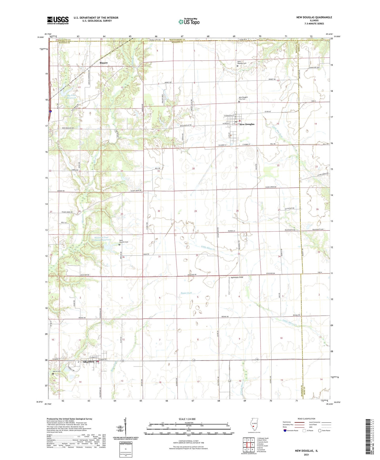
2024 topographic map quadrangle New Douglas in the state of Illinois. Scale: 1:24000. Based on the newly updated USGS 7.5' US Topo map series, this map is in the following counties: Madison, Bond, Montgomery, Macoupin. The map contains contour data, water features, and other items you are used to seeing on USGS maps, but also has updated roads and other features. This is the next generation of topographic maps. Printed on high-quality waterproof paper with UV fade-resistant inks.
Quads adjacent to this one:
West: Worden
Northwest: Gillespie South
North: Mount Olive
Northeast: Sorento North
East: Sorento South
Southeast: Pocahontas
South: Grantfork
Southwest: Marine
This map covers the same area as the classic USGS quad with code o38089h6.
Contains the following named places: Alhambra, Alhambra Elementary School, Alhambra Fire Protection District, Alhambra Post Office, Alhambra Sewage Treatment Plant, Big Four Reservoir, Big Four Reservoir Dam, Big Rock School, Binney, Gehrig School, Green Castle, Hammock Field, Harris Cemetery, Livingston South Oil Field, Mount Calvary School, Mueller Airport, New Douglas, New Douglas City Cemetery, New Douglas Community Volunteer Fire Department, New Douglas Elementary School, New Douglas Post Office, Pisgah School, Pleasant Hill School, Rockwell School, Saint Ubaldus Cemetery, Saint Vincent Cemetery, Silver Creek Gliderport, Staunton Coal Company Reservoir, Staunton Coal Company Reservoir Dam, Township of New Douglas, Village of Alhambra, Village of New Douglas, ZIP Codes: 62001, 62074