MyTopo
Matherville Illinois US Topo Map
Couldn't load pickup availability
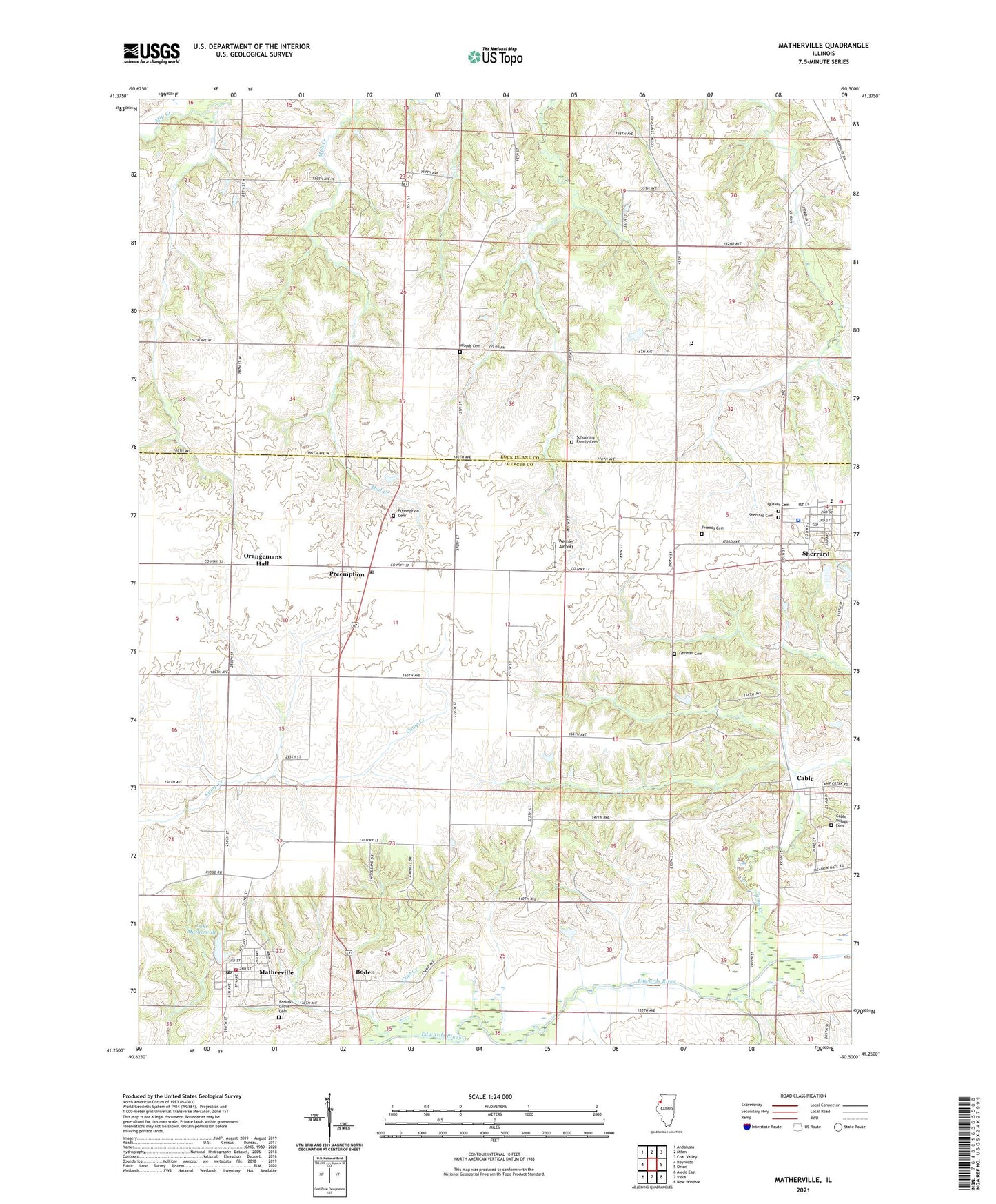
2024 topographic map quadrangle Matherville in the state of Illinois. Scale: 1:24000. Based on the newly updated USGS 7.5' US Topo map series, this map is in the following counties: Mercer, Rock Island. The map contains contour data, water features, and other items you are used to seeing on USGS maps, but also has updated roads and other features. This is the next generation of topographic maps. Printed on high-quality waterproof paper with UV fade-resistant inks.
Quads adjacent to this one:
West: Reynolds
Northwest: Andalusia
North: Milan
Northeast: Coal Valley
East: Orion
Southeast: New Windsor
South: Viola
Southwest: Aledo East
This map covers the same area as the classic USGS quad with code o41090c5.
Contains the following named places: Boden, Cable, Cable Census Designated Place, Cable Village Cemetery, Camp Creek, Center School, Coal Creek, Coal Dale School, Coal Valley Mine, Farlows Grove Cemetery, Friends Cemetery, German Cemetery, Gilchrist Mine, Greene Township Fire Station Matherville, Lake Matherville, Lake Matherville Dam, Matherville, Matherville Elementary School, Matherville Post Office, Orangemans Hall, Preemption, Preemption Cemetery, Preemption Census Designated Place, Preemption Post Office, Quaker Cemetery, Saint Anthonys Church, Schoening Family Cemetery, Sherrard, Sherrard Cemetery, Sherrard Fire Protection District, Sherrard Police Department, Sherrard Post Office, Sherrard School, Township of Bowling, Township of Preemption, Village of Matherville, Weihler Airport, Woods Cemetery, ZIP Codes: 61263, 61276, 61281