MyTopo
Reynolds Illinois US Topo Map
Couldn't load pickup availability
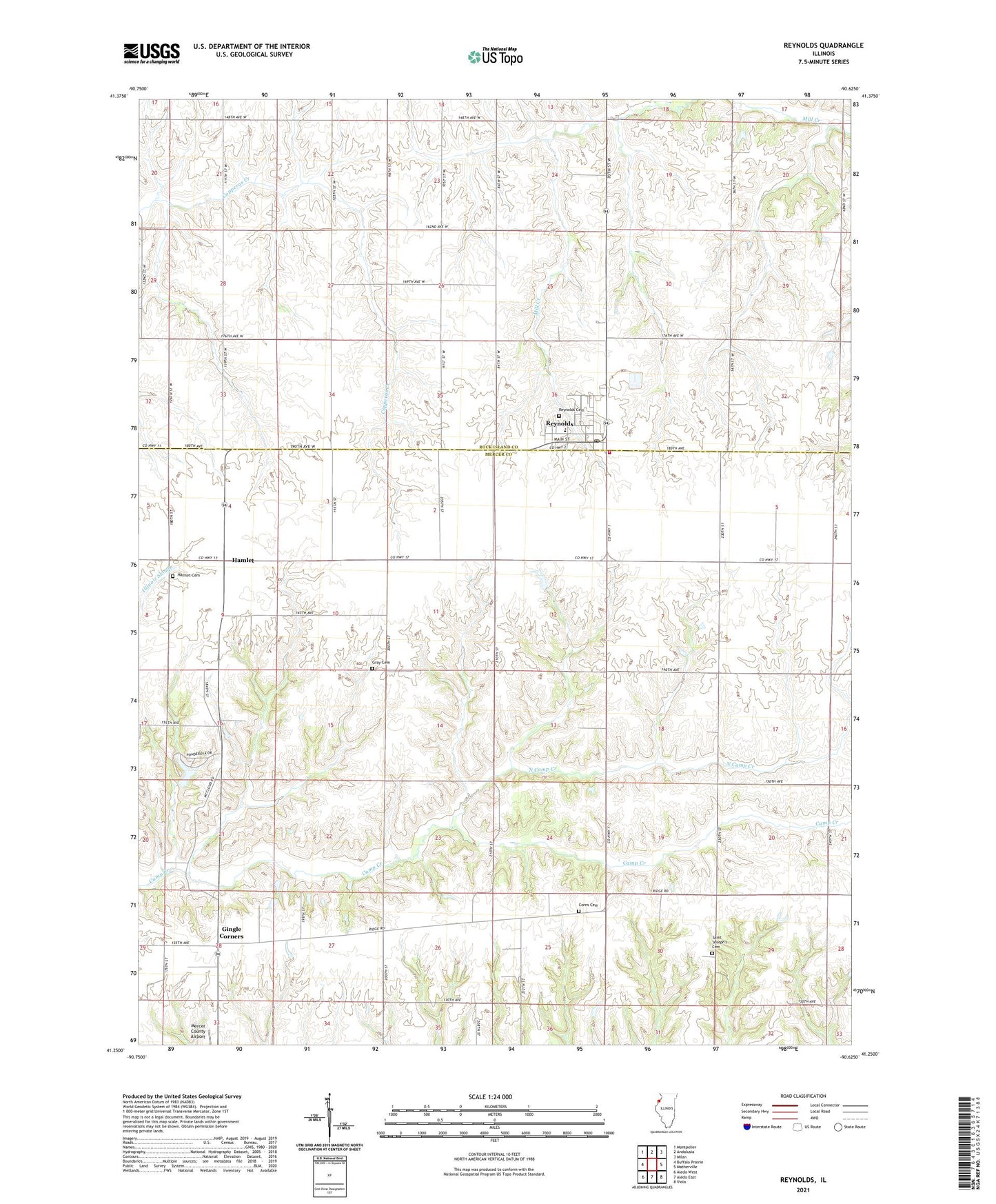
2024 topographic map quadrangle Reynolds in the state of Illinois. Scale: 1:24000. Based on the newly updated USGS 7.5' US Topo map series, this map is in the following counties: Mercer, Rock Island. The map contains contour data, water features, and other items you are used to seeing on USGS maps, but also has updated roads and other features. This is the next generation of topographic maps. Printed on high-quality waterproof paper with UV fade-resistant inks.
Quads adjacent to this one:
West: Buffalo Prairie
Northwest: Montpelier
North: Andalusia
Northeast: Milan
East: Matherville
Southeast: Viola
South: Aledo East
Southwest: Aledo West
This map covers the same area as the classic USGS quad with code o41090c6.
Contains the following named places: Centennial School, Corns Cemetery, Enon Church, Fairview School, Gingle Corners, Gray Cemetery, Hamlet, Hamlet Cemetery, Hamlet Census Designated Place, Mercer County Airport, Monitor School, North Camp Creek, Perryton Church, Perryton School, Prairie Union School, Reynolds, Reynolds Cemetery, Reynolds Elementary School, Reynolds Fire Protection District, Reynolds Post Office, Saint Johns Church, Saint Joseph Church, Saint Joseph's Cemetery, Township of Edgington, Township of Perryton, Village of Reynolds, ZIP Code: 61279