MyTopo
Viola Illinois US Topo Map
Couldn't load pickup availability
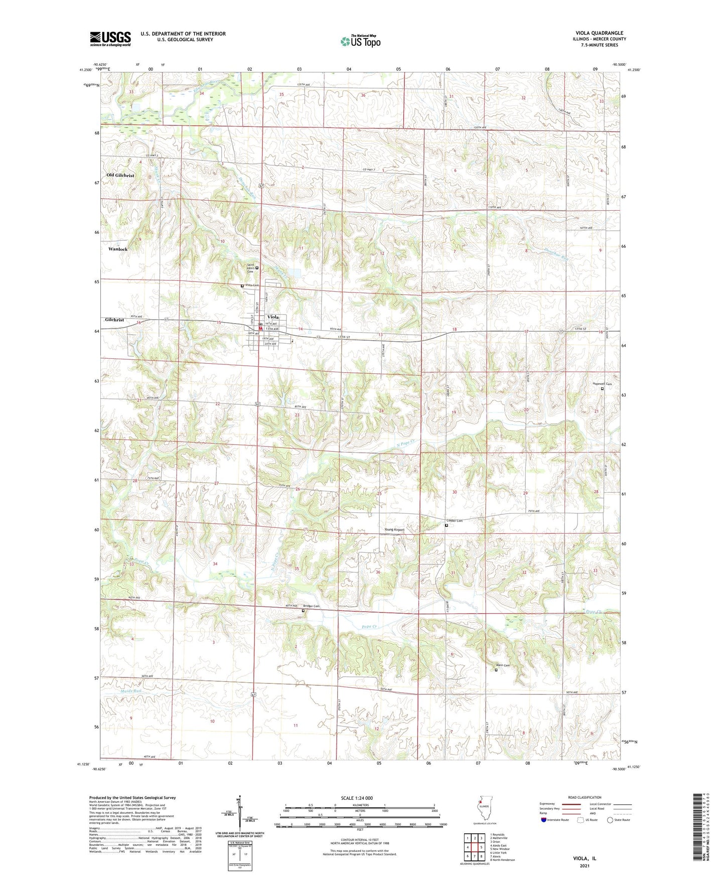
2024 topographic map quadrangle Viola in the state of Illinois. Scale: 1:24000. Based on the newly updated USGS 7.5' US Topo map series, this map is in the following counties: Mercer. The map contains contour data, water features, and other items you are used to seeing on USGS maps, but also has updated roads and other features. This is the next generation of topographic maps. Printed on high-quality waterproof paper with UV fade-resistant inks.
Quads adjacent to this one:
West: Aledo East
Northwest: Reynolds
North: Matherville
Northeast: Orion
East: New Windsor
Southeast: North Henderson
South: Alexis
Southwest: Little York
This map covers the same area as the classic USGS quad with code o41090b5.
Contains the following named places: Adams School, Bridger Cemetery, Brushwood School, Cooper Cemetery, Donohue Run, Fairview School, First Apostolic Church, Gilchrist, Green Summit School, Greenbower School, Hopewell Cemetery, Mann Cemetery, Miles Memorial Park, North Pope Creek, Pleasant Hill School, Saint John's Cemetery, Saint Johns Church, Silver Lake School, Skunk Creek, Township of Greene, Village of Viola, Viola, Viola Cemetery, Viola Fire Station, Viola Police Department, Viola Post Office, Viola Public Library, Viola United Church, Viola United Methodist Church, White Lily School, Winola School, Young Airport, ZIP Code: 61486