MyTopo
Mazon Illinois US Topo Map
Couldn't load pickup availability
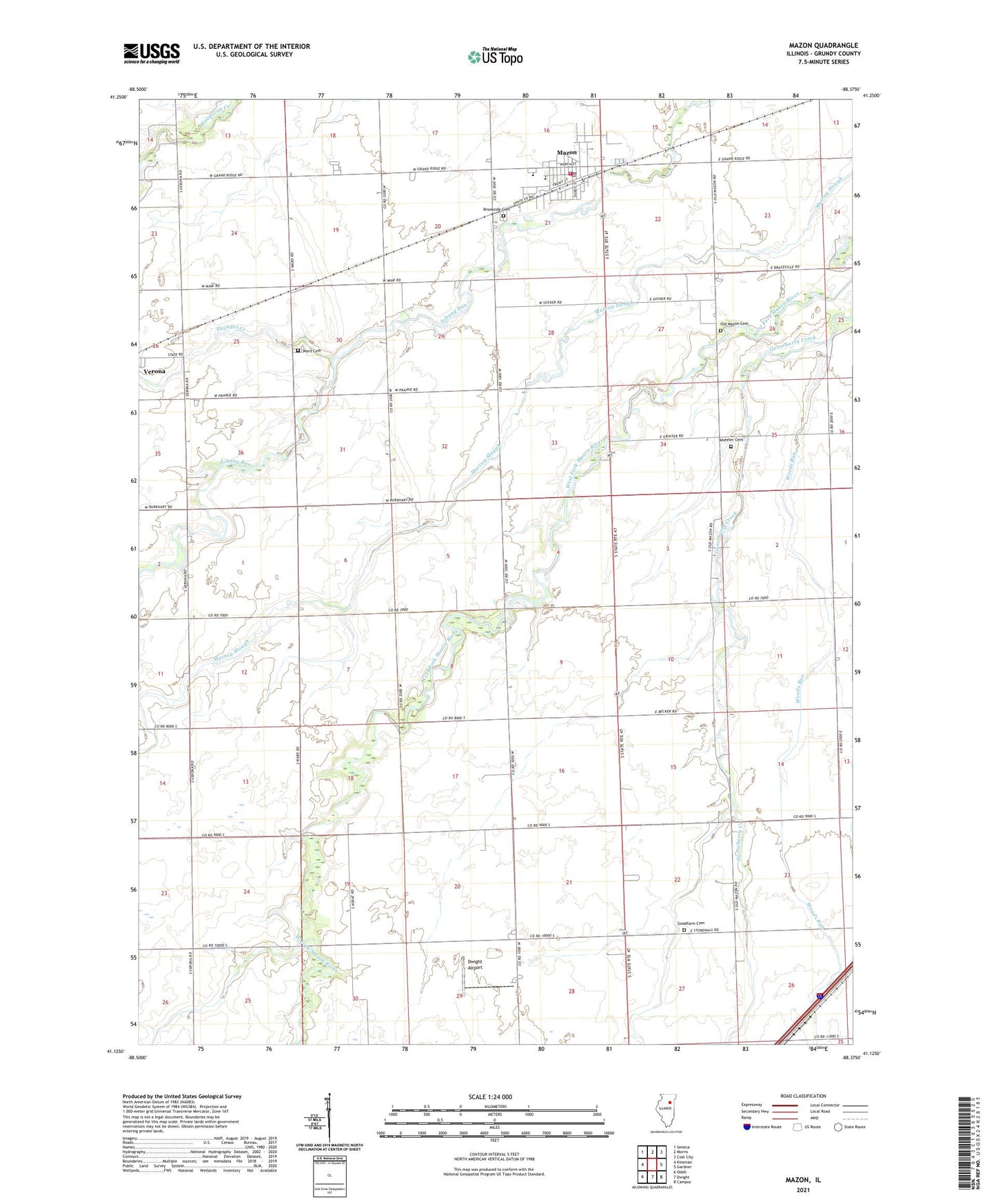
2024 topographic map quadrangle Mazon in the state of Illinois. Scale: 1:24000. Based on the newly updated USGS 7.5' US Topo map series, this map is in the following counties: Grundy. The map contains contour data, water features, and other items you are used to seeing on USGS maps, but also has updated roads and other features. This is the next generation of topographic maps. Printed on high-quality waterproof paper with UV fade-resistant inks.
Quads adjacent to this one:
West: Kinsman
Northwest: Seneca
North: Morris
Northeast: Coal City
East: Gardner
Southeast: Campus
South: Dwight
Southwest: Odell
This map covers the same area as the classic USGS quad with code o41088b4.
Contains the following named places: Brookside Cemetery, Curtain School, Dwight Airport, Goodfarm Cemetery, Goodfarm School, Hamilton School, Highland Town, Lanphere School, Lea School, Maxwell School, Mazon, Mazon Community Fire Department, Mazon Police Department, Mazon Post Office, Mazon-Verona-Kinsman Elementary School, Mazon-Verona-Kinsman Middle School, MVK Ambulance Service, Old Mazon Cemetery, Old Mazon School, Parker School, Thunder Creek, Township of Goodfarm, Township of Mazon, Trinity Church, Village of Mazon, Ward Cemetery, Wheeler Cemetery, Woods Run, ZIP Code: 60444