MyTopo
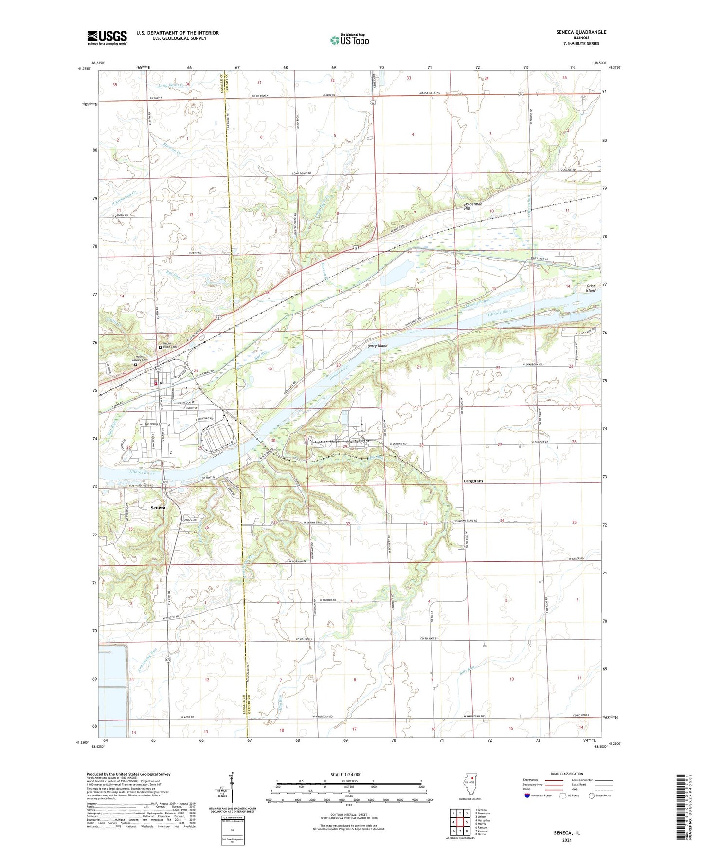
Seneca Illinois US Topo Map
Couldn't load pickup availability
2024 topographic map quadrangle Seneca in the state of Illinois. Scale: 1:24000. Based on the newly updated USGS 7.5' US Topo map series, this map is in the following counties: Grundy, LaSalle. The map contains contour data, water features, and other items you are used to seeing on USGS maps, but also has updated roads and other features. This is the next generation of topographic maps. Printed on high-quality waterproof paper with UV fade-resistant inks.
Quads adjacent to this one:
West: Marseilles
Northwest: Serena
North: Stavanger
Northeast: Lisbon
East: Morris
Southeast: Mazon
South: Kinsman
Southwest: Ransom
This map covers the same area as the classic USGS quad with code o41088c5.
Contains the following named places: Armstrong Run, Barry Island, Barry School, Boondox Field, Brick School, Carson Creek, Crotty Creek, Deadly Run, Erienna Elementary School, First United Methodist Church, Grist Island, Higgins School, Hog Run, Holderman Hill, Holiness Methodist Church, Hull School, Langham, Long Point School, McNellis Bayou, Moody Bayou, Mount Calvary Cemetery, Mount Hope Cemetery, Norman Town Hall, O'Brien Run, O'Malley School, Our Saviours Lutheran Church, Raymond School, Saint Patricks Catholic Church, Seneca, Seneca Ambulance Service, Seneca Elementary School, Seneca Fire Protection and Ambulance District, Seneca High School, Seneca Police Department, Seneca Post Office, Stanton Creek, Township of Erienna, Township of Norman, Village of Seneca, Woodbury School, Young School, ZIP Code: 61360