MyTopo
Gridley Illinois US Topo Map
Couldn't load pickup availability
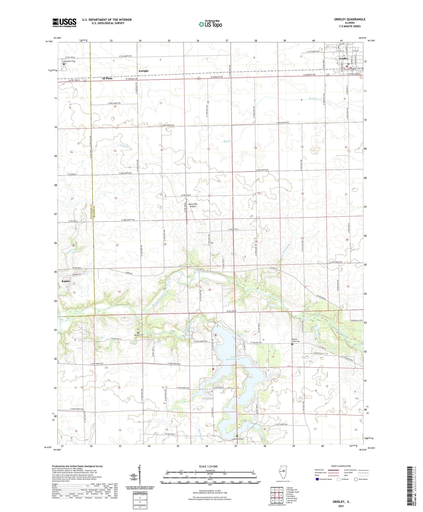
2024 topographic map quadrangle Gridley in the state of Illinois. Scale: 1:24000. Based on the newly updated USGS 7.5' US Topo map series, this map is in the following counties: McLean, Woodford. The map contains contour data, water features, and other items you are used to seeing on USGS maps, but also has updated roads and other features. This is the next generation of topographic maps. Printed on high-quality waterproof paper with UV fade-resistant inks.
Quads adjacent to this one:
West: El Paso
Northwest: Benson
North: Flanagan SW
Northeast: Flanagan South
East: Lexington
Southeast: Merna
South: Normal East
Southwest: Normal West
This map covers the same area as the classic USGS quad with code o40088f8.
Contains the following named places: Big Slough, Camp Heffernan, Camp Peairs, East Bay Camp, El Paso Golf Club, Enright, Evergreen Cemetery, Fishburn School, Four Corners School, Freed School, Grandview School, Gregory Church, Gregory School, Gridley, Gridley Elementary School, Gridley Emergency Medical Services, Gridley Fire Protection District, Gridley High School, Gridley Junior High School, Gridley Police Department, Gridley Post Office, Hickory Creek, Hinthorn Cemetery, Hinthorn Chapel, Hudson Community Fire Protection District Lake, Kuntz RLA Airport, Lake Bloomington, Lake Bloomington Dam, Loving Branch, Messer Cemetery, Money Creek, Pleasant Grove School, Pleasant View School, Prairie College School, Township of Gridley, Union School, Village of Gridley, Wilcox - Coon Cemetery, Wilcox School, ZIP Code: 61744