MyTopo
Mill Creek Illinois US Topo Map
Couldn't load pickup availability
Also explore the Mill Creek Forest Service Topo of this same quad for updated USFS data
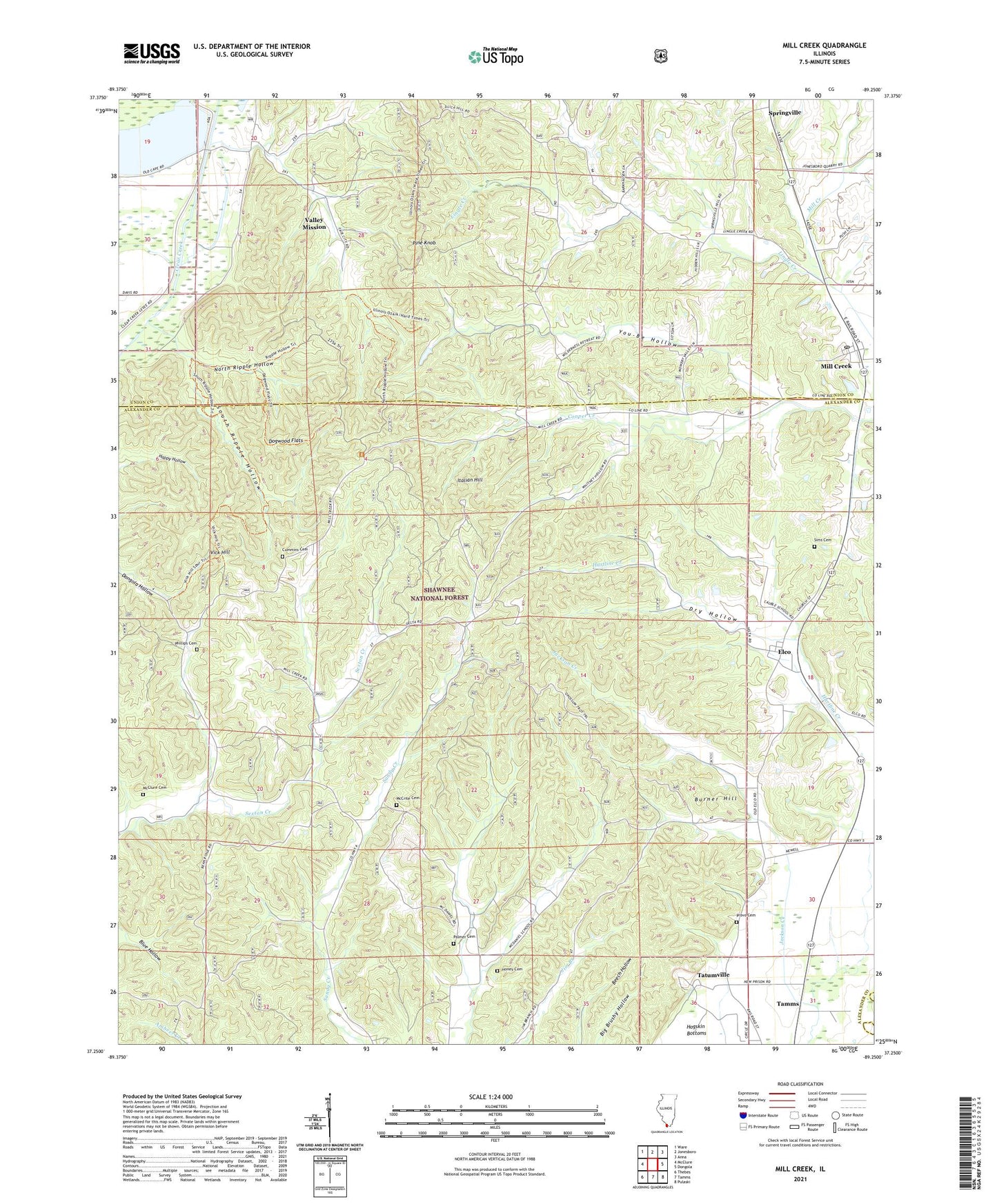
2024 topographic map quadrangle Mill Creek in the state of Illinois. Scale: 1:24000. Based on the newly updated USGS 7.5' US Topo map series, this map is in the following counties: Alexander, Union, Pulaski. The map contains contour data, water features, and other items you are used to seeing on USGS maps, but also has updated roads and other features. This is the next generation of topographic maps. Printed on high-quality waterproof paper with UV fade-resistant inks.
Quads adjacent to this one:
West: McClure
Northwest: Ware
North: Jonesboro
Northeast: Anna
East: Dongola
Southeast: Pulaski
South: Tamms
Southwest: Thebes
This map covers the same area as the classic USGS quad with code o37089c3.
Contains the following named places: Bass Hill Lookout Tower, Birk-McRite Quarry, Burner Hill, Cummins Cemetery, Delta School, Dogwood Flats, Dry Hollow, Elco, Elco Election Precinct, Elco Post Office, Gauble School, Hazelwood School, Hogskin Bottoms, Honey Cemetery, Italian Hill, Lingle Creek, Lingle School, Lone Star Mine, Lylerle School, McClure Cemetery, McCrite Cemetery, McDaniel School, Mill Creek, Mill Creek Election Precinct, Mill Creek Post Office, North Ripple Hollow, Opossum Trot Trail, Palmer Cemetery, Phillips Cemetery, Pine Knob, Pleasant Valley Church, Provo Cemetery, Sims Cemetery, South Ripple Hollow, Springville, Tamms Election Precinct, Tatumville, Upper Elco School, Valley Mission, Vick Hill, Village of Mill Creek, You-Be Hollow, ZIP Codes: 62961, 62988