MyTopo
Moriah Illinois US Topo Map
Couldn't load pickup availability
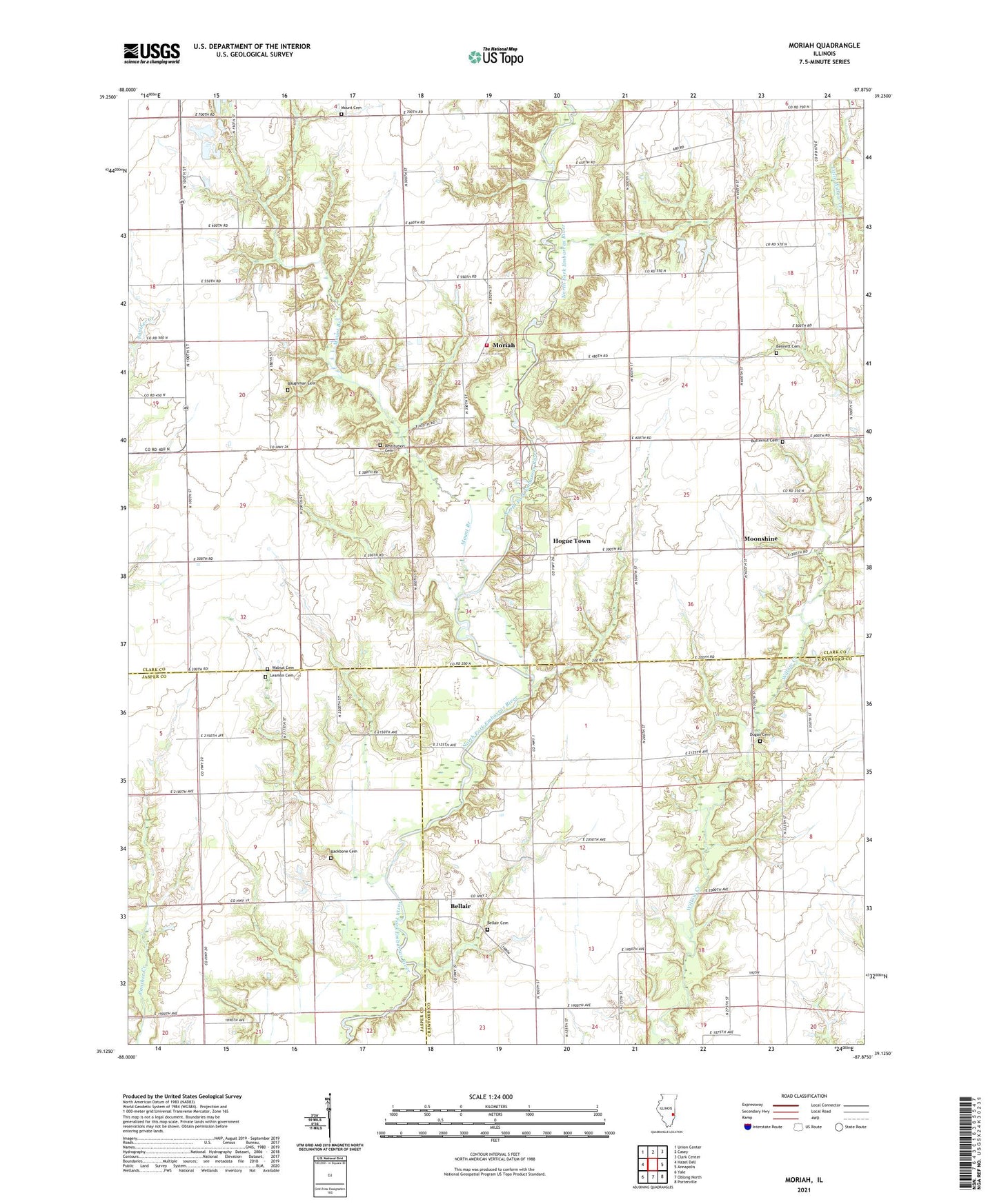
2024 topographic map quadrangle Moriah in the state of Illinois. Scale: 1:24000. Based on the newly updated USGS 7.5' US Topo map series, this map is in the following counties: Clark, Crawford, Jasper. The map contains contour data, water features, and other items you are used to seeing on USGS maps, but also has updated roads and other features. This is the next generation of topographic maps. Printed on high-quality waterproof paper with UV fade-resistant inks.
Quads adjacent to this one:
West: Hazel Dell
Northwest: Union Center
North: Casey
Northeast: Clark Center
East: Annapolis
Southeast: Porterville
South: Oblong North
Southwest: Yale
This map covers the same area as the classic USGS quad with code o39087b8.
Contains the following named places: Backbone Cemetery, Baughman Cemetery, Bellair, Bellair Cemetery, Bellair Oil Field, Bennett Cemetery, Butternut Cemetery, Cottonwood School, Dugan Cemetery, Hogue Town, Leamon Cemetery, Martinsville Fire Protection District Station 2, Moonshine, Moriah, Mount Branch, Mount Cemetery, Mount Church, Mount Olive Church, New Hope Church, North Johnson Oil Field, Oak Point, Olive Church, Restitution Cemetery, Restitution Church, South Johnson Oil Field, Township of Johnson, Walnut Chapel, Willow Creek Church, Willow Prairie Church, Zoar Church