MyTopo
Hazel Dell Illinois US Topo Map
Couldn't load pickup availability
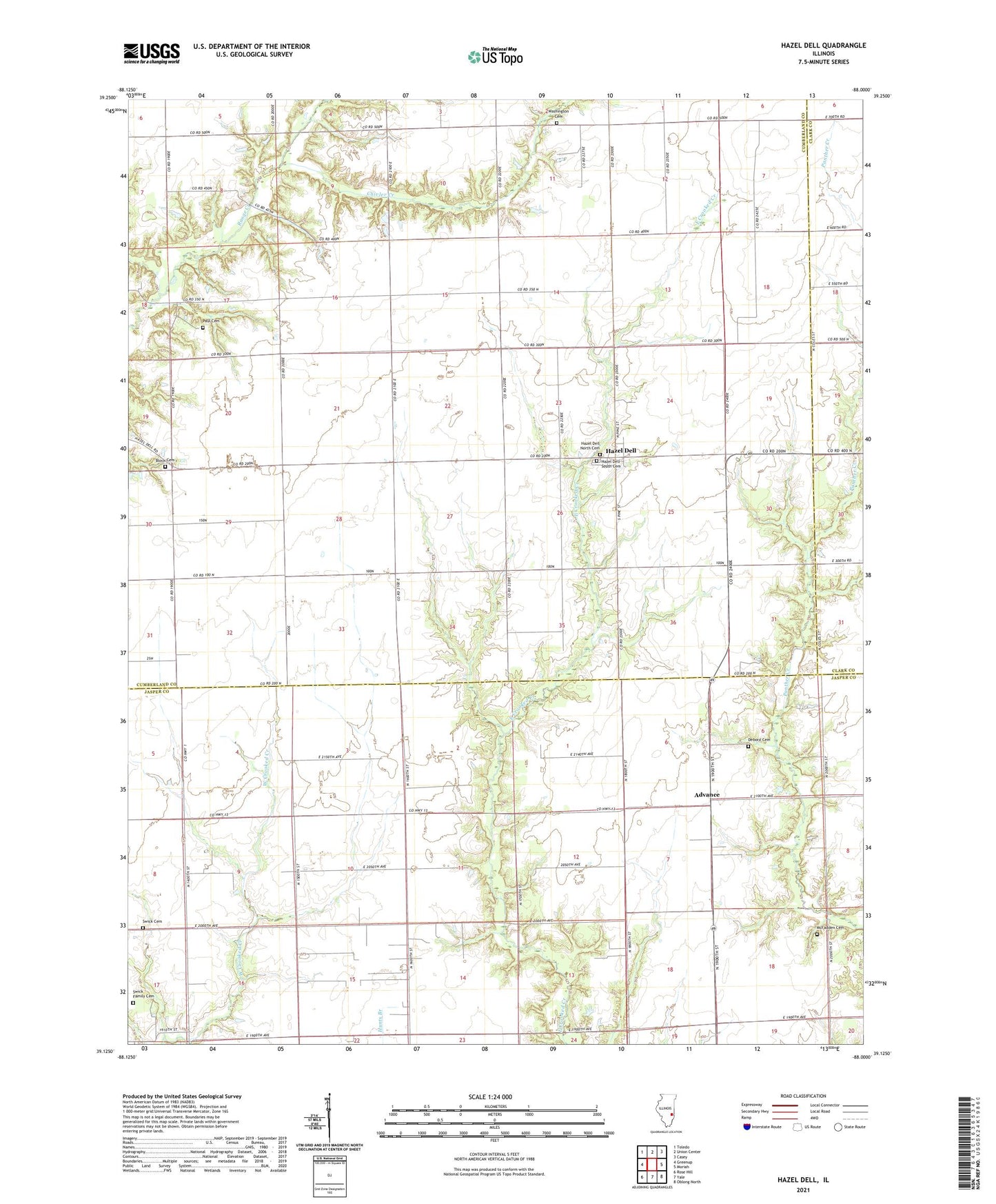
2024 topographic map quadrangle Hazel Dell in the state of Illinois. Scale: 1:24000. Based on the newly updated USGS 7.5' US Topo map series, this map is in the following counties: Cumberland, Jasper, Clark. The map contains contour data, water features, and other items you are used to seeing on USGS maps, but also has updated roads and other features. This is the next generation of topographic maps. Printed on high-quality waterproof paper with UV fade-resistant inks.
Quads adjacent to this one:
West: Greenup
Northwest: Toledo
North: Union Center
Northeast: Casey
East: Moriah
Southeast: Oblong North
South: Yale
Southwest: Rose Hill
This map covers the same area as the classic USGS quad with code o39088b1.
Contains the following named places: Advance, Baumgartner School, Bethany Church, Block Cemetery, Carr Farms, Center School, Chivler Creek, Church of Christ, Copeland School, Debord Cemetery, Delno School, Hazel Dell, Hazel Dell North Cemetery, Hazel Dell Post Office, Hazel Dell South Cemetery, Liberty School, Little Brown School, McFadden Cemetery, Mount Zion Church, Paul Cemetery, Pleasant Point School, Point Pleasant, Prairie School, Rader School, Swick Cemetery, Swick Family Cemetery, Township of Crooked Creek, Township of Grandville, Wade School, Washington Cemetery, Washington Evangelical United Brethren Church, Washington School, West Union School, ZIP Code: 62481