MyTopo
Porterville Illinois US Topo Map
Couldn't load pickup availability
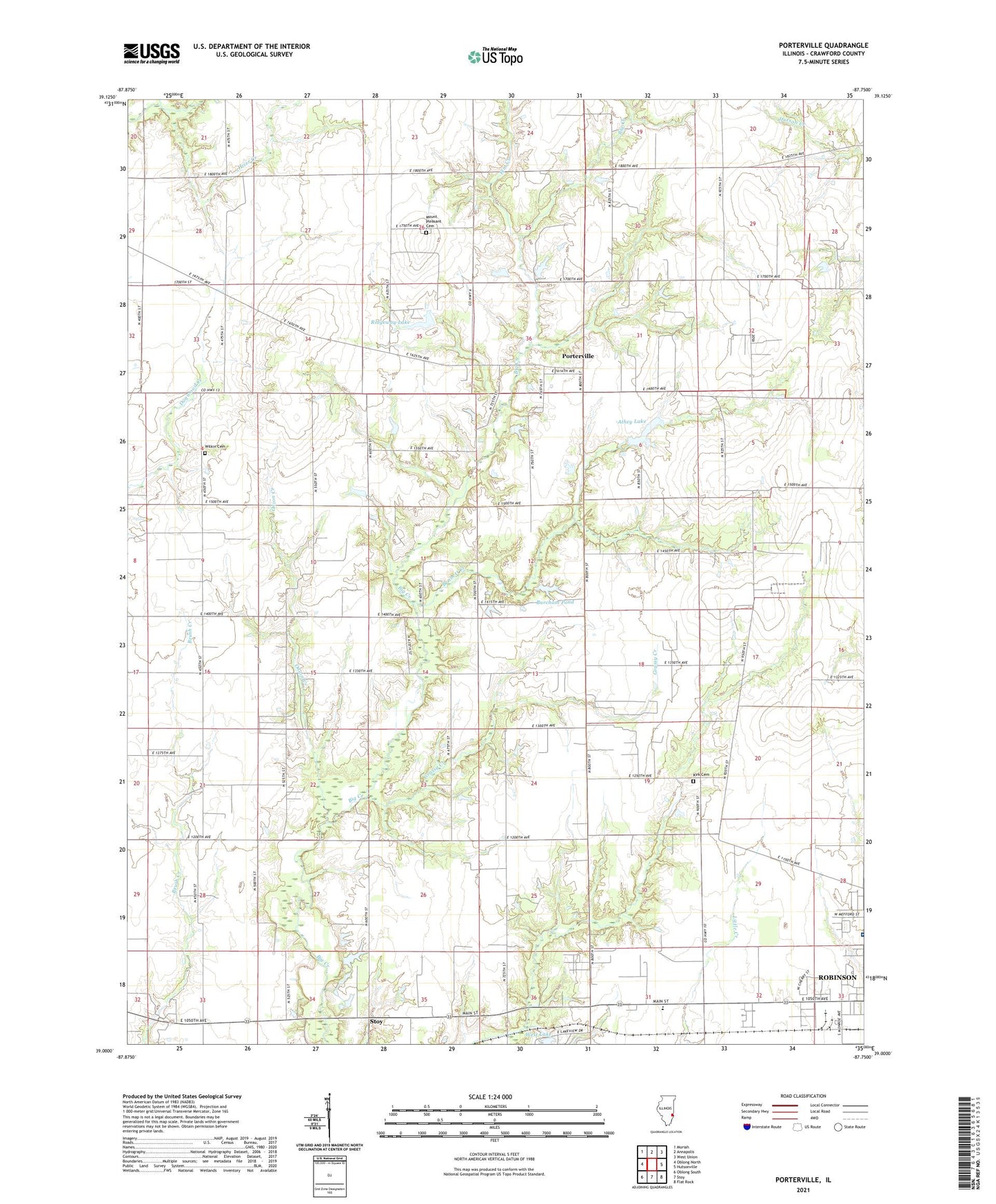
2024 topographic map quadrangle Porterville in the state of Illinois. Scale: 1:24000. Based on the newly updated USGS 7.5' US Topo map series, this map is in the following counties: Crawford. The map contains contour data, water features, and other items you are used to seeing on USGS maps, but also has updated roads and other features. This is the next generation of topographic maps. Printed on high-quality waterproof paper with UV fade-resistant inks.
Quads adjacent to this one:
West: Oblong North
Northwest: Moriah
North: Annapolis
Northeast: West Union
East: Hutsonville
Southeast: Flat Rock
South: Stoy
Southwest: Oblong South
This map covers the same area as the classic USGS quad with code o39087a7.
Contains the following named places: Athey Lake, Athey Lake Dam, Burcham Pond, Burcham Pond Dam, Crane Hilltop Farm, Crawford County, Crawford Memorial Hospital, Crawford Memorial Hospital Heliport, Eaton Post Office, Elm Creek, Gibler Farms, Grassy Creek, Hiser Creek, Kirk Cemetery, Kirk Chapel United Methodist Church, Maple Creek, Maple Creek Farms, Mount Pleasant Cemetery, Onion Creek, Parker Farms, Porterville, Prairie Church, Prairie Grove Church, Prairie School, Rains Grain Farm, Ridgeway Lake, Ridgeway Lake Dam, Robinson Oil Field, Sholders Farms, Weger Farm, West Lake Dam, Wilkin Cemetery, WTAY-AM (Robinson), WTAY-FM (Robinson)