MyTopo
Oakford Illinois US Topo Map
Couldn't load pickup availability
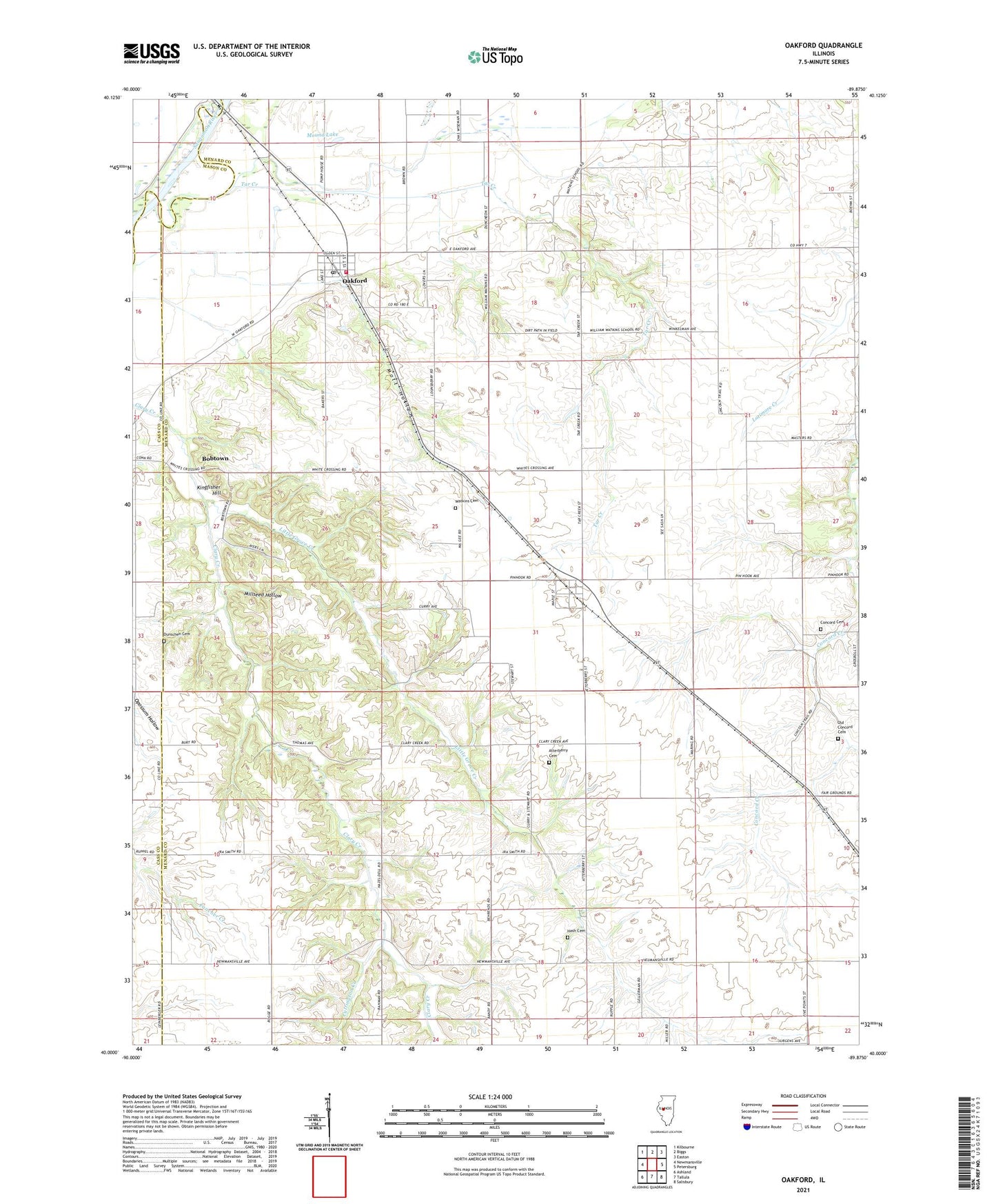
2024 topographic map quadrangle Oakford in the state of Illinois. Scale: 1:24000. Based on the newly updated USGS 7.5' US Topo map series, this map is in the following counties: Menard, Cass, Mason. The map contains contour data, water features, and other items you are used to seeing on USGS maps, but also has updated roads and other features. This is the next generation of topographic maps. Printed on high-quality waterproof paper with UV fade-resistant inks.
Quads adjacent to this one:
West: Newmansville
Northwest: Kilbourne
North: Biggs
Northeast: Easton
East: Petersburg
Southeast: Salisbury
South: Tallula
Southwest: Ashland
This map covers the same area as the classic USGS quad with code o40089a8.
Contains the following named places: Atterberry, Atterberry Cemetery, Atterberry Community Baptist Church, Atterberry Number 10 Election Precinct, Atterberry Post Office, Bobtown, Concord Cemetery, Cuttington Creek, Dunschen Cemetery, Hash Cemetery, Hazel Dell School, Hilltop, Kay Watkins School, Kingfisher Hill, Lafayette School, Little Grove Creek, Little Grove School, Millseed Hollow, Mott Hollow, Mound Lake, New Hope Baptist Church, Oakford, Oakford Fire Department, Oakford Number 9 Election Precinct, Oakford Post Office, Oakford United Methodist Church, Old Concord Cemetery, Panther School, Tar Creek, Tebrugge Mine, Village of Oakford, Watkins Cemetery, William Watkins School, ZIP Code: 62673