MyTopo
Obed Illinois US Topo Map
Couldn't load pickup availability
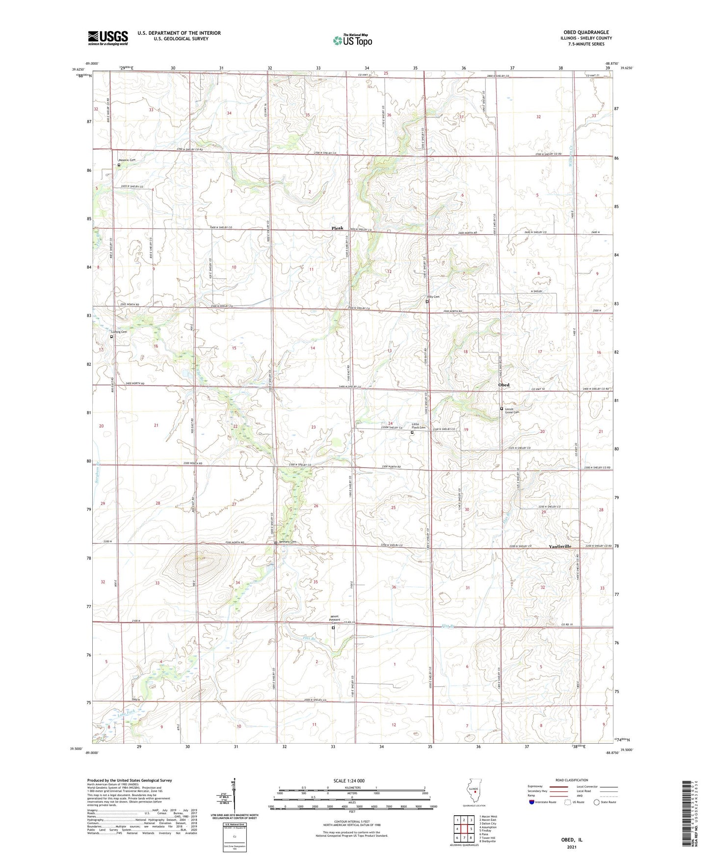
2024 topographic map quadrangle Obed in the state of Illinois. Scale: 1:24000. Based on the newly updated USGS 7.5' US Topo map series, this map is in the following counties: Shelby. The map contains contour data, water features, and other items you are used to seeing on USGS maps, but also has updated roads and other features. This is the next generation of topographic maps. Printed on high-quality waterproof paper with UV fade-resistant inks.
Quads adjacent to this one:
West: Assumption
Northwest: Macon West
North: Macon East
Northeast: Dalton City
East: Findlay
Southeast: Shelbyville
South: Tower Hill
Southwest: Pana
This map covers the same area as the classic USGS quad with code o39088e8.
Contains the following named places: Bethany Cemetery, Chadwick School, Excelsior School, Independence School, Lake Fork, Liberty School, Little Flock Cemetery, Little Flock Church, Locust Grove Cemetery, Locust Grove Church, Locust Grove School, Ludwig Cemetery, Masonic Cemetery, Mount Pleasant Cemetery, Mount Pleasant Church, Obed, Pleak, Pleasant View School, Salem Cemetery, Tolly Cemetery, Township of Flat Branch, Wright School, Yantisville, ZIP Code: 62550