MyTopo
Tower Hill Illinois US Topo Map
Couldn't load pickup availability
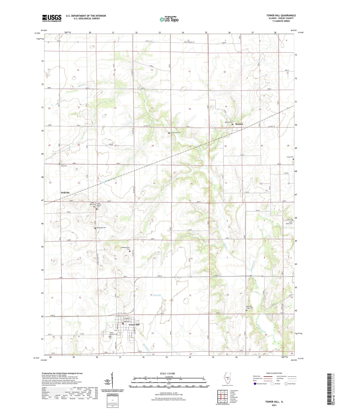
2024 topographic map quadrangle Tower Hill in the state of Illinois. Scale: 1:24000. Based on the newly updated USGS 7.5' US Topo map series, this map is in the following counties: Shelby. The map contains contour data, water features, and other items you are used to seeing on USGS maps, but also has updated roads and other features. This is the next generation of topographic maps. Printed on high-quality waterproof paper with UV fade-resistant inks.
Quads adjacent to this one:
West: Pana
Northwest: Assumption
North: Obed
Northeast: Findlay
East: Shelbyville
Southeast: Fancher
South: Lakewood
Southwest: Oconee
This map covers the same area as the classic USGS quad with code o39088d8.
Contains the following named places: Angel Branch, Armstrong Cemetery, Center School, Champion School, Craig Cemetery, Dollville, Empire School, Frogpond School, Henton, Henton Cemetery, Knobs Baptist Cemetery, Knobs Baptist Church, Knobs School, Methodist Cemetery, Middlesworth Cemetery, Mud Creek, Ragweed School, Redbud School, Ridge School, Robinson Creek Cemetery, Robinson Creek Church, Robinson Creek School, Robinson Creek Station, Rural Townhall, Saint Johns Cemetery, Saint Johns Church, Saint Paul Cemetery, Saint Pauls United Church of Christ, Sandy Hill School, Smith School, Stoune RLA Airport, Tower Hill, Tower Hill Cemetery, Tower Hill Christian Church, Tower Hill Elementary School, Tower Hill Fire Protection District, Tower Hill High School, Tower Hill Post Office, Tower Hill United Methodist Church, Township of Rural, Township of Tower Hill, Victory School, Village of Tower Hill, ZIP Code: 62571