MyTopo
Shelbyville Illinois US Topo Map
Couldn't load pickup availability
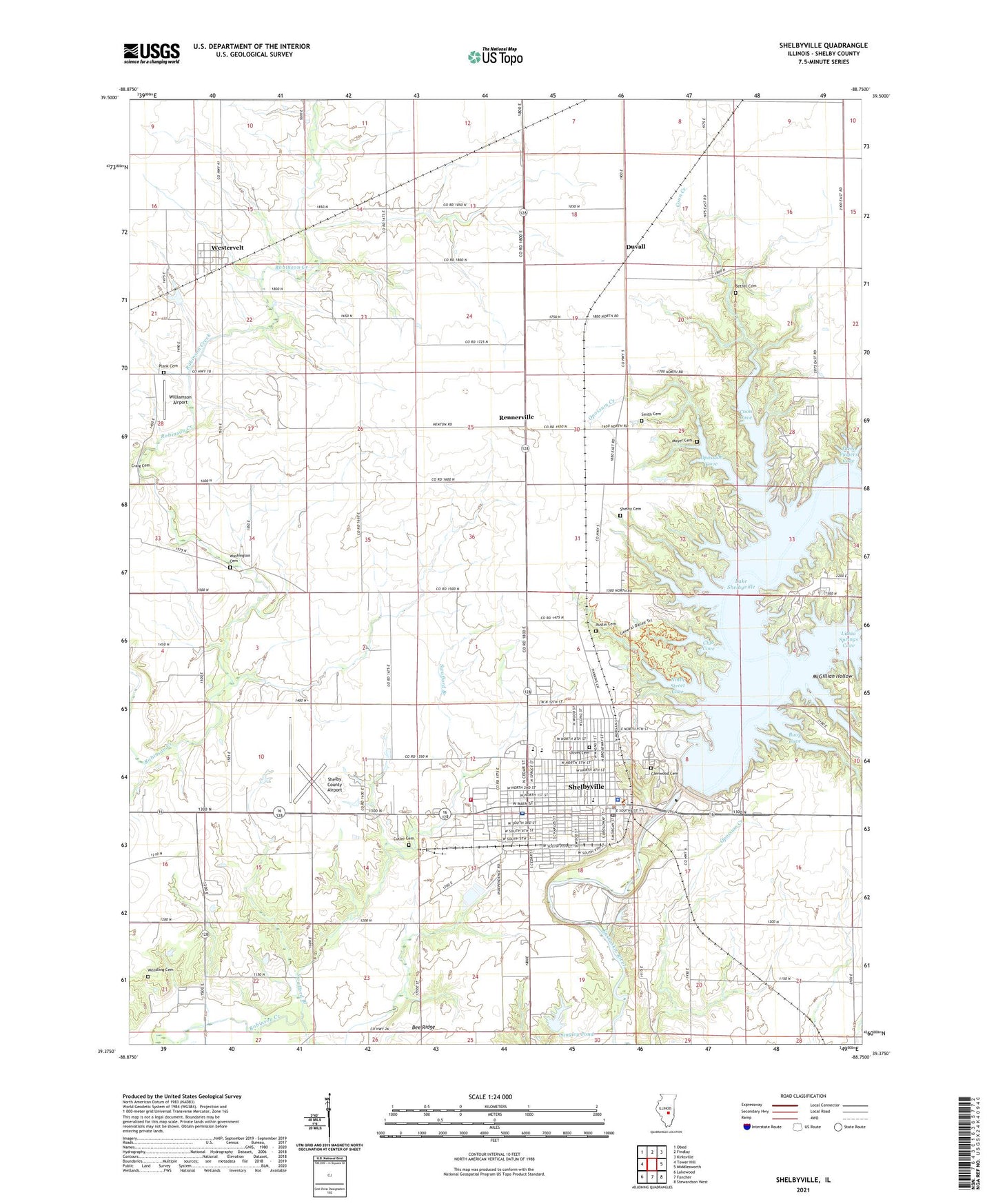
2024 topographic map quadrangle Shelbyville in the state of Illinois. Scale: 1:24000. Based on the newly updated USGS 7.5' US Topo map series, this map is in the following counties: Shelby. The map contains contour data, water features, and other items you are used to seeing on USGS maps, but also has updated roads and other features. This is the next generation of topographic maps. Printed on high-quality waterproof paper with UV fade-resistant inks.
Quads adjacent to this one:
West: Tower Hill
Northwest: Obed
North: Findlay
Northeast: Kirksville
East: Middlesworth
Southeast: Stewardson West
South: Fancher
Southwest: Lakewood
This map covers the same area as the classic USGS quad with code o39088d7.
Contains the following named places: Austin Cemetery, Bee Ridge, Bee Ridge School, Bethel Cemetery, Bethel School, Boone School, Buoy Cove, Champion School, Church of Christ, City of Shelbyville, Club Cove, Coon Cove, Coon Creek, Coon Creek Access Area, Cusaac School, Cutler Cemetery, Duvall, East Liberty School, Fellowship Baptist Church, First Baptist Church, First Presbyterian Church, First United Methodist Church, Forest Park, Free Methodist Church, Glenwood Cemetery, HSHS Good Shepherd Hospital, Immaculate Conception Catholic Church, Johnstowne Mall Shopping Center, Killam School, Lake Shelbyville Dam, Langley Pond, Langley Pond Dam, Lithia Springs Access Area, Lithia Springs Cove, Lithia Springs Creek, Little Brick School, Main Street Elementary School, McGillian Hollow, Moulton Elementary School, Moulton Methodist Church, Moyer Cemetery, Ninth Street Cove, Okaw Center Church, Oliver Cemetery, Opossum Cove, Opossum Creek, Opossum Creek Access Area, Plank Cemetery, Rennerville, Rose Center School, Shelby Ambulance Service, Shelby Cemetery, Shelby Christian Church, Shelby Country Club, Shelby County, Shelby County Airport, Shelby County Courthouse, Shelby County Fairgrounds, Shelby County Mental Health Center, Shelby County Poor Farm, Shelby County Sheriff's Office, Shelby Memorial Home, Shelbyville, Shelbyville Dam East Access Area, Shelbyville Dam West Access Area, Shelbyville Fire Protection District, Shelbyville Free Public Library, Shelbyville High School, Shelbyville Historic District, Shelbyville Police Department, Shelbyville Post Office, Shellen Barker Bridge, Smith Cemetery, Spillway Access Area, Swafford Branch, Three Fingers Cove, Township of Okaw, Township of Ridge, Township of Rose, Township of Shelbyville, Vine Street School, Washington Cemetery, WEJT-FM (Shelbyville), Wendling Cemetery, Westervelt, Westervelt Census Designated Place, Westervelt Post Office, Williamson Airport, WSHY-AM (Shelbyville), ZIP Code: 62565