MyTopo
Alexander Illinois US Topo Map
Couldn't load pickup availability
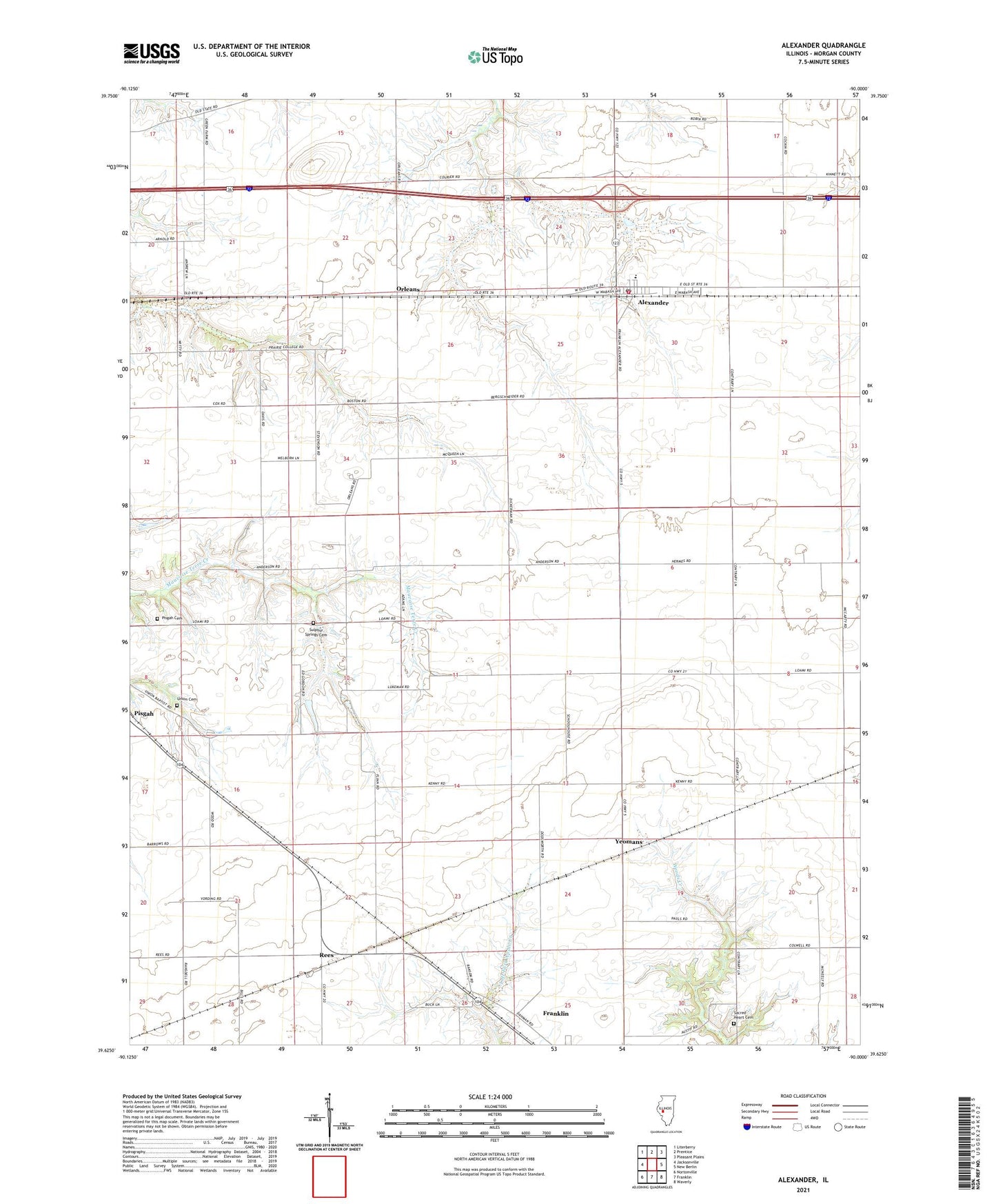
2024 topographic map quadrangle Alexander in the state of Illinois. Scale: 1:24000. Based on the newly updated USGS 7.5' US Topo map series, this map is in the following counties: Morgan. The map contains contour data, water features, and other items you are used to seeing on USGS maps, but also has updated roads and other features. This is the next generation of topographic maps. Printed on high-quality waterproof paper with UV fade-resistant inks.
Quads adjacent to this one:
West: Jacksonville
Northwest: Literberry
North: Prentice
Northeast: Pleasant Plains
East: New Berlin
Southeast: Waverly
South: Franklin
Southwest: Nortonville
This map covers the same area as the classic USGS quad with code o39090f1.
Contains the following named places: Alexander, Alexander Census Designated Place, Alexander Election Precinct, Alexander Elementary School, Alexander Fire Department, Alexander Post Office, College Grove School, East Liberty School, East Walnut Grove School, Little Hope School, Negus Landing Strip, Orleans, Pisgah Cemetery, Pisgah Church, Rees, Rees Landing Strip, Rees School, Sacred Heart Cemetery, Sulphur Spring School, Sulphur Springs Cemetery, Union Cemetery, West Liberty School, Woodlawn Station, Yeomans, ZIP Code: 62601