MyTopo
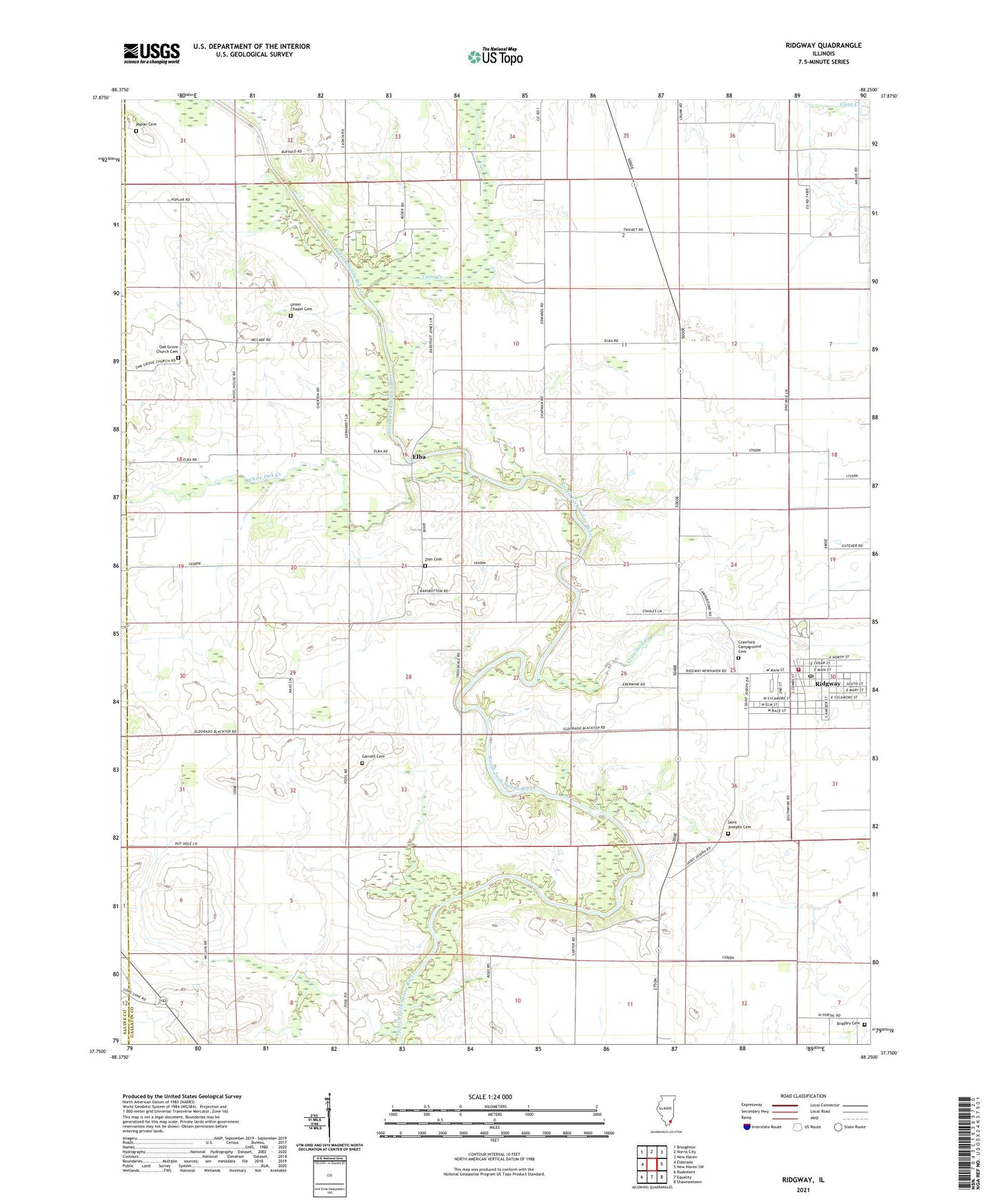
Ridgway Illinois US Topo Map
Couldn't load pickup availability
2024 topographic map quadrangle Ridgway in the state of Illinois. Scale: 1:24000. Based on the newly updated USGS 7.5' US Topo map series, this map is in the following counties: Gallatin, Saline. The map contains contour data, water features, and other items you are used to seeing on USGS maps, but also has updated roads and other features. This is the next generation of topographic maps. Printed on high-quality waterproof paper with UV fade-resistant inks.
Quads adjacent to this one:
West: Eldorado
Northwest: Broughton
North: Norris City
Northeast: New Haven
East: New Haven SW
Southeast: Shawneetown
South: Equality
Southwest: Rudement
This map covers the same area as the classic USGS quad with code o37088g3.
Contains the following named places: Bear Creek, Bradley Cemetery, Cane Creek, Crawford Campground Cemetery, Crawford Creek, Elba, First Baptist Church, Gallatin County Ambulance Service, Garrett Cemetery, Oak Grove Church, Oak Grove Church Cemetery, Omaha Oil and Gas Field, Poplar Cemetery, Poplar Church, Ridgway, Ridgway Election Precinct, Ridgway Fire Department, Ridgway Post Office, Saint Joseph Church, Saint Josephs Cemetery, Township of North Fork, Union Chapel Cemetery, Village of Ridgway, White Oak Creek, Zion Cemetery, Zion Church