MyTopo
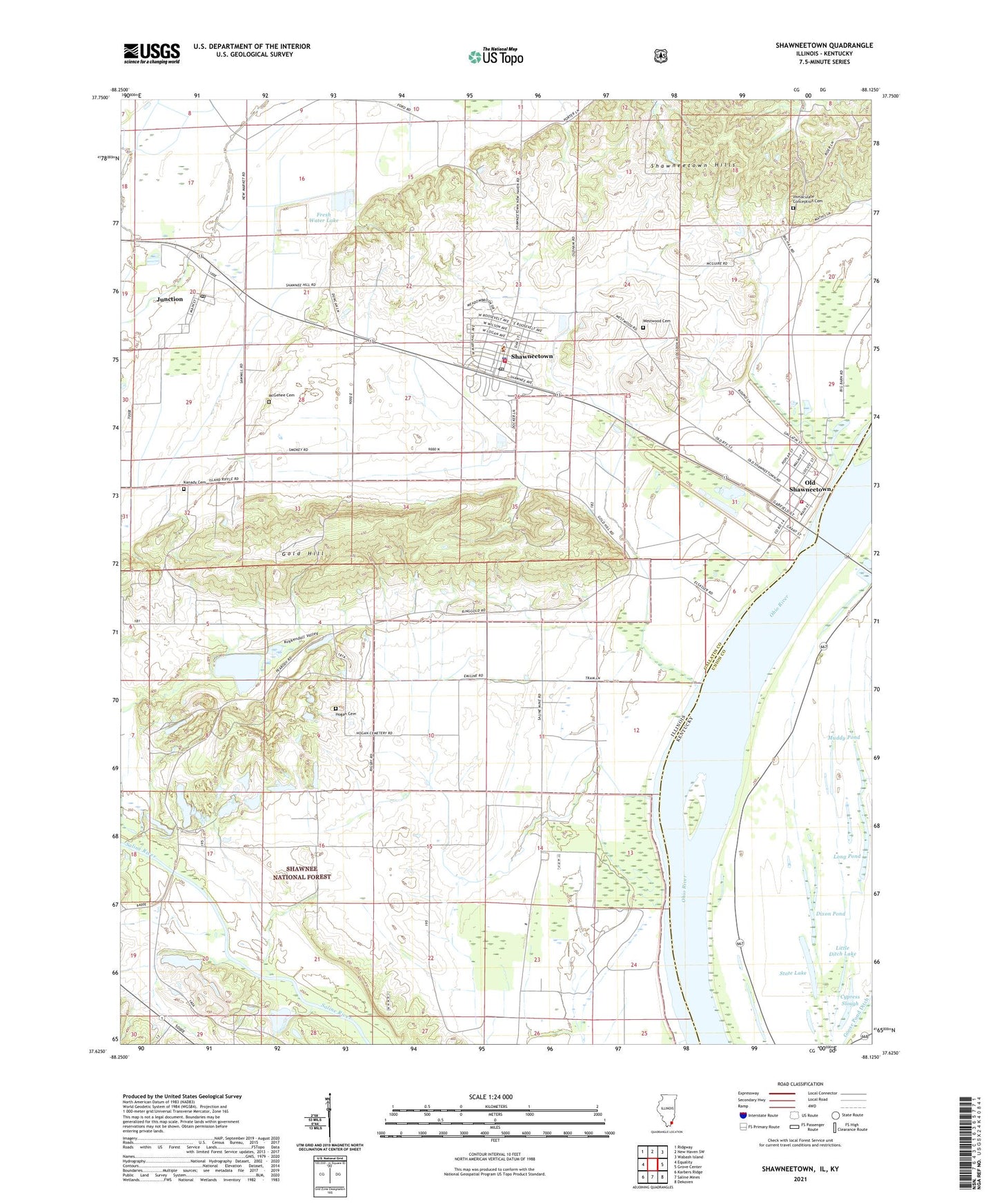
Shawneetown Illinois US Topo Map
Couldn't load pickup availability
Also explore the Shawneetown Forest Service Topo of this same quad for updated USFS data
2024 topographic map quadrangle Shawneetown in the states of Illinois, Kentucky. Scale: 1:24000. Based on the newly updated USGS 7.5' US Topo map series, this map is in the following counties: Gallatin, Union. The map contains contour data, water features, and other items you are used to seeing on USGS maps, but also has updated roads and other features. This is the next generation of topographic maps. Printed on high-quality waterproof paper with UV fade-resistant inks.
Quads adjacent to this one:
West: Equality
Northwest: Ridgway
North: New Haven SW
Northeast: Wabash Island
East: Grove Center
Southeast: Dekoven
South: Saline Mines
Southwest: Karbers Ridge
Contains the following named places: Bird School, Bowlesville, Brickyard School, Buckeye School, City of Shawneetown, Cypress Slough, Dixon Pond, Dortch Private Strip, Eagle Number 1 Fresh Water Lake, Eagle Number 1 Fresh Water Lake Dam, Eagle Number 2 Lake, Eagle Number 2 Lake Dam, Emmanuel United Methodist Church, Fields Church, First Baptist Church, First Presbyterian Church, Fresh Water Lake, Fresh Water Lake Dam, Gold Hill, Gum Springs School, Hogan Cemetery, Illinois No Name Number 2017 Dam, Immaculate Conception Cemetery, Junction, Junction Post Office, Kanady Cemetery, Kanady School, Kuykendall Valley, Little Cypress Ditch, Little Ditch Lake, Long Pond, McGehee Cemetery, Muddy Pond, Old Shawneetown, Old Shawneetown Volunteer Fire Department, Ringgold School, Ringold Church, Shawneetown, Shawneetown Fire Department, Shawneetown Hills, Shawneetown Police Department, Shawneetown Post Office, State Lake, Talley Ferry, Township of Bowlesville, Township of Gold Hill, Turkey Creek, Village of Junction, Village of Old Shawneetown, Westwood Cemetery, ZIP Code: 62984